

Volume 12 – October 1, 1946All material courtesy of the National Park Service. These publications can also be found at http://npshistory.com/Nature Notes is produced by the National Park Service. © 1946. |
A Greeting
By G. C. Ruhle, Editor
After a lapse of years punctuated by the war, NATURE NOTES FROM CRATER LAKE NATIONAL PARK, is again published, a single number being scheduled for the current year. This issue of NATURE NOTES has been sponsored by the Crater Lake Natural History Association and prepared by the members of the naturalist staff, whose mouth piece it purports to be. It is a chronicler of interesting and important bits of natural history of the park. Its contents are original articles, notes, digests, poems, sketches, bits of park life, comments and opinions of interested parties. Members of the park staff and voluntary contributors comprise its aggregation of writers. Editorials are included whenever possible, feasible, urgent. These, true to their name, are solely expressions of conviction or opinion of the park naturalist as editor, not necessarily the general consensus of feeling of the National Park Service or of Crater Lake National Park. Items may be included despite lack of literary merit, for NATURE NOTES endeavors to preserve and transmit a cross section of the individuality and atmosphere of the park’s dramatis personae.
NATURE NOTES stands primarily for conservation, for the protection and perpetuation of our natural features, for the application and operation of the fundamental policies of the National Park System and of the Naturalist Division. It seeks to further its aims by the development of a love of nature through observation and intelligent understanding.
As long as the limited supply lasts, these pamphlets are mailed free anywhere in the United States to every one wishing to receive them. But postal regulations require that a written request be given to the park before they may be franked. One rare occasions, copyrighted articles may appear in NATURE NOTES by special permission. These are fittingly marked. All other articles in the pamphlet are intended for the free use by any publication. It is merely requested that credit be given to the author and to NATURE NOTES, CRATER LAKE NATIONAL PARK. The Naturalist Division always greatly appreciates receiving notice or copies thus used by various organizations.
NATURE NOTES is prepared for your instruction and pleasure. The editor is pleased to receive for consideration contributions of general interest to the readers. Suggestions and inquiries are encouraged, and your constructive criticism is invited at all time.
LAVA BEDS NATIONAL MONUMENT in northern California has been separated from the administrative control of Crater Lake National Park; Ranger Don C. Fisher, long serving it, remains as its custodian. OREGON CAVES NATIONAL MONUMENT in southwestern Oregon retains its connection with the park administration.
Floral Life Zone on the Phantom Ship
By William E. Bush, Ranger-Naturalist
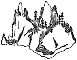
Among the scenic attractions at Crater Lake, few excel in popular appeal or give rise to greater exercise of creative imagination than the small island known as the Phantom Ship. This rugged little island with its spires of andesite, is generally considered to be no more than a picturesque old rock, furnishing appealing subject for those who would use it as vehicle for their contemplations in fantasy by way of mind, palette, or film. Actually, time is fashioning a biological unit on the island; the usual sequences and consequences of nature are molding discernible, competitive boundaries and patterns of adaptation upon its rugged surface.
Physically, the Phantom Ship is a remaining section of the filled conduit of a fissure from which probably poured many of the lower layers of lava constituting Dutton Cliff. Its rocks of pyroxene andesite have in many places been altered by hydrothermal activity. Quartz filled seems give the rock a character uncommon to most of the rocks generally found on the crater walls. The island is about 500 feet long and reaches a maximum width of 200 feet near the east end. Its east-west ridge of spires, towering 170 feet above the water, sharply divides most of the island into two slopes, one very steeply sloping to the south and the other less steeply to the north. The island is separated from the mainland by a shallow channel about 200 feet wide. Above this channel, Dutton Cliff rises abruptly, constituting one of the highest sections of the south-west wall of the caldera.
Observations noted herein were made during two visits to the island on August 8 and August 19, 1946. Some hours were spent in perusal of the situation as it existed, but the plant tally was made on the second visit only. The listings are not to be considered as complete and certainly it will be worthwhile to make additions and corrections as subsequent observations suggest.
The accompanying sketch illustrates roughly the bio-geographic layout of the island. The west end of the island is made up of tall spires which rise vertically; a limited talus at the water’s edge is all that lies between the spires and the water. In this region, few plants have gained a foothold and the area must be essentially classified as barren.
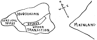
The remainder of the island is divided into two slopes which show a definite segregation of species. White bark pine grows on both slopes in nearly equal areal density, though it appears to be much more in its element on the north side.
The South Slope – The south and southeast slopes of the island, while undoubtedly subjected to great extremes of temperature, are predominantly a warm section. Three ponderosa pine live a stinted existence in this region. The largest one is 35 or 40 feet high and 56 inches in circumference, three feet above the root spread. On this slope are four western white pines, the largest of which is 34 inches in diameter; it is broken off 20 feet above the ground and a crown of new growth doubles that height. High on the east end is a taller one 60 feet high and 25 inches in diameter; it bears an old lightning scar, now nearly healed. These trees are bearing a good crop of cones this year. The ponderosa pine cones are smaller than normal.
A considerable coverage of green manzanita (A. patula) grows just below the spiring ridge that separates the island into two parts; it continues to the water’s edge. All of this presents a clear cut transition situation. However, in addition to this there is considerable mat manzanita (A. nevadensis), and an intermixture of small white-bark pines. In a few cases there may be confusion between P. albicaulis and P. monticola,but most of the trees were bearing cones and no mistake was possible.
The complete absence of lodgepole pine or alpine fir seems surprising, but may probably be explained by the dearth of water-stabilized soil or duff. It was also noted that not one specimen of either red fir or hemlock was found on this slope.
The North Slope – The north slope is less steep than the south; it presents some areas with a soil of erosional debris and duff. On this slope are growing trees typical of the lower Hudsonian Zone. Shasta red fir exist in considerable areal density, but are small for the specie, while mountain hemlock grow in about the same stand density, but the mature trees, though small, are apparently in good condition. The white bark pine on this slope are normal and of good size. The total number of trees (a foot or more high) is 66 while the south slope supports only 28.
High, near the east end of the north slope, is one specimen of white fir about 30 inches high. It appears to be in good condition and should subsequently be checked for its existence and growth. It apparently is the only one on the island.
At the foot of this slope there is a flat talus which is supporting a number of herbaceous plants typical of shady, moist localities; including shield fern, meadow rue, Jacob’s ladder, and bleeding heart. The distribution of herbaceous plants and shrubs is apparently controlled by localized circumstances and zonal distribution is far from obvious. The appended list of the plants observed gives their general location.
Among the unlisted, but not unnoticed flora are the brilliantly colored yellow, red, and orange lichens which cover the vertical walls of the towering spires. Occasional single plants of grass are to be seen near the water’s edge. No attempt at identification of these was made.
Animal life observed consisted of birds, obviously transient. There were two Clark’s crows and three Sparrow Hawks but no other birds were observed. On the first visit, one golden mantled ground squirrel was seen on the talus at the east end. None was seen on the second visit. No traces of other animals were noted, but the writer does not profess to be a skilled observer of such evidences.
Some evidence of human trespass were evident. Recent foot marks on the upper level soils, a film carton, three paper plates, a paper drinking cup, a rusty beer can, and several pieces of orange peel gave evidence that human influence cannot be overlooked.
From 1910 to 1940, the level of the lake has been dropping; this year the lake level is three feet higher than at comparable season in 1940. Evidence of this rise of level is to be noted in the fact that several shrubs, probably willows, have been destroyed by the rising water and their roots and stems are now a foot or more beneath the surface. A half dozen such plant remains were observed.
Thus the island gives rise to two rather clearly defined life zones, namely a hybrid sort of transition on the one side and a definite Hudsonian on the other. A total of about 94 forest trees, including six species, and 32 species of ground plants were observed to be growing on the Phantom Ship.
The following forest trees large enough to be considered as firmly established (a foot or more high) have been noted:
| Tree | Typical Zone | South Side | North Side | Total No. |
| Pinus ponderosa Dougl. | Transition | 3 | 0 | 3 |
| Pinus monticola Dougl. | Upper Transition to Canadian |
4 | 2 | 6 |
| Pinus albicaulis Englem. | Hudsonian | 21 | 29 | 50 |
| Abies concolor Lindl. | Transition | 0 | 1 | 1 |
| Abies magnifica shastensisLemmon. | Canadian to Hudsonian |
0 | 17 | 17 |
| Tsuga mertensiana (Bong.) Sargent. | Hudsonian | 0
|
17
|
17
|
| Totals | 28 | 66 | 94 |
| Ground Plants | Common Name | Occurrence |
| Filix fragilis (L) Gilib. | Brittle Fern | Few (2 or 3) seen. |
| Polystichum scopulim (D.C. Eaton) Maxon. | Shield Fern | Two on North side near water level. |
| Smilacina amplexicaulis glaberMacbride. | False Solomon | Common. |
| Salix lasiandra abramsii Ball. | Abrams Willow | One small plant on south side (8 feet). |
| Salix orestera Schneider | Sierra Willow | One plant on south side. |
| Thalictrum sparsiforum Turcz. | Meadow Rue | Common on north side near water level. |
| Actaea spicata arguta (Nutt.) Torr. | Baneberry | One plant on north side. |
| Dicentra formosa (Andr.) DC | Bleeding Heart | Common at lower levels. |
| Arabis (specie) | —- | East end near water. |
| Ribes cereum Dougl. | Waxy Current | Common. |
| Ribes lacustre (Pors.) Poir. | Prickly Currant | Common. |
| Mitella breweri Gray. | —- | Common on north side. |
| Holodiscus glabrascens (Greenman) Heller. | —- | Common. |
| Sorbus cascadensis G. N. Jones | Mountain Ash | One plant on NE end. |
| Amalanchier florida Lindl. | Service Berry | Most common shrub. |
| Lupinus andersonii Watson. | Lupine | Occasional on SE end. |
| Epilobium glaberrimum Barbey. | Willow Herb | Common on north side. |
| Pyrola picta Smith. | White Veined Pyrola | One plant, north side. |
| Pyrola secunda L. | One-sided Pyrola | One plant, with P. picta |
| Arctostaphylos patula Greene. | Green Manzanita | Considerable on south side. |
| Arctostaphylos nevadensis Gray. | Mat Manzanita | Common on south side. |
| Polemonium shastense Eastwood. | Jacob’s Ladder | Several plants in rock crevices on north side. |
| Phacelia heterophyla Pursh. | —- | Common. |
| Penstemon menziesii davidsoni(Greene) Piper. | Pride of the Mountain | Common. |
| Penstemon rupicola Howell. | —- | Common. |
| Castilleja miniata Dougl. | Paint Brush | Common. |
| Anaphalis margaritacea (L.) Benth and Hook. | Everlasting | Common on east side. |
| Taraxacum palustre vulgare (Lam.) Fernald. | Dandelion | Several near water’s edge on east end. |
| Chrysothamnus nauseosus speciosus(Nutt.) Hall. | —- | Common on east end. |
| Antennaria geyeri Gray. | —- | Several on east and near water level. |
| Eupatorium occidentale Hook. | Western Boneset | Common. |
| Hieracium albiflorum Hook. | Hawkweed | A few on east end. |
– o –
Perception of Nature leads to Knowledge;
Knowledge, to Understanding, Interest, Love.– o –
An Ecological Appreciation of the Lake Trail
By W. J. Nee, Ranger-Naturalist
From the standpoint of botanical appreciation, one of the outstanding Self Guiding Nature Trails of Crater Lake National Park is the Crater Wall Trail commonly referred to as the Lake Trail. This trail has: first, a large number of floral species; second, a broad range of plant associations due to moisture, temperature and altitude; and third, the most extreme spread of flowering time.
Approximately 75 species can be readily identified on the Lake Trail. The following is a partial list of the more prominent plants: mountain hemlock, white bark pine, sedge, Engleman’s aster, Newberry’s knotweed, false helebore, tall ragwort, feather-leaf leutkea, heart-leaf arnica, Crater Lake currant, smooth wood rush, one-sided pyrola, Brewer’s mitrewort, Tomie’s Saxifrage, creeping raspberry, crustaceous lichen, staghorn lichen, fireweed, mountain sorrell, red elderberry, mat huckleberry, rock penstemon, long-leaf arnica, bleeding heart, columbine, fivefinger, western boneset, Jacob’s ladder, thorny currant, parsely fern, alpine everlasting, Hall’s currant, western white pine, Shasta red fir, mitella, willow herb, white veined pyrola, Merten’s corallroot, mat manzanita, Bongard’s buttercup, Lewis’s monkeyflower, Gorman’s stonecrop, pearly everlasting, pine paintbrush, sulphur flower, phacelia, hawkweed, kellogia, mountain maple, fat solomon seal, slim solomon seal, snowberry, prince’s pine, baneberry, fleabane, western wind flower, holly fern, mountain ash, squaw carpet, broom huckleberry, Douglas phlox, veronica, yellow monkey flower, arabis platysperma, and Sitka valerian. Many of the earlier blossoming plants, the grasses, and varieties of sedges are not listed here.
A typical plant association of the upper area is the mountain hemlock, smooth wood rush, and Crater Lake currant association. An excellent example of this association can be seen toward the end of the second switchback. At the end of the seventh switchback is an association of plants that frequent rocky ledges including parsley fern, and crustaceous lichens. At the end of the ninth switchback, the altitude is sufficiently low for the Shasta red fir and western white pine to mingle with mountain hemlock. As on faces the lake, one looks right into the tops of each of the above named trees. Limb pattern, foliage, and cones are very convenient for close comparison. There is a splendid view of a towering cliff immediately behind this tree association. Along the tenth switchback is a very beautiful growth of bleeding heart. A decaying log has provided protection and humus to enhance the beauty of this cluster of flowers.
The thirteenth switchback is a long one but has an association that is altogether different from any of the preceding. A ledge of fragmental material has produced a drier situation upon which characteristic plants have grown. In this association are mat manzanita, veried-leaf phacelia, pearly everlasting, pine paintbrush, sulphur flower, Engleman’s aster, Gorman’s stonecrop, and others. Another similar association but on a more rocky situation is to be found on the sixteenth switchback. Here the predominating plant is Gorman’s stonecrop.
One other association of particular interest is at the bottom of the trail where the Sitka alder and thorny currant form a dense thicket in the talus. Observation of the alder will explain the many dense green thickets around the lower reaches of the crater wall. This grows principally because the drainage from the wall is constant throughout the growing season.
Because of the exposure, protection from desiccating winds, and the supply of moisture, the Lake Trail produces the widest extreme in season of any area so easily available to the public. From the earliest to the latest part of the season, flowers can be seen in all stages of development. In early September, this year, there were Lewis monkeyflowers just coming into bud and blossom while within a few feet, the same species had completely gone to seed. Within a radius of twenty feet, one can see the first blossoms of red elderberry, the green berries and the ripened red berry. Long after the columbine has disappeared around the Park Headquarters, they are just coming into blossom at the foot of the Lake Trail. And so it is with many of the other plants. On this splendid trail, springtime is determined by environmental factors, which make a brilliant floral display the whole season through.
Mammal Populations, 1946
 Olympic black bear are not numerous as compared with pre-war years. The policy of garbage disposal at a considerable distance from any habited area has been successful in preventing unhealthy concentration of these animals. A few complaints have been made by campers of bears stealing foodstuffs left exposed in a vacated camp but these indignant people are outnumbered twenty to one by visitors equally indignant because they haven’t seen a bear since they entered the park.This note is based upon observations, made in Crater Lake National Park, upon the most easily observable mammal species. The present season is distinct in two particulars: The park is open to the heavy public travel for the first time since 1942. The heavy snowfall of the 1945-46 season has provided an exceptional amount of vegetation throughout the area.
Columbia black-tailed deer appear to be exceptionally numerous. They are commonly seen by visitors and trails are found to be dotted with fresh footprints whenever they are visited. Deer are commoner than at any season in the last then years.
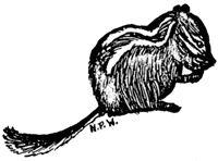
Golden mantled ground squirrels are rather scarce. In 1938 about 150 squirrels, by actual count, inhabited the rim area between the Lodge and the Crater Wall Trail. This year’s population appears to be about one-fifth of this. Squirrels are very numerous along Highway 230 east, outside the park.

Townsend chipmunks, never very numerous, appear in expected numbers. Klamath chipmunks have been rarely observed in the rim area this year. White-footed mice, which in the rim area sometimes enter the cafeteria or lodge in considerable numbers, have caused no comment this year and appear to be below average in number. A few have been taken in snap traps along Munson Creek.
Yellow-bellied marmots may be seen to some extent along the highways. None has been observed along the Rim Walk, where one or two could usually be seen. Conies can be seen in the talus slopes along Garfield Peak Trails but do not call from the rim slopes to any extent this year. They appear to be present in less than average number.
Signs of the Mazama gopher showed in a few places along the rim where the snow melted. The most extensive workings in the rim area were in a small flat between the highway and the cafeteria. When it is considered that spring melts commonly expose extensive gopher workings in cleared spaced everywhere in the park area, the numbers of gophers this year can be considered below average.
Among the medium sized and small carnivores, pine martens have been reported to be about as numerous as usual. A weasel carrying a Microtus and, later, the same individual carrying a small Citellus, was seen at the Information Building. Coyotes have not been reported at all and foxes rarely.
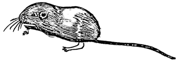
Pocket Mice in Crater Lake National Park
By Dr. R. R. Huestis, Ranger-Naturalist
On July 31, 1941, to his considerable surprise, the writer took two pocket mice,(Perognathus parvus (s. sp.)) within the eastern boundary of Crater Lake National Park. A battery of ten traps had been set along the turnout for the Wheeler Creek pinnacles and ten other traps were set south of this along the east entrance highway. Each battery took a pocket mouse along with a number of Peromyscus. This edge of Wheeler Creek canyon is on the 5500 foot level.
The pocket mouse is a type particularly associated with the Sonoran Zones of the southwestern American desert. They are included in the family Heteromyidae along with the much better known kangaroo rats, also typical desert dwellers. The writer once trapped in a region of the Painted Desert in Arizona so arid that it was a considerable walk from one small creosote bush to the next, yet here a small pocket mouse was taken in many of the traps; the only mammal that touched them and apparently the only one there.
The rim of Wheeler Creek Canyon at 5500 feet is covered by a forest of lodgepole pines(Pinus contorta latifolia), the cleared spaces being occupied by waxy currant (Ribes cereum)) and Bloomer’s rabbit-brush (Chrysothamnus bloomeri). The altitude and vegetation would identify the region as lower Canadian Zone, a rather atypical habitat for pocket mice. However, the soil along Wheeler Creek rim, a powdery pumice, might be expected to be congenial.
Pocket mice are burrowing rodents with small pinnae, and compared with Peromyscus,relatively small eyes. As in the kangaroo rats the temporal bones are enlarged into thin walled bullae. These are believed to increase auditory acuity. The cheeks are supplied with fur lined pouches for storing seeds. The tail is long and furred toward the end with some relatively long stiff bristles. The hind legs are long and powerful, but pocket mice run rather than jump like the kangaroo rats. Like many burrowing mammals they are solitary and quarrelsome if kept together in captivity, one usually killing the other.
The specimens taken in Crater Lake National Park measured as follows:
| Total length | Tail length | Foot | Ear pinna |
| 149.6 mm | 82.2 | 22.5 | 8.1 |
| 155.0 mm | 85.0 | 22.5 | 8.2 |
These measurements are small for even the smaller of the two subspecies which might be expected to work into the park area: Coues’ pocket mouse, (P. p. mollipilosus), from the Upper Klamath Lake region. Both specimens were females, both had been lactating, and both were pregnant. One contained six and the other four embryos. These evidences of fertility suggest that pocket mice are in Crater Lake National Park to stay.
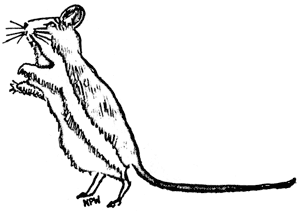
Temerity
By Irving E. Blume, Ranger-Naturalist
The golden-mantled ground squirrel is one of Crater Lake National Park’s most interesting smaller mammals, being a constant source of pleasure to all visitors. One of these creatures had the ingenuity to establish his homestead in an obscure hole in the middle of the highway leading to the Rim area from the Park Headquarters. Just as if he were amusing himself at the consternation of the passing motorist, he would sit on his haunches inches from his hole until the automobile was immediately upon him. As the concerned motorist saw the little fellow and attempted to avoid running over him, the little squirrel would dart into the hole with the car only inches away. Many persons got out of their cars and looked in vain for the smallest traffic cop of the Crater Lake highways.
East Entrance Desert Mammals
By Dr. R. R. Huestis, Ranger-Naturalist
During the latter part of the 1941 season, an investigation was made of the mammalian fauna along the East Entrance highway from the park boundary to the south-east margin of Dutton Ridge. Both sides of the highway were set with live traps for a distance of a little over three miles. Only small mammals can enter these traps of these four species were represented: Klamath chipmunk (Eutamias amoenus amoenus), Sierra least weasel (Mustela cicoquanii muricus), Gambel’s deer mouse (Peromyscus maniculatus gambelii) and Coues’ pocket mouse (Perognathus parvus mollipilosus). This last species had not previously been reported from Crater Lake National Park or any part of Oregon north of Fort Klamath. It is associated with relatively arid territory of north-east California and its presence in a forest-covered region within the park boundary is of interest. The deer mice taken along the rims of Wheeler and Sand Creek canyons are in type more like the Sonoran deer mouse than deer mice taken elsewhere in the park.
Coues’ Pocket Mouse: Three female Perognathus were taken along the rim of Wheeler Creek canyon. One, the largest was lactating and also pregnant. It contained six embryos four in one uterine horn and two in the other. One female was pregnant only and contained for embryos two in each horn. The smallest female was neither lactating nor pregnant and may not be within the limits of adult size. The measurements in millimeters are as follows:
| Body | Tail | Tail % | Foot | Ear |
| 70.0 | 85.0 | 121.4 | 22.5 | 8.2 |
| 67.4 | 82.2 | 122.0 | 22.5 | 8.1 |
| 60.2 | 82.6 | 137.2 | 22.6 | 8.0 |
From the measurements it may be seen that these mice are small bodied and long tailed with relatively large feet and small ears. All these mice are smaller than the species’ average recorded by Vernon Bailey for the state but the beginning of at least a second brood in one female would make it seem probable that she was fully adult.
Gambel’s Deer Mice: Twelve deer mice were taken along the highway between the East Entrance and the Lost Creek Ranger Station. Seven, of which six were females, proved to have a body length of 85.0 mm or more and may be considered adult enough for statistical purposes. Most of them were young adults so the average body length is small. Fourteen mice were taken on Dutton Ridge along the East Entrance highway. Ten of these proved to have a body length of 85.0 mm or more. This group was also composed of young adults. The data follows:
| Body Length | |||
| Class (in mm) | East Entrance | Dutton Ridge | Both |
| 85 | 2 | 3 | 5 |
| 88 | 2 | 5 | 7 |
| 91 | 1 | 2 | 3 |
| 94 | 2 | – | 2 |
| 7 | 10 | 17 | |
| Means: | 82.29 +/- 1.33 | 87.70 +/- .85 | 88.35 +/- .70 |
| Std. Dev.: | 3.52 +/0 .94 | 2.10 +/- .46 | 2.88 +/- .49 |
All means are below 90.0 mm the usual figure for large samples of Peromyscusincluding older mice.
| Tail Percentage | |||
| Class (in mm) | East Entrance | Dutton Ridge | Both |
| 76 | 2 | 3 | 5 |
| 79 | 1 | – | 1 |
| 82 | 2 | 3 | 5 |
| 85 | 1 | 1 | 2 |
| 88 | – | 2 | 2 |
| 91 | 1 | 1 | 2 |
| 7 | 10 | 17 | |
| Means: | 80.71 +/- 2.00 | 82.60 +/- 1.61 | 82.18 +/- 1.24 |
| Std. Dev.: | 5.29 +/- 1.40 | 5.16 +/- 1.13 | 5.10 +/- .87 |
| Comparisons of Means | ||
| Crater Lake Rim | 89.6 | .59 |
| Crater Lake South Entrance | 86.1 | .85 |
| Dutton Ridge | 82.6 | 1.61 |
| Dutton and East Entrance | 82.2 | 1.24 |
| East Entrance | 80.7 | 2.00 |
It may bee seen that mice from the southeastern side of the park have considerably shorter tails than mice taken elsewhere. The fact that they are rather small mice minimizes the differences for smaller Peromyscus have relatively longer tails than larger ones.
The differences between the rim and east entrance samples is 8.9 +/- 2.08 per cent and therefore more than four times its standard error. The difference in tail percentage between the Rim sample and the combined Dutton Ridge and east entrance sample of 17 mice is 7.4 +/- 1.37 percent. This difference is more than five times its standard error. Smaller differences are present between mice from the east and south portions of the park in tail percentages but they are still more than twice their standard errors and so of statistical significance.
A tail percentage of just over 80 is more typical of the interior valleys of California than of any forested part of Oregon and this situation emphasizes the effect upon small mammals which the pumiceous character of the soil and sparse vegetation seem to be producing.
| Ear Length | |||
| Class (in mm) | East Entrance | Dutton Ridge | Both |
| 15.5 | 1 | – | 1 |
| 16.0 | – | – | – |
| 16.5 | 2 | 1 | 3 |
| 17.0 | 1 | 5 | 6 |
| 17.5 | 1 | 1 | 2 |
| 18.0 | 1 | 2 | 3 |
| 18.5 | 1 | 1 | 2 |
| 7 | 10 | 17 | |
| Means: | 17.07 +/- .36 | 17.35 +/- .19 | 17.24 +/- .18 |
| Std. Dev.: | .95 +/- .25 | .60 +/ .13 | .77 +/- .14 |
The mean ear size of these mice is slightly below that of the Rim area, 17.5 +/- .09. Since the ear length is greater in larger mice the difference in body size between the Rim 90.09 +/- .38 and the eastern series may very well be the factor involved. The differences are not statistically significant.
Foot length: Since foot length must be computed separately in each sex that of the females in the combined East Entrance-Dutton Ridge series is the only one presented:
| Class (in mm) | Dutton Ridge-East Entrance |
| 19.0 | 2 |
| 19.5 | 2 |
| 20.0 | 3 |
| 20.5 | 3 |
| 21.0 | 1 |
| 11 | |
| Mean: | 20.0 +/- .19 |
| Std. Dev.: | .62 +/- .14 |
This mean is smaller than that of the Rim or South Entrance series both differences being statistically significant. For females the Rim foot length is 20.7 +/- .08 and South Entrance 20.6 +/- .15. Whether the difference in body size is the only factor is more doubtful in this case.
Summary
- Coues’ pocket mice were present and breeding along the East Entrance highway of Crater Lake National Park in 1941. These mice are at home in arid regions.
- Gambel’s deer mice taken from this region have a relative tail length typical of mice from the interior valleys of California.
- It is suggested that the sparsity of vegetation in this region is an important factor in these distributional arrangements.
Deer Mice in Lava Beds National Monument
By Dr. R. R. Huestis, Ranger-Naturalist
On September 12, 1941, the writer accompanied Park Naturalist George C. Ruhle to the Lava Beds National Monument which was at the time associated for administrative purposes with Crater Lake National Park. Fifty live-traps were set out in the vicinity of Tule Lake and 32 adultPeromyscus maniculatus were taken. These were measured and skilled and the pelages added to the study skin collection at Crater Lake National Park. A statistical study of the measurements is being recorded here for the reference of students of the distribution and systematics of small mammals.
Methods: All measurements were taken of recently anaesthetized specimens removed from the live traps. The mouse is stretched to a uniform tension on a measuring board and the dimensions of the total length, tail length and foot length to the end of the longest claw are recorded with pins. The dimensions are then taken with a vernier caliper. The ear is measured, with the same instrument, from notch to tip. Body length is obtained by subtracting the tail length from the total length. The tail percentage is then obtained by dividing the tail length x 100 by the body length. It allows a better comparison of mice of different size than actual tail length. Tests have shown that this method of measuring recently anaesthetized mice can be done with an average error not greater than one-tenth of a millimeter.
Body Length: This standard measurement varies with age. All specimens included were 85 mm or more in length which is taken as the lower limit of adult body length. This allows comparison with series from other places with a similar lower limit but does not, of course, entirely eliminate differences in average size due to age differences in populations. The arrays are tabulated below:
| Body Length | |||
| Class (in mm) | Females | Males | All |
| 85 | 1 | 3 | 4 |
| 88 | 5 | 7 | 12 |
| 91 | 6 | 3 | 9 |
| 94 | 2 | 1 | 3 |
| 97 | 3 | – | 3 |
| 100 | 1 | – | 1 |
| Total | 18 | 14 | 32 |
| Means: | 91.67 +/- .95 | 88.43 +/- .66 | 90.25 +/- .66 |
| Std. Dev.: | 4.04 +/- .67 | 2.49 +/- .45 | 3.75 +/- .47 |
In Peromyscus, as in man, female mice have a better life expectation than males. Female adults in the Lava Beds are older and therefore bigger than males. In this series they are also more numerous.
| Comparisons of Means of Body Length | |||
| Lava Beds | Silver Lake | Crater Lake South Entrance |
Crater Lake Rim |
| 90.3 +/- .66 | 89.0 +/- .26 | 90.7+/- .45 | 90.0 +/- .38 |
These comparisons are made with a sample of 72 mice from a sage brush association in Silver Lake, Oregon, a sample of 45 mice from Crater Lake South Rim and a sample of 27 mice from a yellow pine and deer brush association at the South Entrance to Crater Lake National Park. Lava Beds mice do not differ statistically in body length from any of these other samples.
| Tail Percentage | |||
| Class % | Females | Males | All |
| 76 | 3 | 1 | 4 |
| 79 | 1 | – | 1 |
| 82 | 4 | 4 | 8 |
| 85 | 4 | 3 | 7 |
| 88 | 4 | 4 | 8 |
| 91 | 2 | 2 | 4 |
| 18 | 14 | 32 | |
| Means: | 83.8 +/- 1.1 | 85.2 +/- 1.1 | 84.4 +/- .74 |
| Std. Dev.: | 4.65 +/- .67 | 4.0 +/- .74 | 4.2 +/- .52 |
The tail percentage is usually bound to be smaller in larger mice. These females averaging larger than the males have relatively shorter tails.
| Comparisons of Means of Tail Percentage | |||
| Lava Beds | Silver Lake | Crater Lake South Entrance |
Crater Lake Rim |
| 84.4 +/- .74 | 84.6 +/- .43 | 86.1 +/- .85 | 89.6 +/- .59 |
It has been found repeatedly that the relative tail length in Peromyscus varies directly with the amount of precipitation and therefore of vegetation covering the ground. Tails are longer where ground cover is more abundant. The Lava Beds are the most arid of the habitats in which series have been taken. They differ in relative tail length slightly from the South Entrance series and considerably from the Crater Lake Rim series the differences being 5.9 +/- .95 per cent. This difference is six times its standard error and therefore statistically significant.
| Ear Length | |||
| Class (in mm) | Females | Males | All |
| 16.0 | 1 | 1 | 2 |
| 16.5 | 1 | 2 | 3 |
| 17.0 | 3 | 7 | 10 |
| 17.5 | 6 | 1 | 7 |
| 18.0 | 2 | 2 | 4 |
| 18.5 | 2 | – | 2 |
| 19.0 | 2 | 1 | 3 |
| 19.5 | 1 | – | 1 |
| 18 | 14 | 32 | |
| Means: | 17.7 +/- .20 | 17.2 +/- .19 | 17.5 +/- .15 |
| Std. Dev.: | .88 +/- .15 | .70 +/- .13 | .85 +/- .11 |
Females have slightly longer ears presumably because they are larger mice.
| Comparisons of Means of Ear Length | |||
| Lava Beds | Silver Lake | Crater Lake South Entrance |
Crater Lake Rim |
| 17.5 +/- .15 | 17.5 +/- .04 | 17.3 +/- .10 | 17.5 +/- .09 |
Lava Beds mice do not differ from the other samples in this character.
Foot Length: Besides age differences there is a constant sex difference in foot length inPeromyscus the females having the smaller feet. The sexes are presented separately but not combined figure is given because of the sex difference.
| Foot Length | ||
| Class (in mm) | Females | Males |
| 19.0 | 1 | – |
| 19.5 | – | 1 |
| 20.0 | 3 | – |
| 20.5 | 2 | 2 |
| 21.0 | 8 | 6 |
| 21.5 | 3 | 3 |
| 22.0 | 1 | 1 |
| 22.5 | – | 1 |
| 18 | 14 | |
| Means: | 20.8 +/- .16 | 21.1 +/- .18 |
| Std. Dev.: | .68 +/- .13 | .69 +/- .13 |
It may be seen that the usual sex differences holds for the females with greater body length have the smaller average foot length.
| Comparisons of Means of Foot Length | ||||
| Lava Beds | Silver Lake | Crater Lake South Entrance |
Crater Lake Rim |
|
| Females | 20.8 +/- .16 | 20.2 +/- .06 | 20.6 +/- .15 | 20.7 +/- .08 |
| Males | 21.1 +/- .18 | 20.5 +/- .07 | 21.0 +/- .08 | 21.4 +/- .14 |
The Lava Beds series does not differ in foot length in either sex from either of the Crater Lake series. There are small but statistically significant differences in the foot length of both sexes between the Lava Beds and Silver Lake series. It is possible this is due to the differences in the sandy soil cover at Silver Lake and the pumiceous or relatively unweathered rock fragment cover in the other regions.
Summary
- Deer mice were abundant in September 1941 in the Lava Beds National Monument.
- The 32 adults taken there resemble series of Peromyscus maniculatus gambeliitaken at other areas in California and Oregon.
- Comparisons of the Lava Beds series with mice taken at Silver Lake, Oregon, and at the Rim and the South Entrance of Crater Lake National Park showed no statistical difference in body length or ear length.
- The Lava Beds series differed statistically in relative tail length from the Crater Lake Rim series but not from the Silver Lake or South Entrance series.
- The gradient in relative tail length varies with the vegetative cover of the regions from which the series were taken: Rim, South Entrance, Silver Lake, Lava Beds.
- The Lava Bed series exhibited a small but statistically significant difference in foot length in both sexes from the Silver Lake series but not from either Crater Lake series.
- The softer soil cover at Silver Lake may be a factor in the production of this difference in foot length between the Lava Beds and Silver Lake mice.
“Yellow” Scarlet Gilia
By O. L. Wallis, Ranger-Naturalist
In the area west of Vidae Ridge, on August 2, I discovered two plants of scarlet gilia (Gilia aggregata (Pursh) Spreng.) with lemon yellow flowers. One plant was 45 cm tall and had 56 flowers. The second had three stems, the longest of which was 33 cm; 25 flowers grew on the three stems. Although mutants of this type are comparatively rare, Ranger-Naturalist Elmer I. Applegate collected one such plant on August 1, 1939, on the road below the old campgrounds. This plant had five stems, the longest of which was 32 cm, and bore a total of 55 flowers.
Brown Mountain Beavers
By O. L. Wallis, Ranger-Naturalist
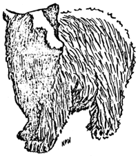
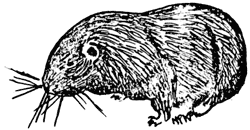 Confined to the Pacific Northwest, mountain beavers are grouped into the single rodent family Aplodontiidae, into one genus Aplodontia and into one species rufa, divided into nine subspecies. The mammal has several other names: sewellel (Indian name), boomer, and mountain burrower. Of these, the last is the most appropriate; forAplodontia is only distantly related to the American Beaver (Castor canadensis), the builder of dams and lodges. Differing in habitat, the mountain beaver lies in a series of underground tunnels, six to seven inches in diameter, with many external openings that are connected, above ground, by a network of runways. There are two types of openings: The one for general use is kept fairly clean and is used as an entrance and exit. The other type of burrow is employed as a refuse opening, through which the rocks and dirt of excavation are pushed forth.The brown mountain beaver (Aplodontia rufa rufa Rafineque), furnishes one of the most individual forms of animal life in Crater Lake National Park, interesting not only because it is one of the most primitive mammals in existence but also because of its limited range, its lack of close relatives, and its intensive food storing activity.
Burrows are usually located in a moist area, on a hilly slope where the soil is relatively loose, where springs exist, and the vegetation is dense. During my summer’s observations, I have noted the (inner) workings near Vidae Falls, in Castlecrest Gardens, in the springy area below the Gardens, and on the south slope of Munson Ridge near the Park Headquarters. In all of these workings, water was found to be trickling through at least a section of the tunnel system throughout the entire summer. For such a timid animal, water supply of this type proves to be protective as well as convenient. The creature is able to drink in perfect safety within the confines of its dwelling; also, the running water offers a means of disposal of waste vegetation material which readily floats out of the lower end of the burrow.
Aplodontia is a mammal which is rarely seen, because it is naturally shy and is mainly nocturnal in habit. On the early morning of August 26, I saw one of the animals loping along its runway and sliding into its burrow in the Castlecrest Gardens.
Ranger-Naturalist R. R. Huestis reports: “During August 1941, a brown mountain beaver took temporary refuge just above the ramp leading to the Sinnott Memorial, using the lower part of a burrow system which has been occupied by a golden mantled ground squirrel for the last three seasons. During two days the mountain beaver made a number of emergences to gather forage or to run the few feet between two entrances to the burrow system, both of which had been somewhat enlarged to better fit the new occupant. The Sinnott Memorial ramp is one of the most traveled walks in the park, so many visitors had the chance of observing and photographing a mountain beaver’s feeding technique, an activity that many experienced naturalists have never observed. The animal itself largely ignored the presence of the gallery except when someone moved close to it. Most of the visitors had never heard that there was such an animal, and, being duly advised of its rarity in public places, were enchanted at their opportunity and stood hopefully for considerable periods of time with their cameras at the ready.”
On August 27, at the Munson Ridge location, I caught a male in a Verbail wire loop live trap. This capture was made to find out what foods the mammal would eat and to study its habits. Measurements of the individual were: total length: 326 mm; tail: 23 mm; hind foot: 59 mm; ear: 23.5 mm.
Characterized by short legs, tail and ears; exceeding small eyes; large feet with naked soles and strong claws; long and stiff whiskers; the animal is very primitive in appearance and resembles a Mazama pocket gopher, (Thomomys monticola mazamaMerriam), which has been enlarged fifteen times. Coarse, shiny dark guard hairs extend above the softer rich brownish or chestnut fur. Below each ear is a white spot. Its stout body and broad, blunt head makes it especially adapted to the burrowing life.
Mountain beavers are strictly vegetarian in food habits, eating most types of herbage which grow near their burrow. I found the vegetation cut for drying in neat piles around the entrance holes or upon nearby rocks or logs. All the stems of the material in any one pile pointed in one direction. Around the hole would be several piles; each contained the same species of plant and may have indicated the size of the load carried by the individual. As a rule, the material constituted plants which grew in the immediate vicinity; on one occasion, however, red elderberry cuttings were observed 45 yards from the nearest shrub.
Foliage collected and eaten by mountain beavers covers a wide variety of plants. Availability seems to be the important factor in the type of food selected. In each of the locations the materials collected varied in direct proportion to the species growing nearby. Although the area adjacent to the burrows at Vidae Falls and Castlecrest Gardens supported great numbers of Lewis’ monkeyflower, in no case, was I able to find cuttings of this species. But my captive animal ate this plant quite readily. At the location on the south slope of Munson Ridge, three of the burrow entrances were located under a green-leaved alder; but no traces of this shrub were identified in the bunches of cuttings.
Although F. Lyle Wynd reports that false green hellebore is fatal to live stock (Nature Notes Volume 2, No. 2 August 1929) and that most species of Aconitum are poisonous to animals and human beings (Nature Notes Volume 2, No. 3 September 1929), both monkshood (Aconitum columbianum), and false green hellebore, (Veratrum viride Ait.), were eaten by the captured beaver without apparent maleffect. Monkshood was identified, also, in the bunches of drying vegetation at Castlecrest.
Twice daily at 7:00 A.M. and 10:00 P.M., from August 20 to August 26, examinations were made of the food piles at the Munson Ridge location to determine if the mountain beaver was active during the daytime. These observations showed that most of the activity of cutting and stacking occurred during the night; only once, on August 24, were new cuttings found at the night examination.
Each morning from August 11 through August 27, the materials appearing at the eleven holes at the Munson Ridge location were counted and marked. The marking was done by writing the date on a prominent leaf with pen and ink. By means of this counting and marking, it was possible to note the number of pieces of vegetation cut and stacked and the length of time required for the material to dry before it was taken into the burrow. During this period, the mountain beaver collected over 3246 pieces of vegetation.Dicentra stems amounted to nearly 25% of the material gathered and Valerianafollowed with nearly 24%. On August 22, alone, 488 pieces were piled. Note Table I.
| Plant Species |
Number of Stems |
Percentage of Total |
| Dicentra | 799 | 24.619 |
| Valeriana | 761 | 23.451 |
| Smilacina | 334 | 18.767 |
| Aquilegia | 78 | 2.404 |
| Sambucus | 35 | 1.079 |
| Aster | 44 | 1.048 |
| Senecio | 30 | .924 |
| Grass | 22 | .678 |
| Epilobium | 15 | .462 |
| Misc. | 852 | 26.256 |
| 3246 | Total | |
Table I – Material gathered at the Munson Ridge location by one mountain beaver during the period of August 11 through August 27. These figures list the number of stems of each of the species and not the bulk of the plant cut by the mammal.
The length of time the cuttings were left to dry depended upon the species, the weather, and the location of the pile. Specimens of Sambucus were not dry after five days. On August 25, four out of twenty-seven cuttings of Smilacina marked on August 21, and five out of twenty-one stems marked on August 22 were still present revealing the length of time some cuttings were left to dry. Dicentra and Valeriana stems were usually removed the next day after they were counted and marked; these have thinner leaves. In locations situated in the dense shrubbery, the drying of the material took twice as long as in open situations. On cloudy or rainy days, the vegetation scarcely wilted, and therefore, remained piled for a longer period.
At the Munson Ridge location the mountain beaver harvested its material as soon as it became completely dried, while the individual at the Vidae Falls site allowed the material to stay out until it became so dry that it was brittle.
In captivity the mountain beaver consumed 497 plants from August 30 to September 5. This count was taken in the number of plants eaten, therefore, indicates a greater amount of food than the number applies when compared with the number of stems counted in the field survey. Twenty-one species of vegetation are represented. See Table III. This range could be greatly increased by more intensive experimenting.
Although the mountain beaver is considered to be quite stupid and primitive, from these food studies, it can be assumed that he is quite a diligent and systematic worker.
| Plants Collected and Eaten by Mountain Beaver | |
| Aconitum columbianum Nutt. | Monkshood |
| Anaphalis margaritacea (L.) Benth. and Hook. | Pearly Everlasting |
| Aquilegia formosa Fisch. | Columbine |
| Aster englemanni var. ledophyllus Gray. | Engelman Aster |
| Dicentra formosa (Andr.) DC | Bleeding Heart |
| Epilobium angustifolium L. | Fireweed |
| Lupinus latiffolius ligulatus (Greene) C. P. Smith | Klamath Lupine |
| Salix eastwoodae Cockerell | Eastwood’s Willow |
| Sambucus racemosa calicarpa (Greene) Jepson | Red Elderberry |
| Senecio triangularis Hook. | Tall Ragwort |
| Smilacina amplexicaulis glabra MacBride | Fat Solomon |
| Valeriana sitchensis Beng. | Varlerian |
| Veratrum viride Ait. | Corn Lily; False Green Helebore |
Table II – Vegetation identified in piles stacked by mountain beavers in all of the locations noted in Crater Lake National Park.
| Rubus lasiococcus Gray. | Creeping Raspberry |
| Vaccinium membranaceum Dougl. | Big Huckleberry |
| Erigeron salsuginosus Gray. | Fleabane |
| Ribes erythrocarpum Coville & Leiberg | Crater Lake Currant |
| Castilleja miniata Dougl. | Paint Brush |
| Mimulus Lewisii Pursh. | Lewis’s Monkey Flower |
| Phacelia heterophylla Pursh. | Phacelia |
| Sorbus cascadensis G. N. Jones | Mountain Ash |
Table III – Plants, in addition to those found in Table II, which were eaten by the mountain beaver in captivity.
Activity of Park Beaver
By O. L. Wallis, Ranger-Naturalist
Beaver activity in Crater Lake National Park at present is at a low ebb. A survey of the old workings of the American beaver (Castor canadensis pacificus), in the Copeland Creek region reveals that there has not been any renewal for many years. Several of the dams observed in 1931 by the park naturalist, (Nature Notes Volume 4 No. 1, July 1931) still exist and are strong enough to retain a great quantity of water.
Observations in the Annie Creek basin near the South Entrance show that beaver have been active here to a limited extent. Cuttings estimated from the weathering to be no older than four months occur in the quaking aspens and the poplars along the stream bed. Older cuttings were seen on white fir, aspen, and poplar trees. One tree, 15 inches in diameter, remains standing although almost completely cut through.
Wildlife expert Robert S. Evans in his 1934 “Survey of Animal Life of Crater Lake National Park” states: “Since last year when an estimated number of 12 was reported for beaver living along the streams of the west slope, fresh beaver work has been found along Annie Creek in the southeast corner of the park;” the 1934 estimate was 18, but that exceeds the numbers which exist in the park today.
The beaver migration from the areas on Copeland Creek and Annie Creek probably resulted from one or both of two main causes: lack of sufficient food to support a colony and freezing of the water too deeply to permit winter activity.
Recovery of a Banded Gray Jay
Dr. D. S. Farner, Ranger-Naturalist
On August 6, 1946, in the course of ornithological investigations along the summit of the Cascade Divide between Annie Springs and Union Peak, two gray jays (Perisoreus canadensis griseus Ridgway) were collected from a family group of at least three. The birds were traveling from tree to tree through a rather dense stand of mountain hemlock (Tsuga mertensiana (Bong.) Sargent).
The collecting locality was one and one eighth miles southwest of Annie Springs, about 50 yards west of the Union Peak motorway. The altitude of this locality is approximately 6250 feet. One of the collected specimens had on its leg Biological Survey Band No. A283458. Mr. F. C. Lincoln kindly supplied the information that this band had been originally issued to Mr. W. T. Frost, formerly a ranger at Crater Lake. According to the data by Mr. Frost this gray jay was banded as an adult at Annie Springs on December 27, 1937. The bird was retrapped nine times on the day that it was banded, and four times on the following day. Mr. Frost placed and additional band of yellow color on the bird’s other leg for purposes of sight identification. This band had been lost by the time of the above described recovery. This recovery is of interest not only because of the age of nearly nine years attained by the bird but also as an indicator of the extremely restricted range of individuals of this species.
Some Miscellaneous Ornithological Notes
By Dr. D. S. Farner, Ranger-Naturalist
These notes have been selected from my field notes for the summers of 1940 and 1946. Only those which made a pertinent or interesting contribution to our knowledge of the birds of Crater Lake National Park have been included.
Erismatura jamaicensis rubida (Wilson) : Ruddy Duck
A pair observed about one half mile from Cloud Cap on the surface of Crater Lake, July 4, 1940. This is apparently a new record for the park.
Accipiter velox velox (Wilson): Sharp-shinned Hawk
Two seen in flight near Red Blanket Creek near the south boundary of Crater Lake National Park, August 28, 1946.
Accipiter cooperi (Bonaparte): Cooper’s Hawk
One observed near the upper end of White Horse Creek Canyon, August 9, 1946.
Buteo regalis (Gray): Ferruginous Rough-leg
One seen in flight near Discovery Point, August 2, 1946.
Aquila chrysaetos canadensis (L.): Golden Eagle
Single birds observed between Wizard Island and the south rim on July 29, 1946 and August 3, 1946.
Circus cyaneus hudsonius (L.): Marsh Hawk
One seen in flight along south rim, July 19, 1946. This bird was in brown plumage.
Falco peregrinus anatum (Bonaparte): Duck Hawk
One seen in flight near Red Cone, July 30, 1946. One seen in flight near Discovery Point, August 9, 1946.
Charadrius vociferus vociferus (L.): Killdeer
One observed at the boat landing on the south shore of the lake, July 13, 1940.
Larus californicus Lawrence: California Gull
Seen almost daily in numbers from one to ten on the surface, or flying above the surface of Crater Lake, July 18, 1946 to September 1, 1946.
Phalacrocorax auritus albociliatus Ridgway: Farallon Cormorant
Conspicuous by their complete absence from the Phantom Ship during the 1946 summer.
Megaceryle alcyon caurina (Grinnel): Western Belted Kingfisher
One observed on Wizard Island, August 4, 1940. One observed on the Phantom Ship, August 17, 1940.
Asyndesmus lewis Gray: Lewis’s Woodpecker
About three hundred seen between the Watchman and Cleetwood Cove, August 31, 1940. These birds were feeding and not in actual migration. I observed none in 1946.
Dryobates pubescens ssp.: Downy Woodpecker
Two observed near Bear Bluff, August 13, 1946. Not previously recorded from the park. Specimens are needed for further study.
Picoides tridactylus fasciatus Baird: Alaska Three-toed Woodpecker
One observed and collected near Red Cone Spring, August 14, 1946.
Nuttallornis mesoleucus (Lichtenstein): Olive-sided Flycatcher
Common throughout the park during the summer of 1946. A pair feeding at least three young out of the nest observed near Bear Bluff, August 13, 1946.
Tachycineta thalassina lepida Mearns: Violet-green Swallow
About 15 seen in the open area around the headwaters of the east fork of Munson Creek, July 23, 1946.
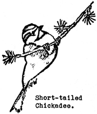
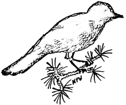
Parus gambeli abbreviatus (Grinnell): Short-tailed Chickadee
A pair with six young out of the nest seen near Park Headquarters, July 13, 1940.
Sitta carolinensia aculeata Cassin: Slender-billed Nuthatch
Single birds observed along the south rim, August 9, 19, 26, 1946.
Cinclus mexicanus unicolor Bonaparte: Dipper
One observed at base of Chaski Slide, July 11, 1940. One observed near boat landing on south shore of Crater Lake, August 18, 1946. It should be remembered that the littoral fauna of Crater Lake is essentially that of a mountain stream and that it is therefore not surprising to find dippers in this situation.
Salpinctes obsoletus obsoletus (Say): Rock Wren
An adult and three young seen near the boat landing on the south shore of Crater Lake, August 2, 1940.
Sialia mexican occidentalis Townsend: Western Bluebird
Three observed near Red Blanket Spring, August 14, 1946. This new record for the park needs to be confirmed by collected specimens.
Spinus pinus pinus (Wilson): Northern Pine Siskin
A juvenile bird following an adult and seeking food from it seen along south rim, August 26, 1946.
Passerella iliaca ssp.: Fox Sparrow
Three seen on Red Blanket Creek motorway about 2.5 miles from the south boundary. One was carrying food in its bill indicating that it was possibly a breeding bird feeding young. One collected, July 8, 1946.
Melospiza melodia ssp.: Song Sparrow
One seen in Munson Meadows in areas where lincolni was abundant, July 20, 1946. This needs to be verified by collected specimens to establish it as a new park record.
– o –
“Nature is the Art of God”
– o –
Food Habits of Crater Lake Salamanders
By Dr. D. S. Farner, Ranger-Naturalist
Two species of salamanders, belonging to the genera Triturus and Ambystoma respectively, occur under the rocks at the waterline of Crater Lake. On August 17 and 24, 1946, 56 salamanders were collected for the purpose of examining their stomach contents.
Of the 27 Ambystoma examined, 19 of the stomachs contained material. Fourteen (74 percent) of these contained terrestrial arthropods, or fragments thereof. These were mostly insects such as ants, wasps, flies, beetles, etc. Usually there were parts of one or two animals only per stomach. Seven stomachs (37 percent) contained aquatic insect larvae. Two stomachs contained unidentifiable material only. One contained only a piece of andesite about one centimeter in length.
Of the 29 Triturus examined, there were 27 with food items in their stomachs. Sixteen (56 percent) contained the fresh-water shrimp, (Hyallela), (one to sixteen per stomach). Nine of these sixteen had no items other than Hyallela. Eight stomachs (30 percent) contained snails (one to 15 per stomach). In four of these, snails were the only item; in the other four, Hyallela was also present. Five (18 percent) contained aquatic insect larvae (Coleoptera, Trichoptera, and Diptera), one to three per stomach. Two contained caddis-fly larvae. In three of the five instances, the aquatic insect larvae were the only food items. Four (15 percent) contained terrestrial insects or fragments thereof (never more than one per stomach). In three of these, the insect, or fragment thereof, was the sole item; in the fourth, there were also two Hyallela. One stomach contained unidentifiable material.
The terrestrial arthropods, mostly insects, found in the stomachs of the salamanders are doubtless individuals which were either dead at the time of eating or were in a helpless and easily captured living condition on or in the water. In view of the fact that 74 percent of the Ambystoma stomachs with food contained such items and only 37 percent contained items would could have been taken alive it seems safe to conclude that the Ambystoma of Crater Lake is largely a scavenger taking mostly dead animals. Live food taken is that which moves slowly. Apparently fresh-water shrimp and snails, both abundant in its habitat, are not utilized. On the other hand, it appears that Triturusacts as a scavenger only rarely since only 15 percent of the stomachs contained terrestrial arthropods. Obviously the principal source of food for Triturus, at least at the time of year in which this study was conducted, consists of fresh-water shrimp and snails. Seventy-one percent of the stomachs examined contained either or both of these items. Aquatic insect larvae constitute the next most important item.
It is of interest to note that, in the stomachs of either species, neither aquaticColeoptera nor Turbellaria were found; although both are abundant in the habitats of these species.
Memorandum on Fishing
By Dr. S. Farner, Ranger-Naturalist
The 1946 fishing season at Crater Lake began on August 3, when the Crater Wall Trail was opened to public traffic. Fourteen fishing boats were available throughout the season which ended on September 2. Fishing activities and methods were in general the same as those of previous years. Many who had fished regularly in 1941 and 1942 returned during the summer of 1946. In general the fishing day ended one hour earlier in the afternoon because of the operator’s policy in calling the boats at 4:00 P.M. or shortly thereafter. As in previous years most of the fishing was done in the vicinity of Wizard Island and along the southwest shore of Crater Lake. No attempt is made here to estimate the amount of fishing or the extent of the catch at the Wineglass. The data on which this report is based are those boat fishing and a limited amount of shore fishing on Wizard Island and near the boat landing on the south shore of the lake.
1. The Catch in 1946. The total catch for 1946 was 97 fish of which 60 were silverside salmon and 37 were rainbow trout. This is the smallest recorded catch since records were begun in 1937. The estimated rate for 1946 is 0.11 fish per boat per hour, the lowest yet recorded. This rate is based on an estimate of boat hours for the season. The lowest rate prior to 1946 was 0.46 in 1938. Most of the silverside salmon were 8 to 12 inches in length and about 1/4 to 1/2 pounds in weight. A few larger rainbow trout were taken.
2. Physical and Chemical Studies. A limited number of observations and measurements were made because of the brevity of the season. Accurate temperature observations were impossible because of the lack of a limnological thermometer. However the use of an improvised method indicated that, at least, no appreciable changes have occurred. Secci disc readings indicate that the clarity of the water has changed little. Perhaps it has decreased slightly. Determinations of dissolved oxygen indicate that the water, varying with depth, is 70 to 80 percent saturated seven to ten parts per million with oxygen thus showing no appreciable change from previous years. Total carbon dioxide is about 33 parts per million of which about 30 parts are in the form of bicarbonate. This is essentially the same as previous analyses.
3. Fish Food. Because of the small number of fish caught, stomach contents from no more than 30 specimens were obtained. Although the data require further study it appears that there have been no appreciable changes in feeding habits. The principal items of food continue to be aquatic insect larvae, fresh-water shrimp (Hyallela), snails, and, less important, terrestrial insects which drop into the water. There appears to be no change in the abundance of these food items. If anything, the snails and fresh-water shrimp are more abundant than in 1941.
4. Age and Growth Studies. Because of the small catch and limited amount of data and materials were obtained. These will be studied this winter and a report prepared at the conclusion of the studies.
5. Natural Reproduction. During the summers of 1940 and 1941 more than 11,000 silverside salmon were taken by fishermen. With negligible exceptions these were the result of natural reproduction in the lake. The silverside salmon taken during the summer of 1946 were also the result of natural reproduction. Also, during the summer of 1946 considerable numbers of fingerlings of silverside salmon were observed near the boat landing. There can be no question that this fish can reproduce abundantly in Crater Lake. However, this year’s sparsity of fish in the lake would seem to indicate that the reproductive success must fluctuate tremendously. Evidence for the natural reproduction of rainbow trout is not as clear, although there seems to be little doubt that this species also reproduces naturally to (a) considerable extent.
6. Why are fish scarce in Crater Lake in 1946? Because of the similarity of fishing methods used in 1946 to those of previous years there can be little doubt that there has been a sharp decline in the fish population in Crater Lake. No defensible theory for the sharply reduced number of fish in Crater Lake in 1946 can be given at this time. Although all conditions appear now to be normal there is no way of knowing or ascertaining the conditions which existed and transpired between 1942 and 1946. Had observations and studies been made during this period it is highly probable that the present decline in population could have been predicted or at least its cause ascertained. Presumably there has been in the past five years and probably in the last three, a period unfavorable either to spawning or to the survival of small fish. The present decline in population serves only to emphasize the fact that Crater Lake is biologically a young and unstable lake and that a wise and successful fish management program can be developed and maintained only if a consistent and active research program be maintained.
7. Should stocking be resumed in Crater Lake? There will doubtless be considerable pressure from local groups for the stocking of more fish in Crater Lake. Such pressure is based on sincere but misconceived ideas that lakes can be easily and simply managed by stocking. Realizing well the difficulty in resisting such pressure this investigator, nevertheless, recommends that no fish be introduced into Crater Lake for at least two seasons to come. The reasons for this recommendation are as follows: (1) Restraining from the introduction of more fish for the next two seasons should give ample evidence as to whether or not natural reproduction is adequate to restore the larger population characteristic of the lake a few years ago. (2) Examination of the planting data, age-group data, and creel censuses gives absolutely no evidence to indicate that stocking, other than originally to establish the populations, has any real effect on the population and the catch by fishermen. Some of the largest plants correspond to the lowest catches. (3) Consideration should be given to the extreme difficulty and expense of properly stocking fish in the lake. It would seem that the economical and the most sensible approach from a conservation standpoint would be to rely on research and management rather than on repeated stocking. After several seasons it is possible that consideration of further planting may be justified for one of the following reasons: (1) Possibly, whereas natural reproduction may at times be extensive, periods may occur in which spawning and survival of small fish may be so sharply reduced that the existence of the population may become precarious. Further research is needed on this point. If such should prove to be true, a matter of policy is evident as to whether or not Crater Lake should be maintained as a fishing lake. (2) There is some evidence now that the strain of silverside salmon now in the lake is one that reaches maturity in or before its third year and that few if any of the fish reach the desirable fourth-year size. Should further observations and research bear out this surmisal it is possible that an additional stocking of silverside salmon could be justified.
8. Recommendations for further research. As indicated above Crater Lake is a young and unstable lake. Proper understanding and management of the fish population will require continuous research. Investigations have been handicapped by lack of certain equipment. For example, it requires more than an hour to take a single sample of water or a single bottom sample in the deeper part of the lake. Actually to obtain adequate data nearly a hundred such samples should be taken during the summer.
A table of the catch 1946 as compared with that of previous years during which records have been kept is found (below).
Period Number of Boat
ReportsNumber of Anglers Total Boat
Fishing HoursTotal Number
of FishRainbow Trout Silverside Trout Number of Fish
per Boat per HourNumber of Fish
per Hour per AnglerJuly 1937 317 634 920 767 — — 0.83 0.42 July 1938 149 298 476 248 — — 0.52 0.26 July 1939 194 376 1182 772 75 697 0.65 0.32 July 1940 248 493 1519 2755 116 2639 1.78 0.91 July 1941 286 764 1854 4579 210 4369 2.42 1.25 July 1946 ——— No fishing in July ——— Aug. 1937 318 636 794 535 — — 0.66 0.33 Aug. 1938 178 356 447 176 — — 0.39 0.19 Aug. 1939 119 234 597 204 38 166 0.34 0.17 Aug. 1940 177 344 978 1433 74 1359 1.46 0.75 Aug. 1941 333 650 1590 2722 113 2609 1.71 0.88 Aug. 1946 180* 350* 97 37 60 60 0.11 0.05 Total 1937 635 1270 1715 1302 593 709 0.76 0.38 Total 1938 327 654 923 424 342 82 0.46 0.23 Total 1939 313 610 1779 976 113 863 0.55 0.28 Total 1940 425 837 2497 4188 190 3998 1.68 0.85 Total 1941 719 1414 3444 7301 323 6978 2.06 1.07 Total 1942 ——— about 300 ——— Total 1943 ——— Shore fishing only. No Data ——— Total 1944 ——— Shore fishing only. No Data ——— Total 1945 ——— Shore fishing only. No Data ——— Total 1946 180* 350* 864* 97 37 60 0.11 0.05 *Estimated. Subject to correction when records of Crater Lake Park Co. are made available.
New Formations at Oregon Caves
By Robert C. Zink, Ranger-Naturalist
The formations seen today on a trip through Oregon Caves have required centuries to be built up. Most of the water whose action formed the caves from the melting ice and snow of the Ice Age, one million years ago. Since that time, the caves were eroded and dissolved out of the mountain; stalactites and stalagmites slowly grew from the evaporation of lime solution as it dripped in the caverns. An upper opening was formed naturally 75 feet above the present Cave Entrance, from which Cave Creek emerges from the mountain. This increased the draft and consequently the rate of evaporation.
In 1930 an exit tunnel 550 feet long was drilled to the upper end of the passages adjoining the Ghost Chamber; 218 feet above the Entrance, it greatly increased draft through the caves, so that it is very noticeable at the Entrance. This increase already shows its effect. On August 10, I noticed a crack in the newly cut marble at the inner end of the exit tunnel. Through this water slowly trickles, and around it calcium carbonate has been deposited to a thickness of 1/16 of an inch. Several stalactites 3/8 of an inch long have been formed. These have been built up in these few years as a result of the warm relatively dry air entering here from outside. Beyond, however, the air is dispersed, so that its overall effect in the caves would be difficult to determine.
The Back Country of Crater Lake
By Dr. C. G. Ruhle, Park Naturalist
Crater Lake National Park is generally considered with but one point of view, namely, that of seeing the lake. This is generally accomplished by taking the Rim Drive which encircles it. Some with a little more time at their disposal hike down the rim trail from the Rim Campground, take a boat trip on the lake, and perhaps venture a climb of Wizard Island or Garfield Peak. Few try anything else. This is rather unfortunate, for the country surrounding the lake abounds in interesting features: there are inviting park-like forests, pumice flats, flower-bedecked meadows, grassy flats around cold springs, solitary cones and craters, and interesting animal inhabitants with which to become acquainted.
This back country has the advantage of being close at hand; none of the trips which are outlined require more than a day’s time. There is no need of fretting with pack and pack animals; no bother about planning and setting up a camp. As there are no saddle horses in the park at present, the trips are for the hiker; except for the gradual slopes away from the lake in all directions the terrain in general is not rough, and there is small probability of getting lost.
The park is traversed from north to south by the Pacific Crest Trail System, being on the section between Diamond Lake and Mount McLoughlin. It is also crisscrossed by a system of primitive roads called motorways, which make excellent trails, but are closed to general automobile traffic, since they can be maintained for administrative purposes only. The hiker is not likely to met with a single vehicle on these motorways, even though he spend a whole week in hiking around. Three are no snakes, no poisonous plants, no savage wild animals about which to worry. In the trips outlined there are not dangerous climbs. The trip down Llao’s Hallway is strenuous and should not be undertaken by one who is physically handicapped.
Only one other warning is considered timely here. Never venture up or down the crater wall or the steep walls of the various canyons. The composing material is very loosely consolidated offering few foot or hand-holds, and there is constant danger from slide rock.
1. Around the Rim. From the rim road there are several interesting trips. The Watchman, which has a fire lookout at its summit, is a short climb of less than half an hour by trail, starting on the north side from the parking area by the road. A splendid view and a chance to learn something of the work of a fire lookout are the reward. The ranger-naturalists conduct scheduled walks to this objective. Firemaps, binoculars, the vantage point of a lookout tower, and an enthusiastic green-clad dispenser of information are valuable aids. Just north of the Watchman is Hillman Peak, 8156, an interesting, easy climb. So, too, is the walk up the grassy slopes to the summit of Llao Rock. On the opposite side of the lake a trail leads from the junction of the Cloudcap Spur to the summit of Mount Scott, 8938, the highest point in the park, which is also surmounted by a fire lookout. From it there is a magnificent view along the crest of the Cascades from Mount Jefferson and the Three Sisters to Mount Shasta. To the west, one gets a bird’s eye view of Crater Lake and its relation to the remnant slopes of old Mount Mazama. Beyond are the Calapooyas and the Siskiyous. To the east are block fault mountain ranges and desert pumice flats.
On the south side of Crater Lake is Sun Notch, only a quarter of a mile above the big loop in the road. The Notch was cut by a glacier existing on Mount Mazama before its destruction. Its U-shaped form is characteristic of a glacially scoured trough. The view from this place of vantage is well worth the few minutes needed to make the trip. From the Notch it is easy and worth while to climb along the edge of the rim to the summit of Dutton Ridge.
Another easy hike is to follow the old road and the crest of Munson Ridge to Park Headquarters or all of the way to Annie Springs, if desired. At places the crest is knife-edged, and opens up surprising views. A return hike to the Rim can be made via the trail that leads through the Castlecrest Gardens.
2. The Northwest Section of the Park. Red Cone, 7372, is a very easy climb that can be made from the north entrance road; the slopes are open and there is no need of following any trail. From this elevation come most of the volcanic bombs, big and small, which are found in the park. There is an old crater on the summit which has been almost completely filled with volcanic ejecta.
In the extreme northwest part of the park on the boundary line are Boundary Springs, the source of the Rogue River. This is an enticing, flowery spot, which can be reached by following the Castle Creek and Bald Crater motorways for seven miles from the north entrance road at a point four miles below the rim drive. The springs can also be reached by a much shorter trip from the Diamond Lake Highway to the north.
3. The Northeast Section. Timber Crater is readily reached by following a motorway from the North Entrance Road. A most delightful hike can be made down the Wineglass Motorway into stately, open yellow pine forests. Three miles down, a spur leads to the right to Cascade Spring several miles away, at which place there is a charming camp site.
4. The Southeast Section of the Park. The principal objective here is Crater Peak, 7265. It is reached by following Crater Peak motorway down Vidae Ridge. A short trail leads from the motorway to the summit. A much longer trip, but also worthwhile, is the trip down Munson Creek below Park Headquarters, following the canyon past Godfrey Glen and the Colonnades to the south entrance. This is a long trip of about 15 miles and requires a whole day. However, a poor trail leads from Godfrey Glen to the road, should one not care to traverse the whole distance.
5. Southwest Corner of the Park. Union Peak, Snow Crater, and Llao’s Hallway are perhaps the most interesting features in the park aside from the lake. Union Peak, 6220, is readily reached by following the Union Peak loop motorway from the Medford Highway, three-fourths mile above Annie Spring. This sharp summit represents the neck of an old volcano that antedates Mount Mazama. To the south of it is Red Blanket Creek, which touches the lowest part of the park and consequently has trees, flowers, and animals found nowhere else within the boundaries. All of this is part of the Pacific Crest Trail. The motorway continues from Union Peak over Pumice Flat, and rejoins the main highway system near Cold Spring Campground.
Snow Crater is a steep-walled depression, no one knows how deep, that is filled with snow to a depth of at least scores of feet, even when the days of the summer melting are over. There is no trail to Snow Crater, but as the forests are open, it is easily reached by following the ridge south of Arant Point for a distance of some two miles. It is well to get specific directions from the ranger-naturalists before starting.
Llao’s Hallway is a spectacular chasm with overhanging walls cut by a tiny creek in the soft fragmental materials, to a depth of one hundred feet or more. It can readily be entered by following a trail down White Horse Creek starting from the old campground on the Medford Highway, four miles below Annie Spring. The Hallway begins less than a quarter mile below the road; with ever increasing depth and impressiveness it continues for about a mile. From the junction with the main creek about a mile away, it is necessary to retrace one’s steps to the beginning. The course below that point is through a deep and dangerous canyon, difficult to traverse, and with little chance of one’s climbing out for five miles or more. Because the Hallway is filled with treacherous snow packs throughout most of the year, it is wiser not to undertake this trip until August or September.
6. Fishing in the Back Country. There is good opportunity to fish in the larger streams of the park but the fish are small. They are usually taken with angle worms.
For all of the trips outlined, it is wise to provide oneself with a topographic map of the park, which is obtainable from the ranger-naturalists on the rim. It is well also to get further information from these men before setting out on the course of discovery.
Editorial: An Appraisement
By Dr. C. G. Ruhle, Editor
Undoubtedly most people are initially attracted to Crater Lake National Park by the extraordinary beauty of the lake. This is expressed particularly in its Parriah blue color, which is not exceeded in brilliance, depth, and intensity by other bodies of water and which contrasts with a landscape especially suitable for its delineation and emphasis. From favorable sites on its singular setting on the truncated summit of a volcano, is presented an expansive outlook of dense forests, pumice waste lands, dark ranges, and high, solitary peaks.
The lake and its immediate surroundings form an infinite combination of pleasurable sense impressions arising from the symmetry and harmony of color, form, pattern, and sound, each acquiring significance by the intimacy of association together. The steep, variegated crater walls center attention on the lake and furnish a frame to delimit the picture and enhance its charms. The graceful green clusters of mountain hemlocks, themselves of exceptional charm, accent sharply the ultramarine color, and while acquiring emphasis by projection against it, act as effective borders for vistas of the lake. Cloud patterns cast moving shadows on the lake, and the varying light affects changes in the reflections of the enclosing cliffs. Countless wind flurries sweep across the basin and stir ripples of wavelets in sharply defined paths, as if created by jets of air.
To complete the picture, put in this framework a magnificent abandon of colorful wildflowers, open, park-like stands of Hudsonian forests, gnarled and wind-tortured veteran trees, desperately clinging to existence or succumbent to the vicissitudes of their home, tortuous rocks fashioned in the furnace of a volcano, and a benign salubrity of climate resulting from a combination of the crispness of the mountains and a suavity of the nearby Pacific shores.
In winter all these are wrapped with or completely buried under a score or more feet of snow, that softens the forms and imparts an enchanting aspect to the landscape. This is the paradise for the skier, but just as many come to see what great change winter has wrought, in the beauty of the lake and its surroundings.
Sublimity, power, and orderly operation are expressed in this creation. As practically all who come are impressed by its beauty, so few are uninfluenced by the significance of its story of origin as acquaintance grows. In this instance, one deals with the evolution of a landscape by age-long operation of forces generated from the power and energy of the inner earth. Although the visual beauty is enough in itself, it gather significance and emphasis only as the story of its genesis and structure are apparent. Crater Lake focuses attention on the realities of a landscape.
Not only Mount Mazama, the decapitated volcano now marked by Crater Lake, but also a vast area of some 200,000 square miles around it was built up by repeated flows of lava. The walls of the lake reveal how the mountain was built up layer on layer of volcanic ash, lava, or wash of streams and glaciers. Sometimes the mountain was quiet; forests and flowery meadows covered its mass, while tumultuous streams slowly were washing away its bulk. At times it was the mother of snowfields and glaciers, at times it glowed with Vulcan’s fire. Later, through collapse or explosion, the top gave way to form the tremendous caldera whose layers have edges that give evidence of recent breaking increasingly to widen the opening.
Of chief scientific interest is an accounting for the presence of this lake of overwhelming depth and beauty on the very summit of an unusual mountain. What are the interesting geological and dynamics of the volcano? What connects the beauty of the scenic features and the story of their origin? Why is the water so blue and so pure? How does one account for the presence of freshness of this lake at all, since it has no inlet and no known outlet? What is the origin, nature, and distribution of the flora and fauna of the region and how have they been influenced by the signal environment in which they are found?
The amounts of rain and snow that are added year by year are adequate to account for the filing of the caldera to its present height with water. Seepage, lack of suspended material washed in by rain, and the nature of the basin are such that the lake possesses marvelous clarity and beauty. Only in a region in which all of these local peculiar qualities are concatenate could a Crater Lake be possible.
Other pages in this section