
History of Rim Drive, Crater Lake National Park
This “History of Rim Drive” is part of the Historic American Engineering Record (HAER) study of Crater Lake National Park Roads, HAER No. OR-107. HAER (Eric DeLony, Chief) is a division of the National Park Service, U.S. Department of the Interior. This project was funded by the Federal Lands Highway Program, administered by the U.S. Department of Transportation, through the NPS Park Roads and Parkways Program. Fieldwork, drawings, and photography were completed under the direction of Todd A. Croteau, Program Manager, and Tim Davis, Program Historian. The recording team consisted of field supervisor and historian Christian Carr (Bard Graduate Center) and architectural technicians Sarah Lehman (University of Oregon), Walton Stowell (SCAD Savannah, Georgia), and Simona Stoyanova (ICOMOS, Bulgaria). Jet Lowe of HAER produced the accompanying large format photography. Stephen R. Mark, Historian, produced the historical report, which was edited by Justine Christianson, HAER Historian
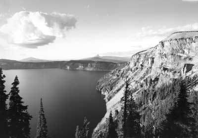
Taken from Pumice Castle Overlook (formerly “Cottage Rocks” substation) on East Rim Drive. Cloudcap is the highest point at right. |
Introduction Table of Contents |
|
| Circuit Roads | |
| Route 7 — Rim Drive | |
| Approach Roads | |
| Route 1 — West Entrance Road | |
| Route 2 — South Entrance Road | |
| Routes 3 & 4 — Munson Valley Road | |
| Route 5 — East Entrance Road | |
| Route 8 — North Entrance Road | |
| Other Roads | |
| Route 6 — Grayback Road | |
| Early Travel to Crater Lake | |
| Fort Klamath — Jacksonville Wagon Road | |
| Design and Construction of Circuit Roads | |
| Building the first Rim Road | |
| The Need for Reconstruction | |
| Designing a new “Rim Drive” | |
| NPS Collaboration with BPR | |
| Road Location | |
| Construction of Rim Drive | |
| Segment 7-A (Rim Village to Diamond Lake Junction) | |
| Segment 7-B (Diamond Lake Junction to Grotto Cove) | |
| Segments 7-C and 7-C1 (Grotto Cove to Kerr Notch) | |
| Segment 7-D (Kerr Notch to Sun Notch) | |
| Segment 7-E (Sun Notch to Park Headquarters) | |
| Other Designed Features along Rim Drive | |
| Trails | |
| Buildings | |
| Signs | |
| Postwar Changes | |
| Segment 7-A (Rim Village to Diamond Lake Junction) | |
| Segment 7-B (Diamond Lake Junction to Grotto Cove) | |
| Segments 7-C and 7-C1 (Grotto Cove to Kerr Notch) | |
| Segment 7-D (Kerr Notch to Sun Notch) | |
| Segment 7-E (Sun Notch to Park Headquarters) | |
| Design and Construction of Approach Roads | |
| The Army Corps of Engineers Road System | |
| Pinnacles Road | |
| Fort Klamath Road | |
| Medford Road | |
| Other Approaches | |
| NPS and BPR Collaboration on Approach Roads | |
| Route 1 (West Entrance to Annie Spring) | |
| Route 2 (South Entrance to Annie Spring) | |
| Routes 3 and 4 (Annie Spring to Rim Village) | |
| Route 5 (East Entrance to Kerr Notch) | |
| Route 8 (North Entrance to Diamond Lake Junction) | |
| Construction and Use of Other Roads | |
| Secondary Roads | |
| Route 6 (Lost Creek to Vidae Falls) | |
| Routes 25-49 (fire roads) | |
| Service Roads | |
| Rim Village | |
| Park Headquarters | |
| Annie Spring vicinity | |
| Outlying Areas | |
| Conclusion | |
| Bibliography | |
| Historic American Engineering Record Addendum to Crater Lake National Park Roads HAER No. OR-107 | |
Introduction
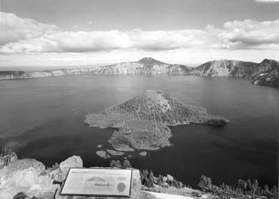
Located in south central Oregon, Crater Lake National Park embraces a portion of the Cascade Range. The park’s main feature, Crater Lake, is the deepest volcanic lake in the world. Framed by jagged, steep-walled cliffs of a caldera produced by the climactic eruption and collapse of Mount Mazama approximately 7,700 years ago, Crater Lake is renowned for both its clarity and intense blue color. The rim rises anywhere from 500′ to almost 2,000′ above the lake’s surface, creating a spectacular visual effect.
Crater Lake National Park was established in 1902 and has been expanded twice from the original 156,902 acres reserved for the “protection and preservation of the game, fish, timber, and all other natural objects therein.” It currently encompasses 183,224 acres and ranges from the summit of Mount Scott at 8,929′ above sea level to a point on the park’s southwest corner where the elevation is 3,980′. About 80 percent of the park area is formally recommended as wilderness, though one legislative proposal submitted in 1994 supported wilderness designation for 97 percent. The latter includes all but a small buffer around the developed areas and roads currently in use during the summer season.
More than three-quarters of the total number of park visitors come during the four summer months (June, July, August, and September). Annual totals reached a plateau of a half million in the early 1960s and have remained around that figure ever since, though these numbers can fluctuate as much as 20 percent from one year to the next. A majority of summer visitors make their first trip to the park, but the time spent within its boundaries averages just four hours. Visitor services and access are restricted during the winter months, when snow removal operations are necessary to maintain a road connection from the west or south entrances to an observation point at Rim Village. Winter weather over this period of eight months thus forces closure of roughly two-thirds of the park’s road system.
Circuit Roads
Route 7 — Rim Drive
Encircling much of the caldera rim is a scenic, two-lane road extending a little more than 29 miles from the main visitor use area at Rim Village to Park Headquarters in Munson Valley. Linking the two developed nodes is an approach road (Route 4) that extends for about 3 miles so motorists can drive a full circuit during much of the summer season. The entire loop is below timberline, but remains above 6,500′ in elevation. Past volcanic activity made for predominately poor soils whose productivity is also limited by drought conditions in summer. Stands of subalpine conifers (mountain hemlock, Shasta red fir, and whitebark pine) appear in varying density and can be interspersed with largely barren pumice fields. The loop avoids repetition by offering different views of Crater Lake from parking areas developed for that purpose and alternating them with glimpses of the hinterland. Rim Drive’s presentation of the lake and surroundings has been successful enough for the American Automobile Association to name it among the ten most beautiful roads in the nation.
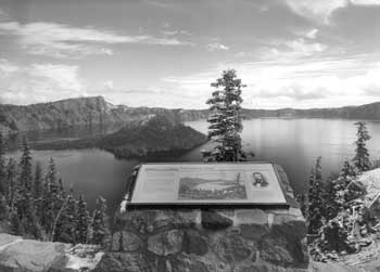 Interpretive marker at the Discovery Point parking area. |
Beginning at its junction with the main roadway through Rim Village, where signs notify motorists of the 35 miles per hour speed limit, Rim Drive heads west on elongated curves for just over a mile before the first large parking area is encountered near Discovery Point. Masonry guardrails, whose otherwise monotonous line is punctuated by crenulations at regular intervals, provide a safety barrier at most of the developed viewpoints and in many places along the roadway where there is danger of vehicles falling down steep banks. It is almost 5 miles from the Discovery Point Overlook to the next junction with an approach road, and motorists pass over a summit at 7,350′ in between these points. The parking areas along what is called “West Rim Drive” are more heavily used during the summer months than elsewhere on the circuit, largely because this road segment serves as a through route for visitors who use the north entrance.
Commencing at the junction with the North Entrance Road is the “East Rim Drive,” which extends for 23.18 miles before it terminates at Park Headquarters. Motorists begin by climbing to traverse the back of Llao Rock, going more than 2 miles beyond the road junction for their next glimpse of Crater Lake. Viewpoints along this northern section are not generally crowded, though traffic congestion is often acute in the vicinity of Cleetwood Cove. This is where motorists leave their vehicles, and pedestrians try to cross the roadway so they can access a trail leading to the lakeshore.
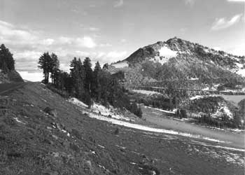
 Looking south to the North Junction parking area with Hillman Peak in the distance. |
Aside from the Cleetwood Cove vicinity, that portion of East Rim Drive between “North Junction” and the spur road to Cloudcap boasts a greater variety of shoulder and slope treatments than elsewhere on the circuit. Not only are the remnants of the earlier Rim Road better hidden through planting and some regrading, but also some cut slopes in this section were covered with layers of dark soil to reduce scarring that could be seen at a distance. This part of Rim Drive also retains some original paved ditches connected to drop inlets for cross drainage. These features reflect thinking by designers during the late 1930s who believed that the road’s subgrade should not be exposed to spring runoff from snowmelt.
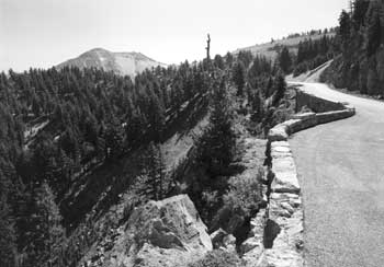
A series of seven “parking overlooks” begin roughly midway between North Junction and Cloudcap. These retain almost all of their stone masonry and a good deal of the planting done in the 1930s to “naturalize” what in essence serves as a foreground to the visual spectacle of Crater Lake. The first overlook is located above Grotto Cove, about halfway around the lake from Rim Village. It, like the other overlooks, features masonry guardrail, stone curbs, and planting islands used as a traffic separation device. The next parking overlook is less than a half mile from Grotto Cove, at Skell Head, and is followed by five more (Cloudcap, Cottage Rocks, Sentinel Point, Reflection Point, and Kerr Notch) over the next 7 miles. Each provides distinctly different views of Crater Lake, while the intervening roadway also allows for impressive vistas that include Mount Scott and the Klamath Marsh.
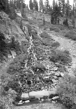
Visitors catch their last look at the lake from Rim Drive at Kerr Notch, located some 21 miles from where they began their circuit at Rim Village. The remaining stretch of road, however, cuts across the precipitous face of Dutton Ridge before it offers an expansive view of the Klamath Basin from near the road summit. Rim Drive then descends toward Sun Notch, where a short trail goes to another viewpoint where the lake can be seen, before following along the outer edge of Sun Meadow to a parking area in front of Vidae Falls. The falls are a cascade about 100′ high, but motorists pause at a parking area built as part of a large fill that covers the lower part of the cascade. A few visitors take the short access road below the falls to a picnic area, which also contains a trailhead to a cinder cone called Crater Peak.
The remaining 2.5 miles of Rim Drive from Vidae Falls do not allow for motorists to pull over and examine an impressive subalpine forest of large trees, but some stop at the parking area for the Castle Crest Wildflower Garden. There is a profuse display of flowering native plants in this wetland during July and August, made by a short path. Rim Drive terminates less than a half mile from the parking area, at its junction with the Munson Valley Road near Park Headquarters.
Approach Roads
Route 1 — West Entrance Road
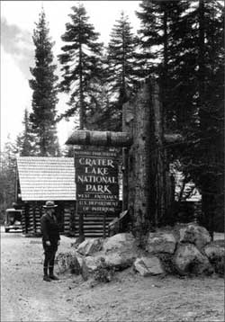 Superintendent Dave Canfield and a new entrance sign, 1936. NPS photo by George Grant. |
Extending from the western boundary of the park to the road junction at Annie Spring, this segment of a state highway leading to Medford and the Rogue Valley is 7.7 miles long. This asphalt road consists of two lanes, each of them measuring 10′ wide, not including the shoulder. Signs notify drivers of the 45 mph speed limit on both ends of this road, but numerous and relatively short curves make it difficult to maintain that speed for any appreciable distance. The slowest section is just over a mile from the Annie Spring junction, in an area misnamed the “corkscrew,” where a reverse curve allows motorists to climb or descend the Cascade Divide.
The West Entrance Road possesses few stopping places or parking areas, even in comparison to other approach routes. With the numerous curves and forested roadside demanding the motorist’s attention, some visitors remain unaware they are in the park until reaching the entrance station located next to the road junction at Annie Spring. The Pacific Crest Trail (PCT) nevertheless crosses the roadway within a mile of the junction and a sign points to an adjacent unsurfaced parking area for trail users. Heading west from the PCT crossing, drivers have virtually nowhere to park alongside the roadway for about 5 miles until a paved pullout delineated with bituminous curb called “Elephant’s Back” is reached. It permits those who stop on either side of the road to see where the canyons created by Castle Creek and Little Castle Creek meet. A half mile to the west is another paved pullout overlooking Castle Creek Canyon that once served as the park’s west entrance before boundary expansion in 1980. The pullout features a vault toilet and information kiosk installed during 2001. Visitors can also stop at the current west entrance a little less than a mile further on, where a sign built in 1998 replicates a rustic log structure erected by the Civilian Conservation Corps in 1935.
The lodgepole pine and Shasta red fir are densely stocked along this route, so most visitors rarely see more than the road prism while traveling. Elephant’s Back furnishes something of an exception, since the canopy is open enough to indicate the expanse of a stream canyon just a short distance beyond the parking area. Some visitors notice the outline of Castle Point, a prominent feature seen as an outline through the “dog hair” stands of lodgepole pine, while driving in either direction a short distance east of Elephant’s Back. From there toward Annie Spring the forest canopy is dense and largely closed, though a portion of Whitehorse Bluff can be seen before climbing the divide on the reverse curve.
Route 2 — South Entrance Road
This portion of Highway 62 links the road junction near Annie Spring with the park’s south boundary, a distance of 10.24 miles. It is an asphalt road consisting of two lanes with shoulders and posted at 45 mph, but elongated curves and greater sight distance in comparison to the West Entrance Road encourage motorists to go consistently faster than the speed limit. There is ample opportunity for visitors to stop and view the stream canyon formed by Annie Creek that cuts through pumice and ash ejected by Mount Mazama during its climactic eruption. Within a mile of the road junction at Annie Spring is the Godfrey Glen Overlook, a paved parking area separated from the canyon’s edge by masonry guardrail. The “glen” is where headwater streams join erosional remnants called “pinnacles,” which occur along the edges of the canyon and can be seen downstream near several other parking areas.
Some separation from the road can be found in any of the three picnic areas on this route. Less than 2 miles south of Godfrey Glen Overlook is the first picnic area, one largely bereft of scenic vistas but located directly across the road from a trailhead leading to Pumice Flat and Union Peak. Two miles further south is a picnic area where Annie Falls can be seen from the southern end of a short loop road. Across the canyon is Crater Peak, a feature easily seen from the highway by looking east. The last picnic area is set amid a forest dominated by ponderosa pine and conifers such as Douglas fir, sugar pine, and white fir. It contains a vault toilet and information kiosk completed in 2002, with only a short walk down slope from these facilities required for visitors to reach Annie Creek.
The last picnic area, one located less than a half mile from the park’s south entrance, is the only place motorists can stop within the so-called “panhandle,” an area transferred from an adjoining national forest in 1932. The size of what amounts to a road corridor, it extends for 2.3 miles and contains large trees that arguably provide the most impressive portal for visitors entering the park. Just over 3 miles from the boundary, however, the ponderosa pine quickly gives way to more monotonous lodgepole pine and some mountain hemlock. These tree species, along with an occasional western white pine, line the roadway toward the Annie Spring junction, though not so oppressive that they keep motorists from the occasional glimpse of features like Crater Peak.
Routes 3 & 4 — Munson Valley Road
From the Annie Spring Junction this road runs north to the junction with Rim Drive at Park Headquarters (Route 3), and then to Rim Village (Route 4). The two-lane asphalt road averages 24′ in surfaced width (including shoulders) and measures 7.06 miles in length. It is posted at 45 miles per hour like both parts of Highway 62 within the park, but there are two long tangents where vehicle speeds often exceed the posted limit. A long spiral curve at grade less than 2 miles from Annie Spring counteracts the tendency to go faster than the speed limit for a short distance, as do a series of shortened curves above Park Headquarters that allow motorists to enter or exit the upper end of Munson Valley.
Route 3 contains the only bridges in the park, starting with a wooden span about 40′ over Annie Creek, and located just a short distance from the spring. It and the bridge over Goodbye Creek, 1 mile to the north, were the first glue-laminated spans in any unit of the National Park System when constructed in 1955 and 1956. The Goodbye Creek Bridge is 70′ high and measures 218′ abutment-to-abutment (see HAER No. OR-107A). Two parking areas on the north side of this bridge form the Goodbye Creek Picnic Area, though the stream separates one set of tables from the other. Both parking areas are delineated with bituminous curb, as are eight roadside pullouts along Route 3.
Although Route 4 is roughly the same length as Route 3, it contains more curves of short radii in having to pass from Munson Valley to Rim Village, and is effectively part of Rim Drive in that it allows motorists to complete a full circuit. Roadside slopes on Route 4 are banked to achieve a rounded appearance, though the vegetation on them is often sparse due to frequent rock fall. Several drop inlets with stone masonry faces are the means of facilitating cross drainage in the steep sections, especially near Munson Springs. The road reaches Munson Ridge (the Cascade Divide) about a half mile beyond the springs and runs largely on contours to Rim Village. One short curve near the village can surprise motorists if they are traveling above the posted speed of 35 mph, not far from where many of them obtain their first glimpse of Crater Lake at the road junction with Rim Drive.
The two parts of the Munson Valley Road provide a dramatically different experience for visitors in terms of what they can see. Large mountain hemlocks and Shasta red fir line the roadside of Route 3, but the absence of understory vegetation provides filtered views into the forest. A parking area separated from the road a short distance uphill from Goodbye Creek allows visitors to leave their cars for a 1 mile walk called the Godfrey Glen Trail, a path that provides them with dramatic views of Annie Creek Canyon not seen from the road. Steep slopes and distant ridgelines are pervasive over most of Route 4, with Castle Crest (a massive ridge below Garfield Peak) dominating the scene above Park Headquarters. As motorists climb toward Rim Village, views of the Klamath Basin and major peaks to the south can be seen.
Route 5 — East Entrance Road
What was once one of the major approach roads in the park is now limited to connecting Kerr Notch on the East Rim Drive with the renowned “pinnacles” on Wheeler Creek. Motorists descend 5.9 miles on a two-lane asphalt road averaging 18′ in surfaced width and then have to turn around at a parking area placed for viewing the pinnacles. Visitors have the opportunity to walk another half mile on a trail from the parking area to the actual east entrance. The through route was discontinued in 1956 after traffic there had fallen to less than 4 percent of all park visitors. Much of the decline stemmed from a relocation of Highway 97 from the Sun Mountain vicinity some distance to the east in 1949. This came after the opening of two major state highways across the Cascades nine years earlier made travel through the park’s north entrance far easier than it had been previously.
The East Entrance Road runs immediately below the East Rim Drive for its first mile, with damage to the pavement evident due to falling rock from Dutton Ridge. This route is at a virtual tangent for the next 2 miles, until it reaches the road junction at Lost Creek Campground. The road closely follows Sand Creek for another mile or so, before veering south to Wheeler Creek and its pinnacles. Partial views of both stream canyons can be obtained in a few places, breaking the monotony imposed by thick stands of lodgepole pine. Once motorists turn around, they have the option of returning to Kerr Notch and rejoining Rim Drive or taking the unpaved “Grayback Road” (Route 6) west to Vidae Falls at Lost Creek Campground.
Route 8 — North Entrance Road
From the Diamond Lake (North) Junction on Rim Drive, the North Entrance Road runs 9.2 miles north to meet state highway 138. It is a two-lane road averaging 24′ wide, not including a shoulder 3′ in width on each side. Much of the road has a higher posted speed (55 miles per hour) than anywhere else in the park, commencing at a point 2.5 miles below the rim. This is due to a relatively straight alignment with no real curvature. Total relief on this road is about 1,000′, half of which is traveled in the first 2 miles below the North Junction.
Open pumice fields and features like Red Cone (7363′), Bald Crater (6478′), and Grouse Hill (7412′) dominate the panorama as visitors descend from the rim and head north. Thick stands of lodgepole pine obscure distant views after the first mile, though the Pacific Crest Trail crosses the highway between Red Cone and Grouse Hill. Visitors enter the Pumice Desert another 2 miles north of the trailhead, and can stop at a paved parking area where the largely barren terrain resulting from the great eruption of Mount Mazama can be better appreciated. The road then disappears into the lodgepole pine forest less than a mile from the parking area on the Pumice Desert, and remains there until the road junction with Highway 138 is reached. There is one short break from the monotony, on a descent toward the entrance station, where part of Mount Thielson (9178′), a jagged peak located on the Umpqua National Forest, can be seen in the distance.
Other Roads
Route 6 — Grayback Road
This one lane secondary road averages just 12′ wide over the 4.4 miles between Lost Creek Campground and the Vidae Falls Picnic Area, with the latter located just a quarter mile below Rim Drive. It is presently unsurfaced, though the remnants of past oil treatment can be seen in several places. Circulation on the Grayback Road is only in one direction (west), with the surface and curvature such that few vehicles can attain speeds greater than 35 miles per hour for even short distances.
A lodgepole pine forest dominating Lost Creek Campground quickly gives way to mountain hemlock and Shasta red fir as motorists cross over Lost Creek and begin climbing Grayback Ridge. They also cross Wheeler Creek (dry during summer) in less than a mile and have to negotiate several curves at grade before reaching points where Sun Creek Canyon, Crater Peak, and much of the upper Klamath Basin can be seen after 2.5 miles of travel. The descent toward Sun Meadow remains almost entirely in the subalpine forest, with limited views of the opening attainable where the road terminates at the picnic area.
Early Travel to Crater Lake
Mount Mazama’s climactic eruption left an indelible impression on the region’s native peoples, some of whom came to Crater Lake for spiritual and ceremonial purposes over the course of many centuries. The first recorded account, however, of reaching the rim came from a failed attempt by a party of would-be miners to locate a “lost” gold mine. They “discovered” what later came to be called Crater Lake on June 12, 1853, but failed to publicize the find from their home base of Jacksonville, the only town of any size in southern Oregon at the time, and one located about 60 miles southwest of the lake. Another group of miners reported seeing Crater Lake in the fall of 1862, though it hardly set off a barrage of publicity in the region’s newspapers.
Fort Klamath — Jacksonville Wagon Road
What made the lake a destination for the comparatively few tourists of the nineteenth century willing to make the trip lasting two weeks or more was a road built to connect Jacksonville with an army outpost established in 1863 at the upper end of the Klamath Basin. One road across the Cascade Range near Mount McLoughlin became a tortuous second choice to a route located in 1865 that followed Annie Creek to a fairly gentle divide, and one leading down from the upper reaches of the Rogue River toward Jacksonville. Once soldiers began building this new road, two hunters hired to supply the company with meat saw Crater Lake and reported it to their commanding officer, Captain Franklin B. Sprague. He wrote to the Jacksonville newspaper about the find as part of publicizing construction of the new road to Fort Klamath. Sprague’s letter focused on the locations of various camps along the road and estimated distances between them for the benefit of teamsters and others bound for the post, but he also described how his men were the first to reach the lakeshore.
A group led by the editor of the Jacksonville newspaper visited Crater Lake in 1869 and gave the lake its name after having used a canvas boat as the means to reach Wizard Island. The resulting publicity spurred subsequent visits by other tourists, though in numbers that rarely exceeded several hundred per season until the mid 1890s. They had access by way of the army’s wagon road within 3 miles of the rim, and many followed another road blazed by the Sutton party up Dutton Creek to the site later known as Rim Village. The upper portion of the Dutton Creek road was one way, and for the last mile, those with wagons faced a situation as late as 1904, where: “One of the older boys or a man would ride to the top or come down from the top to make certain the trail was clear and then fire a signal shot for the wagon to come up or down. Wagons on the way down would tie a log to the back to serve as a drag.”
Establishment of the park in May 1902 brought limited funding for road maintenance, but the first park superintendent, W.F. Arant, soon favored abandoning the road blazed by the Sutton Party and several miles of the wagon road built by the soldiers in 1865. Instead of having to climb this “almost impassable” road up Dutton Creek, Arant proposed veering away from it and then climbing to the drainage divide by means of a “corkscrew” so that visitors could go to the rim by way of Annie Spring and Munson Valley. He began building the new route in 1904 and continued with road construction over the next two seasons, yet the need for more improvements and repair of the wagon road elsewhere in the park were prominently featured in his annual report to the Secretary of the Interior in 1906. Much of the army’s wagon road, in Arant’s words: “has never had any improvement work done upon it; it is washed out, is sliding, crooked, and rough.”
Arant was able to do some additional repair and regrading of the wagon road built in 1865 before his tenure as superintendent ended in 1913, but funding from the Department of the Interior allowed for only a small number of laborers and horse-drawn equipment to be hired each year. As park visitation tripled from 1,400 in 1904 to 4,200 six years later, Arant observed how wagons and automobiles cut into the road surface, making it into a “very fine and deep dust.” He recommended that the road be thoroughly sprinkled with water since the very dusty condition of this and other roads constituted “the most disagreeable feature of traveling in the park.”
Crater Lake from a parking area on the north side of the rim above Steel Bay. |
Design and Construction of Circuit Roads
Only one road ran through Crater Lake National Park when Congress established it on May 22, 1902. The Fort Klamath — Jacksonville wagon road served as an approach route for visitors to the lake, though they still needed to follow a trail marked by blazes for the final 2.5 miles to the rim. A better road on the other side of the Cascade Divide (one going through Munson Valley) reached the site later called Rim Village in 1905, but those desiring to do a circuit around Crater Lake were faced with a cross-country pack trip lasting several days.
The first clamor for a circuit road came from park founder William G. Steel, but only after he started a concession company to provide visitor services at Crater Lake in 1907. Steel told one newspaper that the road’s construction was imminent that September, an announcement that largely stemmed from his optimism about public and private investment at Crater Lake, as fueled by visits from Secretary of the Interior James R. Garfield and railroad magnate Edward H. Harriman, president of the Southern Pacific. Garfield left office after the presidential election of 1908, while Harriman died soon thereafter, but Steel continued his pursuit of funding for roads both to and within the park through the Oregon congressional delegation. His first taste of success in this regard came in June 1910, when Congress appropriated $10,000 for the Army Corps of Engineers to make a survey and provide estimates for future road construction at Crater Lake.
A party of twenty-six men began work to prepare plans, specifications, and estimates for a park road system in August. The engineer in charge came to Crater Lake having studied a topographic map and quickly becoming convinced that a “main highway” or “boulevard” following the rim was feasible, with roads and trails to points of interest radiating from it. As the center of circulation, such a road followed long established precedents, given how circuits for riding and walking had served as the standard way of viewing European parks since the eighteenth century. Prominent landscape designers in the United States during the middle part of the nineteenth century like Andrew Jackson Downing embraced this convention as the desire for public and private parks spread across the Atlantic. It was Downing who provided a hierarchy of service, approach, and circuit roads in his work, and this heavily influenced the design of circulation systems in American national parks. The concept of a circuit road could also be applied at various scales, particularly where this device presented visitors with appealing views and distant prospects. For these reasons surveyors considered a road encircling the lake to be of “first importance,” in that it should follow the “ridges and high points along the crater rim on account of the view.” Approach roads to Crater Lake, by contrast, were to possess little in the way of scenic features.
Building the first Rim Road
Estimates for construction of a complete road system in Crater Lake National Park also reflected the emphasis on a circuit of the rim. Roughly two-thirds of the $627,000 needed to complete the grading for this system in 1911 would go to building the “main highway,” one that the Army Corps of Engineers wanted to locate as “near to the edge of the crater as can be done at as many points as possible.” They figured an average cost of building each mile of road to be $13,000, with the construction estimates based on a roadway 16′ wide shoulder to shoulder and an eventual surfaced width of 12′. This figure did not include paving at another $5,000 per mile, nor the need to build a guard wall as a safety barrier. The engineer in charge of the survey, however, believed that the latter could be hand laid with “dry rubble” without increasing the total estimated cost.
Road building started during the summer of 1913, with work supervised by the Army Corps of Engineers continuing over the next six years. Construction proceeded from the park’s east entrance to Lost Creek, where the Rim Road was to commence. Crews hired on a day labor basis, rather than on contract, started a circuit from there. One group went north toward Kerr Notch and then to the top of Anderson Point in 1913, while another crew worked from a permanent camp established in Munson Valley to reach the rim and continue west. Assistant Engineer George E. Goodwin had immediate charge of the project, which in 1913 also involved a number of refinements to road location indicated by the survey done three years earlier.
 Taken from the West Rim Drive with Watchman in the distance. |
Much of the construction was accomplished through either hand labor or equipment like horse-drawn road plows and graders. Progress in clearing and rough grading could be slowed, however, by the considerable amount of needed excavation by hand with picks and shovels in some places. The likelihood of continuing appropriations from Congress allowed for multi-year commitment by the Army Corps of Engineers at Crater Lake, so Goodwin reported on experiments with various kinds of road surfacing in 1913. This step would follow the grading phase, of course, but the engineers needed to find which type of surfacing could best withstand the climatic conditions and anticipated traffic. They compared various treatments on short sections of road in Munson Valley and found that a combination of an oil bound macadam and bituminous paving held the most promise.
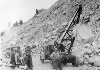
Despite having a small rock crushing plant and a wood fueled steam roller available during the surfacing experiments, lack of funds for surfacing prevented the engineers from completing anything more than a rough graded road around the rim over the next five seasons. Crews completed grading and installation of cross drainage (wood planks in a few places at first, but corrugated metal culverts later predominated) of two segments on the Rim Road in 1914. One connected Lost Creek with the permanent camp in Munson Valley and covered 10 miles, while the other went from Kerr Notch to the summit of Cloudcap, a distance of 4 miles. Having 250 men and fifty teams (many with drag scrapers) during August made a huge difference over 1913, especially since three steam shovels handled most of the excavation.
Appropriations for the work dropped in 1915, so the grading on Rim Road was limited to a section of 3.5 miles between Rim Village and the foot of Watchman. An average force of fifty-five men, six teams, and one steam shovel worked from July to October, with much of the work heavy excavation. The steam shovel handled much of the rockwork, often after drilling and blasting, with finish grading done by hand and teams. Despite the relatively slow progress with grading and installing cross drainage, the engineers reported having settled on a final location for the remaining road construction between the Watchman and Cloudcap.
The heavy winter followed by a cold spring and a labor shortage limited the 1916 season to just 3 miles between Watchman and the Devil’s Backbone, on the highest portion of the western rim. At that point about two-thirds of a projected 35.6 miles of Rim Road had been rough graded, with the engineers commenting that the newest section “provides many advantageous viewpoints of the lake and many beautiful outlooks on the surrounding country.” Grades varied between 2 and 10 percent on the already built road sections, with no curve being less than 50′ in radius and very few being less than 100′. Without surfacing material, however, the Rim Road was bound to become so badly rutted and dusty that automobile travel on it was described as “slow, disagreeable, and in some places dangerous.”
Closing the loop around the rim took two more seasons. Work continued from both ends in 1917, when 100 men and fifteen teams cleared, graded, and installed cross drainage from the Devil’s Backbone and then around Llao Rock to a point above Steel Bay on the northwest side of the lake. A separate contingent of sixty men and ten teams completed a switchback descent from the top of Cloudcap to the Wineglass, where a temporary shelter cabin was built. Day labor thus completed the grading of 6 miles despite a continuing labor shortage that put park road projects in competition with haying and harvesting operations in the nearby Klamath Basin.
Virtually all of the $50,000 appropriation for building roads at Crater Lake in 1918 went to the Rim Road, with most of that amount going toward rough grading of the last 6 miles from Steel Bay to Wineglass. Enough work had been completed by the end of September to allow the first vehicles to complete the entire Rim Road circuit. American involvement in World War I made the labor shortage more acute and snow conditions dictated a late start, but double shifts that often had the two steam shovels working sixteen hours a day allowed the engineers to close the construction camps in early October.
The engineers came back to Crater Lake in 1919, using the unexpended balance from allotments made the previous season to do a small amount of grading and repair on the Rim Road before transferring all property, materials, and supplies to the National Park Service in July. Work had progressed to the point where NPS director Stephen Mather thought it economical for his bureau to assume the responsibility for park roads, even though the engineers saw their project as only 50 percent complete. They pointed to the need for surfacing and paving in every annual report to the Secretary of War since 1913, but no funds for these phases of road construction had been forthcoming, even after a grand total of approximately $417,000 had been expended for equipment, supplies, and labor as of 1919 for grading a system of roads and trails in the park. Well over half that amount was spent on the Rim Road, a project that remained unfinished throughout the following decade.
The Need for Reconstruction
The National Park Service assumed control of the roads in Crater Lake National Park once the engineers departed, but available funding allowed crews to open the circuit each summer by hand shoveling, followed several weeks later by horse drawn equipment that removed rocks from the roadway. By 1923 Park Superintendent C.G. Thomson lamented to NPS director Stephen T. Mather that a rising number of vehicles made maintenance difficult in the absence of surfacing material, since the annual re-grading each fall could not adequately alleviate the problems associated with a rough dirt road. Publicly, however, Thomson extolled the numerous wonders seen from the Rim Road in promoting the park to visitors. According to him, the circuit should be seen as “not a joy ride, but a pilgrimage for the devotees of Nature.” It was where “a hundred views of the magic blue lake and its huge shattered frame” highlighted the “thirty four miles of amazing beauty, three hours of vivid and changeful panorama.” He knew what 200 cars per day over the course of nine weeks each summer could do to such an earth graded road, but Thomson counseled prospective visitors to “approach the experience [of driving around the rim] in a leisurely and appreciative mood, and great will be your reward.”
No matter how reverent the motorist, few considered the Rim Road to be adequately constructed as passenger cars became heavier and faster during the 1920s. Within a decade of the circuit’s “completion” by steam shovel and horse-drawn grading equipment, the narrow roadway made passage of vehicles headed in opposite directions difficult. Even though the average radius of curves “greatly exceeded” 100′, with none being less than 50′, they seemed tight by the highway standards of 1926. Curves needed to be lengthened so drivers could better sustain the posted speed throughout their journey around the rim. Grades varied from 2 to 8 percent (with some stretches of road at 10 percent for short distances), representing another design problem at a time when engineers agreed that a 5 percent grade should be the maximum allowed.
Metamorphosis of the Rim Road into a new circuit of Crater Lake took place as the state highway system and forest roads around the park experienced both steady and dramatic changes spurred by an infusion of federal highway funds expended through the Bureau of Public Roads (BPR). The road system in Oregon grew with the help of funds authorized by the congressional acts of 1916 and 1925 that were aimed at providing the states with aid in building highways. The BPR subsequently supervised contracts to upgrade approach roads to the park, such as the Crater Lake Highway (numbered as 62 after 1926), which had been part of the state system beginning in 1917. It also took the lead in the improvement of the federal system of roads, such as U.S. 97 (also known as The Dalles — California Highway) that served as the main north-south corridor through central Oregon, one that ran just east of the park.
Throughout the 1920s and 1930s, several roads built in the national forests near Crater Lake became part of the state highway system, including one connecting Union Creek with the south shore of Diamond Lake, and then over to U.S. 97. The most profound effect on the park visitation from building new roads, however, came in 1940. Realignment of U.S. 97 away from Sun Mountain and Fort Klamath dramatically reduced visitor traffic through the east entrance, but opening the Willamette Highway (numbered 58) from the north allowed park visitors to save about two hours over what had been the quickest route from Eugene. Previous work to provide a passable road through the park (much of it involved upgrading the Diamond Lake Auto Trail into the North Entrance Road) to a new “north entrance,” in concert with the effort to connect Diamond Lake with U.S. 97 played an important part in the park’s visitation reaching the unprecedented figure of 252,000 that year. At that point the western portion of the Rim Drive began to serve as both through route and a portion of the circuit road around Crater Lake.
Designing a new “Rim Drive”
On the most basic, functional level, there are several main reasons as to why the NPS and BPR undertook reconstruction of the Rim Road. The reasons addressed ameliorating a narrow, rough, dusty road with sharp curves and steep grades. Significant increases in visitation during the 1920s brought more traffic to the park, though at least one observer noticed that the existing road was so difficult to traverse that only a small proportion of motorists attempted to go around the lake.
 View to the north of Wizard Island Overlook, with clouds obscuring the top of Watchman. |
The NPS wanted the new Rim Drive to be a more pleasant visitor experience, but wanted to avoid creating a super-highway on which motorists “would speed around the lake and pass by scenes of beauty in their rush to make the lake circuit.” BPR engineers thereby aimed for a constant average design speed of 35 miles per hour that would avoid gear-shifting on ascent or braking on descent. Instead of the switchbacks and short radial curves evident in places along the old road, designers preferred curvilinear alignment that allowed vehicles to maintain the design speed despite curves and changes in grade. These alignments allowed for constantly changing views by making use of continuous (also called reversing) curves instead of long straight sections (tangents), and eliminated the need for cuts and fills that would be both unsightly and expensive.
Engineers who located the first Rim Road attempted to provide viewpoints of the lake in as many places as possible. The location diminished the interest inherent in being routed away from the lake in some sections, as well as the excitement experienced by visitors in reaching certain viewpoints by trail. The road also created some scarring evident from a few places on the rim since the Army Corps of Engineers had virtually no funding to address landscape concerns, even if such expertise had been available. Designers of Rim Drive aimed for visual unity in reconstructing the road, which included removing it from what visitors saw from the main focal points, or vistas. Unity encompassed the consolidation of park facilities and integrating trail location and design with that of the road.
Another rationale behind reconstructing the Rim Road lay in providing an intended, rather than incidental, link between a road circuit presenting central features and its interpretation to visitors. John C. Merriam, who probably served as the leading figure in creating a formalized interpretive program at Crater Lake, remained adamant that the road primarily serve the purpose of “showing the great features” of the lake and its caldera. He thus decried any attempt to make it a link in a larger through route connecting various points and thought it best to avoid allowing any part of the Rim Road to become a segment of the park’s approach roads. The circuit was instead be part of a plan aimed at presenting features of the region “determined by experts to be of outstanding importance.” Merriam thought that Crater Lake offered “one of the greatest opportunities for teaching fundamental understanding of Nature.”
With Crater Lake showing “the most extreme elements of beauty and power in contrast,” the plan included the development of “stations” where certain views helped visitors appreciate “elements derived from the geological story of Crater Lake and those arising from elements of pictorial beauty.” Merriam cautioned, however, that the “hand of the schoolmaster” not be overly evident at these particular places. The most overt attempt to educate visitors would instead be made at the Sinnott Memorial in Rim Village, a place Merriam referred to as “Observation Station No. 1.” He saw it as the “main project,” though “minor projects” of building the road, some trails, as well as additional observation stations had to be closely coordinated with developing the Sinnott Memorial for visitor orientation.
Where interpretation had formerly been incidental to the experience of traveling Rim Road during the 1920s, the slow metamorphosis of reconstruction was intended to bring this function to visitors in a more concrete way. Each of the seven observation stations built as part of Rim Drive were intended to serve as stops on the naturalist-led caravan that traversed the road in a clockwise fashion, from Rim Village to Sun Notch. All were chosen for their part in displaying a different aspect of the lake’s beauty. Spaced proportionately around the lake, designers intended to each have hard-surfaced parking for a minimum of fifty cars.
Plans for each observation station were to match the “unique beauty of the lake itself,” since Merriam thought the lake represented “a supreme opportunity to teach the significance of beauty through offering to the visitors the experience of beauty.” The points chosen by Merriam and his associates on the western side of the rim were accessible by trail so that the road would not come near enough to the station to create “a disturbing element to one who wishes to observe the lake in quiet.” This was something of a contrast with the four stations located on the northern or eastern side of the lake, which became part of the planning and design of the road. NPS landscape architect Francis G. Lange designated three of the four stations (Skell Head, Cloud Cap, and Kerr Notch) as “parking overlooks.”
Merriam wanted a leaflet describing the stations of Rim Drive to be available at the Sinnott Memorial, in conjunction with adequate signs at each station. These stops might also include an inconspicuous holder for literature describing the station for those who did not visit Rim Village first. As a designer, Lange supplied a more detailed vision for the stations adjoining the road. They should contain, in his words,
“a small promontory circulation point with the necessary stone guard rail (log, if found more suitable) and an interestingly treated sign distinguishing the point in question, as well as denoting any other unusual features. It is also suggested that a suitable mounted binocular glass be set up at each point where found desirable, being mounted on an appropriate stone base.”
For those stations accessible by trail, Lange recommended “stone steps if necessary, then a small promontory platform, some treatment of guard rail, possibly a sign and then a binocular mounted on a stone base.”
Beneath the observation stations in a hierarchy of developed viewpoints along Rim Drive lay the substations, numbering thirteen in 1934, but increased (at least in plans) to seventeen a year later. Substations shared many similarities with the observation stations in that they were chosen for aesthetic or educational reasons, but differed in that they did not function as stops on the caravan trip, nor were all of them formally developed with paved parking areas, signs, or masonry guard rail. Unlike the stations, they sometimes highlighted features situated away from Crater Lake and often focused on specific geological features.
Developed pull outs or “parking areas” served as the next level below the substations in the hierarchy. Although not chosen at random, these stopping points lacked the aesthetic values attributed to the observation stations and substations. Lange commented in 1938 about an effort to restrict the number of such points. Where “an interesting view of the Lake can be obtained,” he wrote, an effort “has been made to provide accommodations.” He also noted in the same report that where “excellent” views of the hinterland existed, several small parking areas were provided.
Preserving the primitive “picture” of Crater Lake received greater emphasis from the engineers and landscape architects as they planned the reconstruction of Rim Road than the interpretation of beauty and geological features. Merriam stressed Crater Lake and its rim was one of the three most beautiful places in the world and that every effort should be made to keep the road from imposing on views of Crater Lake or the surrounding region. Landscape architect Merel Sager described how the greatest damage to park landscapes came from the construction of roads and urged that an “intelligent and comprehensive program of roadside development” could better fit these roads into their surroundings. This meant attention had to be paid to the road as seen in the landscape and the landscape as seen from the road.
Rim Drive followed the old Rim Road wherever possible to minimize impact. Landscape architects and the foremen under contract also paid special attention to planting the noticeable cuts in new sections and trying to disguise (or “obliterate”) abandoned stretches of old road when funding allowed. Contract provisions called for protecting all trees not within the clearing limits (or “right of way”), placing dark soil and trees on conspicuous cuts and covering fills to diminish the ragged appearance of large rocks. Another dimension to the work involved “bank sloping,” where flattening and rounding was aimed at stabilizing cut and fill slopes to permit establishment of vegetation, while warping aided the transition between the bank and roadway. All of these measures reflected the standard practice of using landscape treatments to contribute to the utility, simplicity, economy, and safety of scenic highways built primarily for the enjoyment of motorists. The national parks received special attention in this regard, partly because the NPS pioneered many of the standardized landscape treatments in road design.
NPS Collaboration with BPR
The NPS gained a measure of control over its need to continually upgrade park roads in the face of increased vehicle speeds and a massive increase in automobile ownership with passage of legislation in 1924 authorizing annual appropriations specifically for this purpose. After working to solidify a working relationship with BPR over the next year or so, NPS director Stephen T. Mather signed an inter-bureau agreement on January 18, 1926. Under its terms, the NPS and BPR were to use “every effort to harmonize the standards of construction” they employed with those of the Federal Aid Highway system located outside the parks, while at the same time securing the “best modern practice” in locating, designing, constructing, and improving park roads. The inter-bureau agreement stipulated that the NPS reimburse BPR for overhead expenses from the annual appropriations for park roads. This included various levels of investigation and survey, the preparation of bid documents (derived from the plans, specifications, and estimates, known as PS&E), as well as salaries for engineers to supervise and inspect contracted work.
Once initiated, projects followed a familiar sequence that began with road location. After reconnaissance, engineers did a preliminary survey (or P-line) of the road location to obtain topography for representative cross sections. The P-line allowed for curvature and connecting tangents to be placed by “projection” back in the office, a step resulting in the semi-final location (or L-line). Staking in the field, or final location, necessitated the establishment of benchmarks on the ground, as well as any adjustments to grade or positioning of cross-drainage. All stages of road location were subject to NPS approval, with most of the changes provided by landscape architects.
The process of road design along Rim Drive was shared between the BPR and NPS. At a landscape scale, BPR designed three basic elements of the road: horizontal alignment, vertical alignment, and cross-section. The design of curves and tangents in a planar relationship is horizontal alignment, with preference given to use of spiral transition curves instead of tangents throughout most of the circuit. These made for a sympathetic alignment in relation to the park landscape, but also brought average speed and design speed closer together for the purposes of safety. Vertical alignment or “profile” is how the located line in plan view fits the topography in three dimensions, especially in reference to grade, sight distance, and cross drainage. The banking or “superelevation” of curves represented one particularly significant part of vertical alignment, since adequate sight distance in relation to the design speed needed to be maintained, particularly where a combination of curvature and grade occurred. The third element, cross-section, is a framework in which to place individual features and their relationship to each other. Features such as road width, crown, surface treatment, and slope were usually depicted through drawings of typical sections.
At the scale of individual features, the NPS worked to provide the BPR with standard guidance for the design of road margins (shoulder, ditch, bank sloping), drainage structures (culvert headwalls and masonry “spillways”), and safety barriers (masonry and log guardrails) along Rim Drive. As the lead NPS landscape architect for much of the project, Francis Lange produced planting plans in conjunction with a number of site plans for areas along the road corridor that needed individualized treatment beyond the standard measures described in the contract specifications.
 Scott Bluffs parking area with Mount Scott in the distance. |
Road construction consisted of three types of contracts beginning with the grading phase. There were numerous items on which contractors bid on the basis of unit prices for each. BPR engineers, in consultation with NPS engineers and landscape architects, provided estimates for the items, starting with clearing vegetation from the roadbed. Removing stumps and other obstacles to rough grading through blasting or burning constituted a separate item called grubbing. The subsequent rough grading with heavy machinery began with excavation, usually divided into separate bid items called “unclassified” and “Class B,” with the latter often specified by the NPS to avoid damage to natural features. Rough grading also included items such as moving excavated material based on estimated volumes needed for cuts and fills, placement of concrete or metal culverts as cross-drainage, as well as the flattening of slopes at prescribed ratios to control erosion. Completing the earth-graded road involved several items under the heading of “finish grading.” This step included fine grading of the sub-base and shoulders, as well as bank sloping. Depending on how much funding was available, subcontractors handled the stone masonry for culvert headwalls, guardrails, and retaining walls at this stage. Other subcontracted items under the heading of finish grading included old road obliteration and special planting once bank sloping had been accomplished.
With the grading phase completed, a separate contract for preliminary surfacing could be let. This next phase of road construction involved laying a base course of crushed rock on the roadway, followed by a top course of finer material to provide a definite thickness and protection for the earthen road underneath. This type of contract might include items, usually subcontracted, such as building masonry structures like guardrails (often on fills created during rough grading that had to settle over the winter) or special landscaping provisions to be completed as part of executing site plans or working drawings provided by the NPS.
Bituminous surfacing, or paving with asphalt, was done through another contract. This phase of road construction involved laying aggregate (crushed stone and sand) along a specified width of roadway as a base, followed by placing a bituminous “mat” as binder. The thin surfacing of bitumens known as a “seal coat” served as the final step. Completion of the paving contract generally signified the end of BPR involvement with construction. Road maintenance and post construction items thus became NPS responsibility.
Reconstructing 3 miles of approach road between Park Headquarters and Rim Village set the NPS/BPR collaboration in motion at Crater Lake. With the location survey completed several months prior to formal approval of the inter-bureau agreement, the grading contract commenced during the summer of 1926. The project reduced the maximum grade (from 10.9 percent to 6.5 percent) of this approach and produced a new roadway 20′ in width. As a precursor to reconstructing the Rim Road, this realignment became known for how visitors obtained their first view of Crater Lake as a spectacular and sudden scenic encounter. Landscape architects with the NPS chose the point of “emergence,” one allowing visitors to enter a new “plaza” developed on the western edge of Rim Village or begin a circuit around the lake.
The initial step in planning for reconstruction of the Rim Road took place once the inter-bureau agreement had been signed. The BPR reconnaissance survey of the park’s road system in 1926 furnished a starting point and allowed Superintendent C.G. Thomson to reference estimated construction costs in a report on his priorities for road and trail projects over the next five years. NPS officials in Washington requested the report in connection with allocating the congressional appropriation for park roads and trails, a separate process from the site development plans of the period that were aimed at facilities for areas like Rim Village.
Rudimentary lists of projects with estimated costs evolved over the next five years into a bound set of drawings by landscape architects showing the proposed site development in the context of projected park-wide circulation. Formal adoption of these “master plans” by the NPS came as appropriations for park development steadily increased, but these documents remained apart from planning for the location and design of roads. BPR accomplished these tasks through its usual process prior to letting contracts for road construction, subject to NPS approval. Master plans contained some information about Rim Drive and other road projects, but only as context for what the NPS landscape architects hoped to accomplish in a “minor developed area” such as the Diamond Lake (North) Junction or at the “parking overlooks” like Kerr Notch, Skell Head, or Cloud Cap.
Road Location
The idea of better positioning the park for through travel in reference to the location of U.S. 97 drove Superintendent Thomson’s priorities in his report about possible road and trail projects in 1926. A rerouted East Entrance Road received top choice for the time being, but Thomson wanted the west Rim Road improved “as soon as appropriations would permit” in order to better “take care of travel from Crater Lake to Diamond Lake.” He reasoned that this section received more use than any other on the Rim Road, thereby meriting consideration when more money became available, especially since a new location near the Watchman might help get the entire circuit open earlier in the season. Given the park’s short season, Thomson emphasized the importance of the Rim Road to the visitor experience by describing the circuit as “easily one third of the value of our Park and until it is fully open, thousands of people are denied” what he called “their greatest reaction.”
The BPR reconnaissance survey not only allowed Thomson to reference the construction estimates in his priorities, but also allowed him to comment on proposed road locations. It designated the Rim Road as Route 7 in the park and divided the circuit into five segments, labeling them as A, B, C, D, and E. Thomson took an immediate dislike to what BPR proposed as 7-E, a road segment 4 miles long and running from Sun Notch to Crater Lake Lodge by way of Garfield Peak. In addition to being very expensive, the proposed road location necessitated two tunnels and a “gash across the face” of Garfield Peak, which, as Thomson stated, was “altogether too beautiful to be subjected to the unconscious vandalism of ambitious engineers.”
Oddly enough, given his comment on the location of 7-E, Thomson endorsed what BPR proposed for segment 7-D. He envisioned that “all travel will enter the pinnacles (East) entrance” and then proceed to the rim to enjoy what Thomson thought to be the preeminent view of Crater Lake at Kerr Notch. In spite of the cut required across the face of Dutton Cliff on two sides, he enthused about how vehicles might travel “practically on contours” to Sun Notch. Visitors could thus enjoy a panorama of the Klamath Basin and the “tumbled” Cascade Range.
In urging that segment 7-A be given first priority for fiscal year 1929, Thomson stated that the stretch of road between Rim Village and the Diamond Lake (North) Junction constituted “practically a main stem for us.” It not only carried traffic to and from Diamond Lake, but also was the most traveled section used by visitors who did not go all the way around the rim. He believed construction of this 6.7 mile segment might take only one season, to be followed by the other segments over the next four years. In response, BPR conducted a preliminary location survey as another step toward construction during the summer of 1928. Beginning from Park Headquarters in Munson Valley, they went over Thomson’s preferred line for 7-E to Sun Notch in July and then pushed toward Kerr Notch on the reconnaissance line for 7-D. The location crew left Crater Lake at the end of September, having run a P-line for those two segments as well as the one connecting Rim Village with the Diamond Lake Junction. They did so abruptly, after receiving word from Albright that there would be no funding for road construction at the park in 1929.
The delay may have been fortuitous since Thomson transferred to Yosemite National Park in early 1929 and the new superintendent, E.C. Solinsky, wanted additional study of the P-line and segment 7-A in particular. One of his reasons pertained to a plan for building a new administration building at Rim Village. Solinsky believed that such a structure obviated the need for a ranger station there, so the latter could be located at the Diamond Lake Junction. Since he intended it to serve as an entrance (checking) station, Solinsky recommended postponing the building programmed for 1929 until the location of the junction could be finalized.
Another reason for further study pertained to Merriam’s desire for designing roads and trails “with special reference” to presenting park features and those in the surrounding region “which have been determined by experts to be of outstanding importance.” The Laura Spelman Rockefeller Memorial supplied a grant for a study of the educational possibilities of the parks in 1928, one administered by a committee headed by Merriam. Most of the field visits associated with the study took place over the next summer, followed by recommendations to congressmen well positioned in the appropriations process. At Crater Lake the study effort translated into money for building the Sinnott Memorial with a special $10,000 appropriation as well as funds to hire a permanent park naturalist and an expanded summer staff of naturalists.
Merriam visited the park in August 1929 and paid special attention to the location of Rim Drive. He then wrote to Albright about the need for someone who understood the park’s geological features to assist with locating segment 7-A. The recommendation brought about an on-site inspection of the P-line in October 1929, beginning at Rim Village and going clockwise on the old road to Kerr Notch. Arthur L. Day, volcanologist at the Carnegie Institution of Washington and head of its Geophysical Laboratory, served as Merriam’s representative. Joining him at the meeting were the district and resident BPR engineers (J.A. Elliott and John R. Sargent, respectively), as well as NPS chief engineer Frank Kittredge, chief NPS landscape architect Thomas Vint, and Solinsky.
The group recommended keeping the road as close to the rim as possible over the first mile from Rim Village, but with additional easy curvature to the first volcanic dike visible at the Discovery Point Overlook. They suggested elimination of a tight radial turn at the foot of the Watchman, and then chose a line that kept the road away from views of Crater Lake until the Watchman Overlook. Kittredge noted how BPR appeared to have “solved” the snow problem around the Watchman, presumably by running a lower line than the one adopted by the old Rim Road.
BPR opted for a low line around Llao Rock, though the group favored a spectacular “ledge route” involving sidehill excavation and a series of “window tunnels” on the lake side to obtain better views and reduce 2 miles of travel in reaching Steel Bay. Everyone came to agreement over leaving the Rock of Ages (Mazama Rock) undisturbed. All of the group members wanted the road to reach the top of Cloudcap, but no one thought of marring the fringe of whitebark pine overlooking the lake. This portion of the circuit required further study, the group advised, especially if it stayed close to the rim. The group endorsed the surveyed line between Cloudcap and Kerr Notch, with the stipulation that visitors should be able to reach the viewpoint for Cottage Rocks (Pumice Castle), as well as the Sentinel Point and Kerr Notch localities.
Although the group did not review the P-line between Kerr Notch and Sun Notch, Kittredge characterized it as requiring heavy blasting to make a roadway across sheer cliffs. He saw no way around blasting, but thought damage could be limited if care was used in preventing material from “flowing” down slopes. Kittredge also mentioned two prospective routes beyond Sun Notch, with a decision needed about whether to bypass Park Headquarters and go to Rim Village by way of Garfield Peak instead. One route that did just that came to be known as the “high line.” The other route, a “low line,” largely utilized the existing road connecting Lost Creek to Vidae Falls.
 Andesite boulders quarried at the base of the Watchman during the 1930s became a conspicuous part of designed cultural landscapes at Rim Village, Park Headquarters, and along Rim Drive. |
With segment 7-A scheduled for bid in the fall of 1930, the next phase of location work focused on it. Resident BPR engineer John R. Sargent took charge of the L-line survey for the initial part of Rim Drive after NPS landscape architect Merel Sager found the P-line unsatisfactory in “numerous” places. Sager effected revision of the old line with advice from Merriam, Harold C. Bryant (assistant director of the NPS as head of the branch of research and education in the Washington Office), and Bryant’s deputy, geologist Wallace W. Atwood. Sager and Vint went over the revised line with Sargent in August, with Sager returning in October to meet with Sargent about designating certain places along segment 7-A with Class B excavation. Clearing by NPS crews under BPR supervision commenced shortly thereafter as a way to allow the prospective grading contractor the benefit of a full working season in 1931.
L-line surveys continued over the following summer and proceeded quickly enough over segments 7-B and 7-C for the NPS to pre-advertise bidding on them in November 1931. The location work covered a new road of just over 13 miles, one now routed almost to the base of Mount Scott. This line avoided the 10 to 12 percent grades on the old Rim Road’s ascent of Cloudcap through use of a dead-end spur road to the top. After some discussion, the NPS chose a line having a gentler grade routed away from the rim down to the Cottage Rocks viewpoint, instead of going down the south face of Cloudcap. The portion of segment 7-C between Cloudcap and Kerr Notch then became known as 7-C1 and subsequently divided into two grading contracts, units 1 and 2.
Park Superintendent David Canfield could thus confidently assert by November 1934 that the award of two grading contracts in 7-C1 brought the Rim Drive three-quarters of the way around the caldera. Anticipated construction, Canfield noted, would provide the planned connection with the East Entrance and U.S. 97, leaving only a quarter of the circuit “untouched” except for survey work. Location of that remaining quarter became contentious, beginning with a salvo launched in May 1931 by Park Commissioner William Gladstone Steel. He wanted a road built from the base of Kerr Notch to Crater Lake Lodge inside the caldera at a 4 percent grade, a route to be accompanied by a tunnel leading to the water. Horace Albright, now director of the NPS, dismissed the idea as “chimerical.” Bryant wrote to Steel and attempted to point out that the new road’s alignment was aimed at preventing it from being visible at a distance to those standing on the rim.
In any event, Sager pointed to a pair of big problems associated with any “high line” route proposed for connecting Sun Notch with Rim Village, starting with the outlay needed for obliterating scars on the sides of Garfield Peak. He also called the construction of a tunnel proposed by BPR “inadvisable,” owing to the prevailing rock types on the ridge above Crater Lake Lodge. Albright intended to study the high line in relation to the low line favored by Sager and other landscape architects in July 1931 as part of his stop to attend the dedication of the Sinnott Memorial. The director ran out of time to make a field inspection of segment 7-E on that visit to the park, then deferred a decision on it, finally decideding not to build a road into Sun Notch by the end of June 1933. Albright wrote to Solinsky on his last day as director in August and ordered that a “primitive area,” a roadless tract prohibiting vehicular access, be shown on master plans for the lands north of the old Rim Road between Lost Creek and Park Headquarters.
BPR engineers, and Sargent in particular, did not easily give up on the high line. Sargent persuaded Lange and the new superintendent, David Canfield, to walk the surveyed line of roughly 3 miles between Sun Notch and the lodge in July 1935. Lange went into considerable detail about the many construction and landscape problems posed by going through with the high line project in a memorandum to the NPS office of plans and design in San Francisco. He also pointed to the face of Dutton Cliff in segment 7-D as offering the “outstanding” problem, since the road location through large slides of loose rock would be difficult to camouflage. To put a road into Sun Notch around Dutton Ridge struck him as contrary to the park idea of “preserving those areas which are worthy of protection and keeping out any possible development.” Dutton Ridge in particular seemed to Lange to be a “spectacular creation,” while the primitive area around it gave him the impression that he was the first person to visit. He concluded the memorandum with a plea to keep any road at least several hundred feet below the rim at Sun Notch in the event that the higher line of segment 7-D won out over the low line.
Kittredge and the resident NPS engineer, William E. Robertson, also walked the high line within days of Lange’s field trip. They did so in response to a news article appearing in a Portland paper that came in the wake of Concessionaire Richard W. Price taking his case for the high line to the chamber of commerce in Klamath Falls. The local congressman contacted Secretary of the Interior Harold Ickes at roughly the same time, and Ickes then referred the query to NPS director Arno B. Cammerer. Albright’s successor dispatched Associate Director Arthur Demaray to Crater Lake for an on-site inspection of the two road locations, and told Ickes that the matter would receive further consideration upon Demaray’s return to Washington. Kittredge’s assessment of the high line from Sun Notch to Rim Village focused on the impact to Garfield Peak, though he offered the possibility of two one-way roads traversing the cliff face in line with Frederick Law Olmsted’s recommendation for that type of construction “for certain places.”
In his reply to Kittredge, Demaray dismissed the high line location for 7-E due to its impact on Garfield Peak. He told Kittredge that further consideration should be given to the high line in 7-D, one that ran “from Kerr Notch around Dutton Ridge to Sun Meadows, then joining the present road [from Lost Creek] at the Vidae Falls. This amounted to a “combination line,” one that Canfield strongly supported when he asked Cammerer to transfer funds originally programmed for the low line route and instead put them toward building segment 7-D. Lange again warned that such a road would “deface and permanently injure” the cliffs of Dutton Ridge, though he injected some levity into the situation by offering BPR the paraphrase “You take the high line and I’ll take the low line,” sung to the tune of “Loch Lomond.”
 Vidae Falls. |
Cammerer went ahead with recommending the “combination line” of a high 7-D and a low 7-E to Ickes on November 16, 1935. The secretary approved it several weeks later and his office issued a press release to that effect. Sargent confidently anticipated the decision by completing the fieldwork for what he called the “final located line” between Kerr Notch and Vidae Falls by late October, so that plans could be completed over the winter. Engineers estimated this stretch of 5.5 miles as the most time consuming portion of Rim Drive to build, so BPR divided it into three units (as 7-D1, 7-D2, and 7-E1) for the purposes of bids on future grading contracts. Sargent also ran a P-line of 4.3 miles for the last segment of Rim Drive, one connecting Vidae Falls with Park Headquarters, in the fall of 1935. His successor, Wendell C. Struble, revised the line over the following summer to eliminate about a mile of road construction, mainly because he and Lange agreed that the new line effectively reduced the scar width of 7-E2 as seen from Crater Lake Lodge.
The problem of how to approach Vidae Falls from Sun Notch and then cross the creek remained since, as Vint pointed out, Sargent’s line came too close to the falls and made any road crossing involving a fill too noticeable. He recommended that the line follow an approach road down to the proposed Sun Creek Campground (a development aimed at the interfluve between Vidae and Sun creeks near the old Rim Road), so that any fill used to span Vidae Creek might then be less obvious. A higher location required a bridge, Vint noted, one preferably built of logs. Canfield questioned the cost in relation to an expected life of fifteen years, while also suggesting some revisions to a design used for the log bridge built over Goodbye Creek (located south of Park Headquarters) in 1929.
Resolution to the Vidae Falls dilemma did not come until January 1938, after Cammerer wrote to Canfield’s successor, Ernest P. Leavitt. Not only did he want the new superintendent’s views on the controversial location of segment 7-D, but also he took that opportunity to express a preference for a bridge at Vidae Falls. Leavitt responded with rather emphatic reasons for why the line from Kerr Notch to Vidae Falls constituted a serious mistake, then gave Cammerer a number of reasons why a fill made better sense than a bridge at the falls. Demaray informed Leavitt in January 1938 that a fill had been approved, largely due to the “depleted condition” of funds for roads and trails during the current fiscal year and the small allotment anticipated for 1939. At this point the associate director regarded any lingering questions over the location of Rim Drive as “closed,” since a contract for grading 7-E2 had been awarded the previous fall.
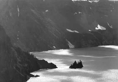
Wizard Island from the Watchman Overlook. |
Construction of Rim Drive
Segment 7-A (Rim Village to Diamond Lake Junction)
With roughly $250,000 allotted for grading just shy of 6 miles between Rim Village and the Diamond Lake Junction, BPR advertised for bids on May 1, 1931. P.L. Crooks Construction Company of Portland was awarded the contract and began work in June by establishing their camp near the Devil’s Backbone. Work proceeded quickly from Rim Village, with roughly one quarter of the job completed in only three weeks.
The contractor’s workforce of ninety men (increased to 125 by mid-July) soon began to encounter rougher terrain, where blasting and other means were needed to move more than 50,000 cubic yards of rock per mile. Just the first four rock cuts (which averaged 35′ in depth) consumed over half of the estimated 150,000 pounds of powder as needed for the entire job. The remaining seven cuts were not thought to be so difficult, with the exception of one running by the Watchman Overlook that measured over 90′ deep.
In early July, the NPS made note that four steam shovels were working to widen the existing road while “every effort” went toward retaining “as much of the natural beauty of [this] section as possible.” One of the measures taken limited the contractor to small quantities of powder when blasting, thus throwing rock into the roadway rather than the “right of way.” This method facilitated more effective debris removal by truck and reduced the length of fill faces, while preserving vegetation. Crews dug trenches at the toe of fills to hold rocks from rolling further down slope, and protected tree trunks with planking to prevent injury from flying rocks. The contractor later modified this practice through using worn truck tires, placing one on top of the other around tree trunks. This practice protected the trunk on all sides and allowed crews to move the tires from one rock cut to another as blasting progressed.
With all of the anticipated blasting and rock removal, the NPS tried to warn potential visitors about finding “some inconvenience” and advised them to take the “east drive” in preference to the west, even forecasting that the latter might be closed for two week intervals beginning in August. Despite this gloomy prediction, traffic flow on the west rim remained “unhampered” throughout the season. Much of the reason lay in constructing contiguous cuts and fills in half sections, thereby permitting the passage of vehicles. The project even allowed inauguration of the Rim Caravan that summer, a regularly scheduled excursion conducted by ranger naturalists that featured half of its sixteen stops within the first 6 miles of road beyond Rim Village.
By November 1, the job stood at approximately 75 percent complete. This was despite utilizing “as much hand labor as possible” to help alleviate local unemployment problems. Two of the heaviest cuts (one being around the Watchman Overlook) remained for the 1932 season, yet the four months spent on the job that summer did not quite bring it to completion. Aside from some finish grading, most of the remaining work related to landscape items. These, however, remained limited in comparison to subsequent grading contracts on other segments of Rim Drive. Old road obliteration, for example, took place only where abandoned sections touched on the new roadway. Consequently, long pieces of the old Rim Road remained plainly visible from high points such as the Watchman or Hillman Peak.
This somewhat patchy approach to landscape work also applied to the masonry items. Whereas the contractor saw the culvert headwalls to completion, only 250 yards of retaining wall and guardrail were built. The latter work during the grading contract came on the Watchman grade, where the NPS had the most concern for safety. The need for additional masonry wall along the road margins commanded sufficient attention, such that the NPS referred to the next contract as “Surfacing and Guardrail” when BPR advertised for bidders in the summer of 1932.
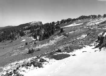 West Rim Drive is shown below (at left); the route of its predecessor, the old Rim Road– is now part of a hiking trail along the rim. |
Although a surfacing contract was awarded that fall, the successful bidder (Homer Johnson Company of Portland) did not begin work until August 1933 due to a record snow year. Barely two months elapsed before the onset of winter suspended the job, but unusually dry conditions allowed work to resume in April 1934. It proceeded quickly enough for final inspection of the surfacing to take place less than six months later, mainly because the Johnson plant produced 550 tons of crushed rock per day.
A subcontractor, Angelo Doveri of Klamath Falls, handled construction of the guardrails. The resident landscape architect for the season of 1934, Armin Doerner, described a slow start during the late spring and early summer. He found that different workmen each tried to express “his own ideas about masonry,” so it proved difficult to obtain “a uniform type of wall” at first. When Doerner and the BPR inspector finally agreed on the style wanted, the work improved and proceeded at a faster pace. Sargent and Doerner agreed to the locations of the walls, starting with two relatively short ones near Rim Village and another of some 500′ in length at the Discovery Point Overlook. By the final inspection in October, Doerner thought the guardrails had a “very pleasing” appearance aside from some imperfections. One was the trimming, which made it difficult to obtain the specified amount of weathered surface. Achieving the desired variety of color in the walls became problematic when quarrying all of the rock from the same locality.
The surfacing contract did not include enough funding to provide masonry guardrail to line the outer edge of each viewpoint, nor at the road margin where 7-A had been located along a precipice. Engineers tried to mitigate the latter problem by banking the road toward the inside slope, as they did along parts of the Watchman grade. The lack of guardrail, however, became even more noticeable at the Diamond Lake Overlook near Hillman Peak, a viewpoint whose outer edge had initially been delineated with irregularly spaced boulders having jutted ends. Its appearance put this substation markedly out of character with the rest of Rim Drive, so Lange prevailed on a CCC crew who partly buried treated logs to line the outer edge of the overlook in 1936. Each of the logs was hewn at its ends to provide better visual transition when spaced at regular intervals, since Lange hoped to bring weathered boulders to the site and alternate them with the logs. This treatment represented something of a stopgap measure in the absence of masonry guardrail, but it functioned as a better alternative than more crude barriers.
Doerner criticized another flaw in the surfacing phase of road construction in 7-A in 1934. He took aim at certain daylighted cuts (ones where equipment created open areas devoid of vegetation) that became pullouts once they had been surfaced with crushed rock. Not only were these unintentional additions superfluous since plenty of stopping places had been provided in the plans, but their appearance was so unsightly that Doerner wanted the surface material removed. He wrote that these flat areas should be allowed to grow over with a natural ground cover, since apparently there was no way to haul additional material to these sites and obliterate the pullout by bank sloping. The only obliteration stipulated in the surfacing contract for 7-A aimed at removing the quarry and crusher site from view, along with cleaning up the camp located near Devil’s Backbone. Johnson’s reluctance to do the latter may have stemmed from plans that targeted some of the camp buildings being used for the paving phase of road construction during the summer of 1935.
BPR awarded the contract for paving 7-A to J.C. Compton of McMinnville, who then started giving the road a bituminous surface treatment. This job consisted of several steps, with the first being the spreading of aggregate (or “prime coat,” as Lange called it). The laying of a bituminous “mat” of at least 3″ in depth came next, one extending over the entire roadway and parking areas. Lange thought the black color of the mat fit “well with the surrounding country,” and remarked how it presented a “fine appearance in relation to existing natural features.” The last step in the paving contract started with application of a seal coat or wearing course to a width of 18′ in accordance with federal highway standards of 1932. Its black color was then altered with a fine coat of rock, which upon rolling and brushing, yielded what Lange called a “uniform medium gray color.” The contractor completed this step on segment 7-A by October 1935, but returned the following year to finish a related paving job (on the North Entrance Road, route 8) and restore the site of his construction camp located near Devil’s Backbone.
Road striping did not come until 1938, but was in accordance with earlier advice from Lange, who advised that a “yellow, or similar colored line” could serve the purpose. He did not favor a continuous line over the entire road, but rather use of the stripe on curves or other areas in need of such marking to insure the safety of motorists.
Segment 7-B (Diamond Lake Junction to Grotto Cove)
Pre-advertising for bids on grading the stretch of road from the Diamond Lake (North) Junction to the point half a mile past Wineglass took place in the fall of 1932. Insufficient funding prevented letting a contract until September of the following year, at which time the award went to the firm of Von der Hellen and Pierson of Medford. The contractors went to work in October 1933, but BPR suspended the job upon the first snowfall several weeks later. In contrast to what NPS crews accomplished prior to the contract award in segment 7-A, the clearing and grubbing of 7-B became the contractor’s responsibility. They moved ahead on the basis of plans calling for a roadway of 22′ with a ditch 3′ wide. Another contract had to be let, this time to Dunn and Baker of Klamath Falls, in order to widen the roadway another 2′. This change was the result of a visit to the park by Secretary of the Interior Harold Ickes in July 1934.
Much of the work performed on the first grading contract in 7-B took place during the long summer season of 1934. Von der Hellen and Pierson set up camp near the Wineglass at a secluded spot where water could be pumped from the lake some 650′ below them. In contrast to grading segment 7-A, the grading contract for 7-B required comparatively little blasting and hauling of rock. The contractors could thus use caterpillar tractors and scrapers in handling the pumice material. They had some assistance from the final located line that called for five tangents of various lengths, but with several rock cuts required as part of preventing overly heavy curvature in the alignment. Doerner gave Von der Hellen and Pierson high marks for not scattering stumps beyond the clearing limits (or “right of way”) when blasting stumps, despite the road being characteristically close to the rim in many places. He also commented on the care taken with dumping rock at the ends of deep fills so that deep trenches at the bottom of fill slopes might catch debris from rolling any further. The contractors then used plenty of soil to completely cover the rock at the bottom of such fills.
Subsequent widening of the roadway began in September 1934, but Dunn and Baker found it impossible to take the same protective measures. In many places crews brought the rock back up slope by hand after it damaged trees. The road widening meant that Von der Hellen and Pierson could disregard some of the required bank sloping and shoulder rounding. Similar to the previous grading contract for 7-A, however, these contractors still had responsibility for other kinds of landscape work. Doerner reported that the masonry retaining walls and culvert headwalls in 7-B displayed good workmanship during the long season of 1934, though completion of these items did not come until the following summer.
Most of the old road obliteration in 7-B came in 1935, when Von der Hellen and Pierson hired a landscape foreman under Lange’s supervision. As resident landscape architect for the NPS, Lange saw an obliteration program to be “of immediate value to the natural appearance of new road construction” because it went beyond planting the ends of old road segments as was done during the grading of 7-A. With a crew of four to ten men, the landscape foreman planted approximately 100 whitebark pine and fifty lodgepole pine over 1.2 miles of old roadbed in 1935. The difficult growing conditions meant that some 75 cubic yards of soil covering was used in conjunction with a scheme that included spreading duff and small branches so as to eventually produce a “uniform” line of planting “unnoticeable to all but those accustomed to the old road location.” Lange took a number of photographs to show the effectiveness and appearance of such efforts, as part of his plan to obliterate 10 miles of old road. He estimated this multi-year project needed roughly 5,000 trees as well as 2,000 loads of soil, and required the services of two or three foremen and twenty laborers.
Grading and widening the roadway also necessitated what Lange called “special planting” aimed at large slopes exposed by construction. The foreman and his crew treated two sections of 7-B in 1935, with the first located near the Wineglass road camp where they treated a cut slope with some trees and dark soil so as to diminish the intensity of the vivid red color seen from Cloudcap. Work began by digging parallel trenches filled with mountain hemlock branches to hold the “new soil” and aid establishment of trees transplanted at the site. This procedure was also used to conceal a white line created by grading near Steel Point that could be seen from the Crater Lake Lodge.
Production of surfacing material for 7-B started even before the successful bidder, A. Milne of Portland, began opening a quarry near the Wineglass road camp in September 1935. The contractor set up a crushing plant there, an operation that Lange described as well screened from the road. It could produce a relatively large amount of material at 1,500 tons per day when running at capacity during the short working season. Once the plant at the Wineglass road camp produced sufficient quantities for both 7-B and 7-C, virtually all of the actual surfacing with crushed rock took place in 1936. With the paving of those road segments not due until 1938, BPR advised the NPS that maintenance crews should apply a light oil treatment in the interim to prevent loss of the soft rock quarried and processed for surfacing material at the road camp.
Milne’s subcontractor for the masonry guardrails made good progress in only two months on the job in 1935, completing almost half of the stipulated 450 lineal yards in segment 7-B. Lange seemed pleased with the pace at which work on the guardrails proceeded, but he commented that the first sections of wall built where the road first touched the rim east of Llao Rock were not entirely satisfactory. Within a short time, however, he remarked about how this item became “exceedingly well done” and included photographs in his annual report of some representative guardrails from this road segment.
Failure to provide such barriers, especially where the road ran close to a precipice concerned Lange, though he did not cast blame for the oversight. He instead called for the NPS or BPR to provide some rule for such areas in future contracts, whether the remedy lay in masonry wall or partially buried logs in combination with seated boulders. Since funds for additional masonry guardrail seemed out of the question, logs treated with creosote of varying lengths were placed to line road margins where the danger appeared to be the most acute. Lange preferred logs to alternate with boulders and produced a drawing to that effect, but the BPR district engineer did not believe that estimates in the existing advertised contract allowed for the cost of gathering and placing boulders. Lange nevertheless wanted spaces left between the logs in order to allow for the future introduction of boulders as part of a subsequent contract, so the installation of these barriers proceeded accordingly in 1936. Logs were also used to define islands in what Lange called “traffic control areas” at road junctions. The surfacing contract provided for treating the Diamond Lake Junction with partially buried logs having chamfered ends and some planting once fine grading of the site had been completed as part of the surfacing contract.
Segments 7-C and 7-C1 (Grotto Cove to Kerr Notch)
Available funds for letting a grading contract from Grotto Cove and the summit of Cloudcap in September 1933, plus short-term uncertainty over the L-line near Mount Scott, resulted in splitting segment 7-C away from what was now called (for contracting purposes, at least) 7-C1. The grading contract for 7-C and the spur road to Cloudcap (4.4 miles in all) went to Dunn and Baker, who were also awarded the contract for widening 7-B and 7-C in 1934. It made for a smooth transition, especially since this firm had the benefit of a long working season that year.
Clearing and grubbing were included within the bid items for grading 7-C, just as they had been for the previous segment. Other similarities to previous grading contracts were items like the masonry headwalls for culverts and the limited amount of old road obliteration. Dunn and Baker experienced more difficulty than Von der Hellen and Pierson with rocks rolling beyond the toe of fills during blasting operations. Some damage, for example, resulted when in an accidental overcharge of powder sent a large quantity of rock below a cut near Scott Bluffs. Having to repair the damage made the most challenging part of rough grading even slower, since the stipulated light shooting had to be followed by construction of a retaining wall. Superintendent Canfield described these rock formations as difficult, but ones that the contractors handled efficiently and in the same manner as those in segment 7-A.
After completing most of the items as part of widening 7-B and 7-C, Dunn and Baker went to work during the summer of 1935 grading one of two units in segment 7-C1. This section of 1.5 miles extended from the Cloudcap Junction (where the spur road to the summit diverges from Rim Drive) to Sentinel Rock. Von der Hellen and Pierson, meanwhile, started grading the other unit of 7-C1 (a section of 2.4 miles of road between Sentinel Rock and Kerr Notch) that summer after having finished grading in 7-B.
All the rough grading in 7-C and 7-C1 meant that the amount of landscape work accomplished during the 1935 season was relatively small, apart from subcontractors finishing the culvert headwalls and some planting related to old road obliteration in the Cloudcap vicinity. Lange made a point, however, of describing two associated problems that rose to the top of his list to correct over the following summer. One resulted from cuts where one side of the cut was too low in height to be properly sloped. He acknowledged that a number of landscaped parking areas were necessary for visitors to enjoy the scenery and make repairs to their vehicles if necessary, but any proliferation of unintended parking areas detracted from Rim Drive being able to harmonize with its surroundings. Lange wanted these areas converted into slope banks where at all possible, and then showed an example of the recommended treatment in his annual report for 1936.
An even larger problem stemmed from daylighting prominent viewpoints in 7-C for fill material, thereby compounding the challenge of having to obliterate old road on soils that tested virtually sterile. Lange began making an argument for extensive landscape treatment of what he began to call “parking overlooks” in 7-C and 7-C1 as part of his season ending report for 1935. He pointed to certain examples, such as the excessive daylighting at Skell Head, in identifying five localities for special landscape treatment as part of a future surfacing contract.
Lange made preliminary sketches of five parking overlooks, going somewhat beyond what had become the standard treatment for viewpoints along Rim Drive. In addition to masonry guardrail to delineate the edge of the rim for motorists, Lange added a bituminous walk running the full length of the wall as well as a stone curb to separate the viewing platform from parking. Each of the five overlooks featured an island defined by a combination of weathered boulders and logs so as to protect a small amount of planting that consisted of native shrubs and trees. He argued that the islands helped to diminish the size of each of the daylighted overlooks, thereby placing each of them into proper scale in relation to Rim Drive. The islands also provided greater safety by separating motorists using the road from those leaving or entering each overlook.
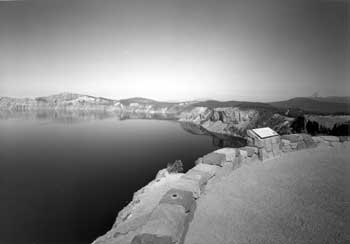 Interpretive marker and parapet wall at Skell Head. |
After describing how the stations located along Rim Drive might appear in his season-ending report for 1935, Lange obtained topography and other engineering data from BPR for the parking overlooks over the following summer. Whereas segments 7-A and 7-B had so far represented missed opportunities to properly develop the stations and substations along Rim Drive through the contracting process, Lange wanted to show what could be achieved at viewpoints located in 7-C and 7-C1. He included photographs in his reports of progress made at four parking overlooks in 7-C through the surfacing contract (the same one awarded to Milne for 7-B) during 1936, with each showing how the masonry guardrail looked in relation to logs used for demarcating the islands. Although still in the rough grading stage of construction, Lange anticipated similar landscape treatments at four parking overlooks in segment 7-C1. Rejection of bids for the 7-C1 surfacing contract in the fall of 1936 proved to be an eventual boon to the development of the parking overlooks, since BPR subsequently doubled the amount available for landscaping these viewpoints. The move reflected the need to transport and place weathered boulders, as well as the use of topsoil, peat, and fertilizers as soil amendments prior to planting some 400 trees and 600 shrubs at the parking overlooks. Lange produced site plans for seven overlooks located between the Wineglass and Kerr Notch that were formally approved in December 1936 and then incorporated in the revised set of plans, specifications, and engineering estimates used to solicit bids at the end of June 1937.
BPR awarded the surfacing contract for 7-C1 to the Portland firm of Saxton, Looney, and Risley in July, with the job getting underway in late August. The contractors made relatively quick work of spreading a base course over the 4 miles of this road segment, completing it in the fall of 1937. The landscape component was only half finished by the end of the season, even though the two foremen who reported to Lange directed a crew of twelve laborers. Planting required hauling topsoil and peat from “pits” located near Park Headquarters, in addition to using 3 tons of fertilizer obtained in Klamath Falls. Lange described preparation of the planting beds as a base of peat, to be followed by placing shrubs or trees, with topsoil and fertilizer put “around but not too close to the root system.” Duff was then scattered throughout the immediate vicinity of the planting. Crews followed the same procedure when planting at the parking overlooks during the 1938 season, although this time they were under the supervision of new foremen. They planted a total of 625 trees, as well as 2,300 shrubs and plants at the viewpoints over two summers.
The masons, meanwhile, added to guardrail previously completed in 7-C by finishing another 750 lineal feet of guardrail in 7-C1 that season. They also continued to place what Lange described as “excellent stone curbing” at the overlooks, in addition to the weathered boulders indicated on the site plans. Lange also assisted the masons by providing a working drawing for steps leading to a trail at Sentinel Point and a sketch for the stone drinking fountain installed at Kerr Notch. The additional touch of paving walks at four parking overlooks in 7-C came as part of the paving contract awarded in June 1938 to Warren Northwest, a construction company with regional offices in Portland.
The contractor erected its plant at the Wineglass road camp over the following month, situating it so as to be equidistant from both ends of a job that called for paving approximately 12 miles of Rim Drive between the Diamond Lake Junction to the road summit atop Cloudcap. In contrast to the work completed in 1936 along the 6 miles of 7-A, this contract included paving “gutters” in accordance with guidance developed by Thomas E. Carpenter, deputy chief architect for the NPS. His work reflected a trend toward shallower ditches requiring less maintenance, given that the bituminous paving acted as a seal against run off that might otherwise disintegrate surfacing material used to protect a road’s subgrade. The gutters were to work in concert with catch basins or inlets connected to culverts placed underneath the road at regular intervals. For this contract the “invert” was set at 5″ below the seal coat, with an actual level depth of 3″ in the paved gutter. Lange commented that the gutters had an “excellent appearance” in his report for September 1938, but the contractor returned in 1939 to do additional sealing because cold weather the previous fall caused some cracking.
With the paving contract essentially completed, Lange used a number of photos in his season-ending report for 1938 to show how landscape treatments improved typical road sections in 7-B and 7-C. In contrast to the numerous landscape items left unfinished in 7-A, both of the latter segments exhibited good examples of old road obliteration, bank sloping, and special landscape treatments such as adding dark soil to reduce scars. Paving and placement of catch basins in conjunction with the placement of backfill for gutters seemed to signify that the new Rim Drive was “rapidly becoming a reality,” with all work projected to be finished in the fall of 1940. Lange made a point of depicting the finished parking overlooks in 7-C and 7-C1 since they demonstrated how to rehabilitate damaged areas while properly developing the observation stations and substations. The only thing missing from 7-C1 was the paving, but it went to the top of Superintendent Leavitt’s funding requests for roads and trails beginning in 1939.
Segment 7-D (Kerr Notch to Sun Notch)
Formal adoption of the so-called “combination line” in December 1935 pushed BPR to finalize plans to locate Rim Drive between Kerr Notch and Sun Notch. Instead of “skirting” Dutton Ridge as the official press release had claimed, the road location required major cuts on both sides. The large amount of excavation anticipated caused BPR to split 7-D into two grading contracts, with 7-D1 originally projected to encompass about 2.7 miles from Kerr Notch to a point on the south side of Dutton Ridge where the road would crest. The lowest bid on this first contract, one that required a staggering 176,000 cubic yards of excavation, was rejected in July 1936 since it was considerably above the engineer’s estimate. The need to make an award within existing allotments led to another advertisement for bids a month later, this time with the distance of 7-D1 reduced to just over 2 miles. The contract went to Orino Construction of Spokane, who then set up camp on Sand Creek in Kerr Valley and began its clearing operations. Dunn and Baker, meanwhile, won the contract for grading the next 2.9 miles of road. This included both 7-D2 (which ran from the end of Orino’s contract on Dutton Ridge over to Sun Notch) and the adjoining 7-E1. They could do little more than establish camp on Vidae Creek before the construction season came to an end.
With the grading contract for 7-D1 estimated to be some 70 percent excavation, Lange warned that the job required extremely careful measures to protect trees. He made special reference to fill material, which could escape in areas dominated by long and continuous slopes. With blasting operations imminent in July 1937, Lange described how the ground cover of willows and other plants located beyond the grading line were already being struck by falling material. It upset him enough to write that the location for 7-D should never have been approved because of the resulting damage, though this sentence was subsequently scratched out on his report.
Blasting by Orino over the next few weeks gave Lange and resident engineer Struble almost opposite impressions. Whereas Struble described the contractor’s progress as unsatisfactory due to extreme care taken with type “B” excavation, Lange wrote about Orino permitting a number of excessive shots not in accordance with instructions from BPR. Slides traveled, he observed, far below the necessary line of repose. This damaged trees to such an extent that the majority had to be removed. Crews pruned trees where blasted material hit their tops, while cuts were treated with creosote if the damage did not require removal. Lange gradually prevailed upon Struble to require Orino to protect trees in subsequent blasting by shooting with less powder. The difficulty of grading in such terrain, however, made complete protection “almost impossible,” even when trees from the roadway were placed against those situated below the grading line.
Cuts represented another aspect of rough grading that detracted from what Lange had described as an area that was “originally admired for its stately and primitive character.” One of these measured approximately 145′ to the roadbed from the crest of the cut, causing falling rocks to be a constant danger due to so much loose material on Dutton Cliff. An “epidemic” of minor accidents kept the park physician busy, such that Leavitt noted that the men hired by Orino seemed especially prone to broken ribs. Not only were equipment operators vulnerable, but also those men working on several hundred feet of hand placed retaining wall. Lange described the wall as necessary in order to give the roadway its designed width of 24′. He especially liked how it blended with the surroundings from the point above Kerr Notch, writing that the massive rocks obtained in the cuts were well selected for color and uneven faces.
The difficulties encountered by Orino in grading 7-D1 during the 1937 season (his crews consumed more than 60 percent of the allotted time, yet completed only a third of the job) contrasted markedly with how Dunn and Baker fared in 7-D2. The south and west sides of Dutton Ridge and the area above Sun Meadow required about 50 percent rock work, but the contractors found it easier than what engineers had estimated. Progress on grading 7-D2 stood at almost full completion by October 1937, with only finish grading and some landscape details expected for the following season. Lange identified “very little” damage to trees, either in burning those cleared from the roadway or during grading operations. He described how log cribbing used on this job reduced injury to standing trees and noted that the contractors retrieved all of the rocks passing beyond the desired point of repose at the toe of each fill.
Lange seemed particularly pleased with the masonry features along 7-D2, making special reference to what later became known as “spillways,” in his season-ending report for 1937. He included a photograph showing a floor laid to catch run off derived from continual seepage on slopes, to be connected with culverts as part of cross drainage. The masonry component of this grading contract was otherwise limited to building culvert headwalls, most of which appeared along the south side of Dutton Ridge, where snowmelt created seasonal drainage.
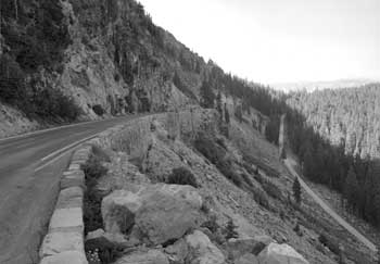 East Rim Drive along Dutton Cliff with the Pinnacles Road below it. |
Guardrails were to be part of the surfacing contract, but Lange could not help noticing how the road location he so heavily criticized opened some fine views along this section of Rim Drive. After securing topographic data from BPR, he prepared sketches for parking areas like Sun Notch along 7-D2. The parking areas became part of finish grading in 1938, as did additional bank sloping and covering a portion of the scar on Sun Grade with dark soil.
Orino completed most of the rough grading in 7-D1 during the 1938 season, but all of the time allotted for the contract had long since elapsed. A somewhat sympathetic Lange explained that the number and size of the retaining walls needed along the eastern side of Dutton Ridge justified a contract extension. The hand placed walls begun in 1937, for example, were placed on each end of a masonry wall to span one of the fills. Others required masonry walls roughly 25′ in height, with one noteworthy example exceeding twice that measurement.
The fills settled sufficiently for construction of masonry guardrail to move forward as part of the grading contract for 7-D1 during the 1939 season. Lange expressed some hesitancy in allowing Orino to extract rock from the Watchman for some 3,000 lineal feet of guardrail, but he and Leavitt relented once the contractor agreed to use a heavy crane for obtaining material. This method eliminated new “tote” roads and other construction impacts associated with reopening a quarry that had been “restored” since 1936. Struble thought the guardrail component was especially well organized during the summer of 1939, especially since the masons had completed the job by August 20. Lange saw the rock selection and workmanship as very good, commenting on how the guardrail had been introduced to “best advantage, resulting in varying curves to fit the terrain.”
In his season-ending report for 1939, Lange called the provisions for protecting the landscape in 7-D1 “commendable” despite his misgivings about the road’s location. Damaged trees were removed, pruned, or had cuts created by flying rock treated with creosote. Other measures included special planting on slopes below the fills so as to reduce future damage from rock fall on the East Entrance Road, as well as some fairly extensive bank sloping and regrading as part of old road obliteration around Kerr Notch. Several small items had to be deferred to future contracts, with one example being Lange’s proposal to plant the areas adjoining each of the three spillways in 7-D1 so as to better “reproduce” the natural stream bed adjoining the road.
After inviting bids for surfacing 7-D along with segment 7-E in August 1939, BPR awarded the contract to Orino several weeks later. Although largely devoid of landscape items, this job included a provision for building more than 300 cubic yards of masonry guardrail in 7-D2. The contract centered on producing aggregate for the next two phases of construction, so Orino set up a rock crushing plant in June 1940 not far from the camp he occupied along Sand Creek during the grading contract.
The nearby quarry yielded enough rock for a base and top course of surfacing material and some 27,000 tons of aggregate to be stockpiled for future paving of the remaining segments of Rim Drive. This “leg up” approach to paving left a mere $70,000 needed for plant mix, labor, and equipment to place a bituminous surface on segments 7-C1, 7-D, and 7-E. The paving job represented the final piece after the government had spent a little more than $2 million in contracts for building Rim Drive since 1931. Difficulties with obtaining equipment for the rock crusher, however, hindered progress on the surfacing contract so that production of aggregate was not completed until September 1941. In the mean time, the contractor applied a “double prime bituminous surface treatment” to the unsealed roadbed as a temporary measure for carrying traffic until such time that actual paving took place.
American involvement in World War II allowed for only enough funding to remove slides that resulted during the winter of 1941-42. With paving put on indefinite hold, the suggested treatment of the parking areas became a forgotten item. Lange used a photo to depict one such stopping place in 7-D1 as part of his final report at Crater Lake for 1939. With the masonry guardrail completed, he remarked that the parking areas should be given a lighter color finish than that of the road.
Segment 7-E (Sun Notch to Park Headquarters)
The initial P-line run by BPR assigned segment 7-E to a route linking Sun Notch with Rim Village, but the subsequent adoption of a “combination line” led to dividing the segment into two pieces for contracting purposes. A sort of “middle line” connected Sun Notch with Vidae Falls and became 7-E1, while 7-E2 roughly corresponded to the old “low line” running from Vidae Falls to Park Headquarters. Some adjustment to the road mileage stipulated in the respective grading contracts was still necessary, however, due to the uncertainty that existed in 1936 over what the site development around Vidae Falls might entail. This resulted in shortening the contract for grading 7-E1 by four tenths of a mile so that it could be combined with 7-D2 and then advertised for bid.
Dunn and Baker completed all of the rough grading and most of the finish portion of the contract in 7-E1 during the 1937 season. Just over a mile in length, 7-E1 turned out to be relatively easy work. In running above the western margin of Sun Meadow and along the bottom of a slide on the flank of Applegate Peak, the new road provided Lange with an opportunity to show a particularly good example of bank sloping through a heavy rock slide. The only other landscape item that he or the superintendent noted in 7-E1 concerned the need to obliterate an old “motor trail” improved by the CCC in 1933, one that started toward Sun Notch where the old Rim Road crossed Sun Creek.
BPR awarded the contract for grading 7-E2 to E.L. Gates of Portland in October 1937. This meant that work on the final 3.3 miles of Rim Drive began the following spring, with the nagging question of whether to construct a bridge or use fill to span Vidae Creek finally resolved. Gates constructed the fill over the following summer, which included placement of a pipe culvert with stone headwall at both ends. Lange estimated the contractor to have completed 90 percent of the rough grading in 7-E2 that season. Photographs in his final report for 1938 showed ditch and slope treatment along one stretch of road, some old road obliteration through bank sloping, and placement of what he called a “culvert drain” with rough stone pavement less than a mile from Park Headquarters.
Aside from planting, most of the remaining items in the grading contract pertained to completing the road connection below Vidae Falls to the proposed Sun Creek Campground. A need to relieve pressure on the campground at Rim Village drove selection of new sites, such as Sun Creek, away from where the lake could be seen. As one of several satellite areas, NPS officials hoped that a new campground below Vidae Falls might provide an attractive alternative to the problems associated with overuse in Rim Village. Superintendent Leavitt liked the Sun Creek site, but did not want it opened for use by visitors until properly developed so as to avoid damage to the trees and ground cover. The first step toward building the campground came in the form of a serpentine road going down a quarter mile from Vidae Falls to an area that once served as an informal picnic site on the old Rim Road. A bank slope constructed at its intersection with the Rim Drive served the dual purpose of reducing the campground road’s presence to motorists traveling the main route, yet also afforded sufficient visibility from one road to the other.
Plans for a stopping point beneath the waterfall called for widening the road fill on the upstream (or northern) side of Rim Drive, so as to allow for parallel parking. Installation of a stone drinking fountain at this parking area came in July 1939, but construction of additional landscape features had to wait until the subsequent surfacing contract was let. These included building a raised walk 4′ wide in front of Vidae Falls, which was separated from the roadway by a stone curb. Just as they had in 7-D, Lange and other NPS landscape architects anticipated distinguishing the Vidae Falls parking area from Rim Drive through the use of pavement having a rougher texture and somewhat lighter color finish.
Introduction of the fill spanning Vidae Creek constituted what Lange termed as the “major landscape problem” in 7-E2. He reported that it required more than 1,000 yards of topsoil in preparation for planting the entire slope as part of making the fill conform to surrounding terrain. This effort required more than 5,000 plants, shrubs, and trees. Al Lathrop, formerly one of Lange’s assistants for CCC work, had charge of a crew numbering ten men and paid by the contractor. They needed sixteen days to plant a mix of species that included willows, mountain hemlock, huckleberry, purple-flower honeysuckle (twinberry), and spirea. A sprinkling system was needed so that the plantings on the fill could initially be watered every day, then two or three times per week until early autumn. Lange described the source of water as a “reservoir” built at the “head” of Vidae Falls, located about 100′ above the fill and out of sight from Rim Drive. From there a 3″ line was placed to one side of the falls and connected to smaller lines spaced about 30′ on centers across the planted slopes of the fill. He estimated it might take two or three seasons for the planting beds to provide the desired effect.
Leavitt expressed some satisfaction in writing to Cammerer that all grading contracts let in conjunction with building Rim Drive were finally complete as of September 1939. Lange mentioned this milestone in his season-ending report for the year and optimistically projected the surfacing phase to be finished in 1940, with the paving to follow in 1941. The surfacing of 7-E did indeed come about over the following season, but the funding request for paving this road segment languished throughout World War II and for more than a decade afterward. The NPS simply had to make do using oil and asphalt treatments aimed at protecting the subgrade and surfacing material of this road segment.
 Parapet of the Sinnott Memorial. |
Other Designed Features along Rim Drive
A series of contracts let for grading, surfacing, and paving were the most visible and costly parts of road construction, but the NPS also took the lead in designing and building trails, structures, and signs on Rim Drive. The latter group did not require contracts or the need for BPR oversight and could be funded from park accounts for projects (generally through hiring temporary employees from these accounts, a method called “day labor”) or through allotments from work relief programs like the CCC. In each case, these designed features were intended to meld with the contracted items as a part of the circulation system called Rim Drive.
Trails
With only a few notable exceptions, most of the foot trails built during the 1930s were intended to provide park visitors with distinctly different views of Crater Lake from points not reached by road. Trails allowed relatively easy access to a couple of observation stations located along the western portion of Rim Drive, while also giving visitors the opportunity to reach viewpoints such as Mount Scott and Sentinel Point on the opposite side of the lake. Like roads, they were built to specified standards that required (at least in several instances) reconstructing earlier work on prominent features like Garfield Peak or the Watchman. Much like his BPR colleagues, the NPS resident engineer took the lead in locating trails, though final approval of the route along with measures to protect vegetation came through the lead landscape architect on site.
NPS resident engineer William E. Robertson located a new trail linking the western end of Rim Village with Discovery Point during the summer of 1932. This occurred once Merriam and Wallace W. Atwood selected a site for an observation station, one serving as the end of the footpath from Rim Village and a viewpoint that required only a short walk from the nearby parking area on Rim Drive. The Discovery Point Trail thus consisted of two segments, with the longest having easy grades lasting for nearly a mile along the rim before it met the large parking area at Station 55. From there the trail made a short climb to the observation station at Discovery Point. Crews built the trail in roughly three weeks in 1932, while Robertson noted that he consulted Sager both before and during construction.
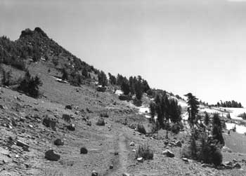 Trail following the old Rim Road below Hillman Peak. |
Work on reconstructing the trail to the top of Watchman also took place in 1932, starting from a point on the old Rim Road that was situated above the new location for Rim Drive. This path utilized portions of a rough trail made the previous summer to transport materials for constructing the lookout and trailside museum, but with better curvature and the addition of features like hand-placed retaining walls and stone slabs for use as benches. The completed trail started at the Watchman Overlook on Rim Drive and incorporated a piece of the old Rim Road to a point where the path built by day labor brought park staff and visitors to the summit. As with other popular trails where dust was perceived as a problem, crews oiled the finished surface.
A trail planned for connecting the parking area at the Diamond Lake Junction with the viewpoint selected by Merriam as the fourth observation station along Rim Drive did not materialize. This probably stemmed from a decision made in 1934 to transfer funds earmarked for development of three observation stations to instead help finance repairs at the Sinnott Memorial. Without money to build masonry guardrail and install a viewfinder at the observation station, there seemed to be little need for a short trail from the junction to what became known as Merriam Point, or a longer path to Llao Rock.
None of the remaining observation stations beyond the Diamond Lake Junction featured trails. CCC enrollees improved a path linking Sentinel Rock with the parking overlook at substation 7-B in 1940, once the steps forming a trailhead were completed through the surfacing contract. The CCC also extended a rough “service road” part way up Mount Scott by building a horse trail that reached the summit, which provided a better way of packing supplies to a lookout located more than 2 miles away from Rim Drive. Visitor use as a foot trail came as a secondary consideration, at least initially, so the connection between trailhead and parking area remained weak.
Building foot trails became even less of a priority once Rim Drive proceeded past Kerr Notch toward Park Headquarters. Nothing more than social trails resulted at Sun Notch, for example, despite of the careful study urged by an art professor commissioned by Merriam to visit the park in 1932. In a similar vein, Lange suggested extending a trail begun by the CCC near Vidae Falls in 1934 to Garfield Peak, or making a loop with an overlook so that visitors could view the falls from above. Neither idea came to fruition, though CCC enrollees built 1 new mile of trail to the top of Crater Peak in 1933. Visitors traveling by foot or horseback on a fire road that commenced where Rim Drive ran near Tututni Pass could thus reach the summit of the prominent cinder cone that can be seen from various viewpoints around the park. The trail through the Castle Crest Wildflower Garden near Park Headquarters originated in 1929, though not in reference to any future location of Rim Drive. A new parking area intended to serve as the trailhead, however, came about as part of the grading contract for 7-E2 in 1938. This development corresponded with an effort led by the permanent park naturalist to reconstruct the trail that summer.
Buildings
The NPS actively encouraged visitors to see the Sinnott Memorial “as soon as possible” upon arriving in the park because it helped them locate places of interest. Although situated in Rim Village, “Observation Station No. 1” functioned as the main orientation point prior to participating in a naturalist-led Rim Caravan or taking a self-guided excursion on Rim Drive. In this respect, the official park brochure for 1938 described the parapet as featuring high-powered field glasses
“on the important features, helping the visitor to understand the geological history of the lake and to appreciate the relationship between the scenic and scientific. Displays in the exhibit room, maintained in connection with the observation station, further aid the visitor to appreciate the beauties of the park and to interpret the moods of Crater Lake.”
Built in 1930, the Sinnott Memorial’s design borrowed heavily from the slightly larger Yavapai Station erected on the south rim of the Grand Canyon in 1927. Merriam was the main force behind both buildings and saw to it that each incorporated an open porch or parapet along with an enclosed display room or museum. Sager drew the plans for the Sinnott Memorial, but Merriam expressed the underlying purpose of the building as
“a window through which it is planned to show the visitor things of major interest at the Lake. The active use of the structure is strictly that of looking out and the museum aspect should be reduced to a minimum, using only such materials as are helpful in development of the window idea.”
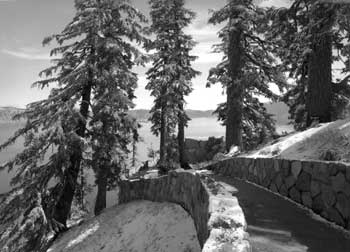 Victor Rock Trail to the Sinnott Memorial. |
Although operational with the installation of parapet exhibits in 1931, Merriam and park officials did not consider the Sinnott Memorial completed until August 9, 1938. That morning an exhibition aimed at helping visitors appreciate the aesthetic values of Crater Lake opened in its museum room. The featured photographs, paintings, and lighted transparencies were intended to induce visitors to see various aspects of the beautiful landscape for themselves. Merriam and his associates hoped that a “new phase” of educational work at Crater Lake might thus begin, one where the interpretation of scenic and scientific values at the Sinnott Memorial might inspire visitors as they explored the park on their own.
Apparent success with reaching visitors at the Yavapai Station prompted NPS Chief Naturalist Ansel Hall to suggest in early 1930 that a fire lookout planned for the Watchman be enlarged to accommodate an “educational lookout station or branch museum” on the lower floor. Albright and Merriam received copies of Hall’s letter to Solinsky, and by March landscape architect Charles E. Peterson had prepared a sketch for the building that included an elevated lookout with a “trailside museum” adjoining it but at ground level next to a “terrace” on the lakeside. After making a more definite study of the building’s location, Sager sent Hall a revised sketch by Lange in June 1931 incorporating all three elements. An allotment of $5,000 and the final drawings prepared by Lange allowed laborers to complete most of the building that summer. Work at the site continued in 1932, at which time workmen built a masonry parapet wall around the point in front of the building along with a bituminous walk. Hall installed field glasses for the use of visitors to reinforce dual purpose of the structure.
Assistant Superintendent and Chief Park Naturalist Donald Libbey described plans for exhibits and the mounting of range finders at each corner of the parapet prior to official opening of the Watchman Observation Station in 1933, but his transfer that year put installation of those interpretive devices on indefinite hold. The NPS, however, continued to promote the building as an observation station throughout the 1930s by offering a shortened version of the full Rim Caravan that ran from Rim Village to the Watchman Overlook and culminated with a hike to the lookout. The trip was so popular that it became a daily feature of the naturalist program, relegating the full Rim Caravan to the status of a special offering held just once a week.
Visitors using the north entrance eventually obtained their first view of Crater Lake at the Diamond Lake Junction. The ranger station located there became known as the “North House” to employees upon its construction in 1930. The initial design called for exterior walls made of logs, but Sager drew the final plans to specify the use of stone masonry in line with the precedent established at Rim Village. The North House contained public restrooms, made possible by piping water from a spring located near the Devil’s Backbone, with an office situated between them. In being slightly recessed into a gentle slope back from the rim, the structure provided an attractive seasonal residence that could also double as a visitor facility. Nevertheless, the park’s master plan started calling for its removal in 1939, since improvement of the North Entrance Road (Route 8) in the interim allowed for fee booth and associated quarters to be located next to the park boundary.
Funds for building a “checking kiosk” near the North House became available in the fall of 1933, but work did not begin until the following summer. Robertson commented that frequent storms led to periodic delays during the project, which was finally completed over the summer of 1936. Until that time rangers collecting park entrance fees at the road junction enjoyed no protection from the elements because the North House had been located some 80′ removed from Rim Drive. Collecting fees remained difficult, however, because the volume of traffic that resulted from opening the Willamette Highway in 1940 led to longer lines and congestion at the road junction. As a result, the NPS placed a portable station near the actual north entrance in July 1941 that Superintendent Leavitt described as greatly improving fee collection. Despite the advantages of being on the rim to provide visitor information, moving the checking operation spelled a quick end to the kiosk’s effective life.
A development seen as complementary to the Diamond Lake Junction was briefly considered for Kerr Notch near the end of 1936, though not referenced in the site plan by Lange for a parking overlook. Envisioned for the junction of Rim Drive and the East Entrance Road, a ranger station similar in size and appearance to the North House would take the place of a log structure built in 1917 near the park boundary some 7 miles distant. Crews razed the latter structure in 1938, but the new ranger station at Kerr Notch did not materialize even though the building could have used the same water system that allowed use of a drinking fountain at the parking overlook.
Signs
Customized signage for Rim Drive evolved from a CCC project begun in 1936 at Park Headquarters that aimed to replace various types of metal signs posted throughout the park. Enrollees produced hand-carved wood signs of varying sizes with raised letters painted chrome orange (for visibility at night) against a dark brown background, based on Lange’s drawings of entrance, directional, and building signs. Their production and placement greatly accelerated over the summer of 1938 after establishing an outdoor workshop at the CCC camp near Annie Spring. Lange reported that 200 signs had been completed by November, including some that identified parking areas and points of interest on Rim Drive. Through photographs in his season-ending report, he attempted to show how this type of sign possessed good visibility, if properly placed, for conveying mileage and direction on Rim Drive. These examples included signs mounted in a triangular configuration at road junctions and others slotted into bollards.
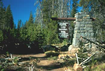 East Entrance motif. |
CCC enrollees produced more signs at Camp Oregon Caves over the following winter and began installing them upon returning to Crater Lake for the 1939 season. They reestablished a workshop at the park that summer for a crew of fifteen men to carve, assemble, and then place eighty signs. Lange provided “field sketch details” as drawings for the crew to follow as he had the previous year, but the signs completed that year varied somewhat more in size and shape because of emphasis on the individualization of signs for points of interest located along Rim Drive. Although he originally expected to complete the project by October, the shift away from standardization may have accounted for why the crew did not finish installation of the remaining signs until 1940.
The sign project’s apparent success stood in sharp contrast to the lack of orientation markers or literature describing each of the observation stations, ideas once advanced by Merriam and embraced to some degree by the naturalists. At one point Assistant Superintendent and Chief Park Naturalist Donald Libbey had plans drawn to install markers similar to one on top of Pilot Butte in Bend, but he transferred before the NPS could fund the project. Lange’s recommendation in 1935 for a “binocular instrument” at each of the observation stations quickly dropped off the list of prospective projects, as did the suggestion from Merriam about placing inconspicuous holders for interpretive literature targeted specifically at the stations and substations. The latter probably resulted when no one came forward to implement the recommendation by Merriam that experts produce literature for each of these stations, even after Howel Williams began his classic study of the park’s geology in 1936 and actively continued his fieldwork through 1939.
Postwar Changes
World War II effectively delayed the full completion of Rim Drive until the Mission 66 years of park development, largely because budgets at Crater Lake and elsewhere in the National Park System remained at barely custodial levels until 1957. At that point an infusion of project funding began to come as part of preparing for the fiftieth anniversary of the NPS (to be celebrated in 1966) that also corresponded to greater annual visitation that drove the need for new facilities as well as the redesign of existing ones. NPS officials cited Rim Drive as an outstanding example of past collaboration with BPR at the beginning of “Mission 66,” and they even singled out the park’s road system as illustrating the type of control exerted by the NPS planning process. Master plans and related documents supposedly guarded against “whims of opinion or varying methods of development” brought by changes in personnel.
The “progression of work and revision” guided by the park’s master plan for the most part centered on building new employee housing at Park Headquarters and developing a campground near Annie Spring, though a number of smaller projects were also funded by Mission 66. As for changes along Rim Drive during this period, only the parking and trail to the lake at Cleetwood Cove merited attention through revision of the master plan. By the end of Mission 66, however, the master plans once prepared by resident landscape architects and then approved by the superintendent and personnel in central offices had largely given way to sporadic site plans and other assistance supplied by professional staff stationed away from the park.
Much of the Rim Drive became a one-way system oriented clockwise beginning in 1971 in response to a management objective that arose from concern on the part of some in the NPS that the road between Rim Village and the Diamond Lake Junction had become too congested. As the greatest change to circulation around the rim since adoption of the “combination line” between Kerr Notch and Park Headquarters, the one-way system seemed to create more problems than it solved. NPS planners stationed in Denver observed that it generated a greater number of traffic accidents (due to higher vehicle speeds in the absence of opposing traffic) and many complaints over the sixteen summers that it remained in force. The supposedly problematic road segment 7-A opened for two-way traffic again in 1976, so that discussion of widening that portion of Rim Drive gained momentum. Previous development at the Watchman Overlook and subsequent reconfiguration of the Diamond Lake Junction, however, had greater impact on the road as originally designed and built.
Segment 7-A (Rim Village to Diamond Lake Junction)
The most pervasive addition of the Mission 66 period along this portion of Rim Drive came in the form of interpretive panels mounted on bases composed of stone masonry to match the guardrails. The panels were intended to help make the circuit a self-guided tour, serving the dual purpose of enhancing visitor understanding and dispersing use over a wider area away from Rim Village. Six of the thirteen locations initially chosen for these devices on Rim Drive fell within this road segment, including the most elaborate development associated with wayside exhibits, a cluster of five panels installed during the summer of 1959 at the Diamond Lake Overlook. More typical were the single panels on bases incorporated into the masonry guardrails at the Discovery Point parking area, the Union Peak Overlook, and the Diamond Lake Junction where glacial scratches can be seen.
Construction of stone bases for the wayside exhibits began in 1958 under a contract, with work taking place intermittently through the next four seasons. The five bases built at the Diamond Lake Overlook were freestanding at first, filling the gaps originally left for placing boulders between the log barriers. A new masonry parapet was built to incorporate the bases at this site by 1963, but it and another section of guardrail added over the following decade failed to match the original masonry guardrail constructed elsewhere along Rim Drive.
The interpretive panels proved to be the most problematic part of wayside exhibits since the routed plastic could not hold up to direct sun, windblown pumice, moisture, and vandalism. Routed aluminum soon became the favored material in some locations, but the NPS began replacing panels with the more durable metal photo plaques by 1966. The latter type of interpretive marker lasted for more than two decades before these were replaced by a new set of fiberglass exhibit panels beginning in 1987. Neither generation of wayside exhibit panels, however, achieved the thematic unity in their content as envisioned by the interpretive concept statement composed for the park’s master plan in 1972.
Initial discussions about adding picnic areas along Rim Drive took place before the war, during the season of 1939, when park visitation reached a new high of 225,100 that year. With attendance steadily increasing, especially during the summer season, to 360,000 by 1956, the onset of Mission 66 represented an opportunity to go forward with one of the secondary park priorities listed in the master plan. Day labor leveled and then surfaced six areas around the rim in 1957, with one located in segment 7-A. It became known as the Discovery Point Picnic Area once pit toilets and tables built with concrete ends and redwood lumber had been installed during the summer of 1958. Subsequent development at this picnic area consisted of paving the parking lot and delineating it with boulders as a control device, in addition to the inevitable replacement of tables, toilets, and garbage cans.
The Mission 66 prospectus drafted in 1956 critiqued the parking overlooks and turnouts, particularly those along segment 7-A, as being too few in number and insufficient in size. As a means to draw people away from Rim Village, these stopping places needed increased parking space, especially where views had been enhanced through the addition of wayside exhibits. This enthusiasm for altering the size and number of viewpoints along Rim Drive eventually faded, as the master plan approved in April 1965 restricted its call for additional parking to the Diamond Lake Junction. Planners from the NPS service center in San Francisco nevertheless proposed a site study for the Watchman Overlook after one of them observed its “hazardous condition” in August 1966. They recommended more formalized parking and extending the masonry guardrail from the road margin to provide a measure of safety for visitors who walked to an adjacent ledge for a view of the lake. A site plan produced several months later thus called for slight realignment of the road on additional fill so as to accommodate thirty-nine cars. It also called for “hardening” the viewpoint with a colored asphalt walk, one whose outer edge would be bordered by a wall consisting of stone veneer and a concrete core.
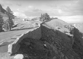 Watchman Overlook. |
With construction funds in relatively short supply when compared to the Mission 66 program of just a few years earlier, the project at Watchman Overlook remained on hold until the early months of 1971. At that point another site plan suggested dropping the realignment and reworked the design to yield parking for thirty cars that could be oriented diagonally in line with the implementation of a one-way road system. The revised site plan included new features to Rim Drive such as bituminous curb, contrived rock “outcrops,” and masonry piers linked by pressure treated wood pealer cores as a safety barrier. Construction at the Watchman Overlook thus began in 1972, though completion of all items in the contract took another two summers. As a cue for visitors to stop, the separated parking and conspicuous design features at the Watchman Overlook quickly made it the most popular stopping place on Rim Drive, even if most park employees expressed little hesitation in referring to the locality by its resulting nickname of the “corrals.”
With the resumption of two-way traffic along segment 7-A, park officials wanted to widen the paved surface of Rim Drive from 18′ to 22′, and then 24′. As they explained to engineers from the Federal Highway Administration (formerly known as the BPR), the narrow roadway and numerous steep slopes made traveling along this two-way section hazardous for modern recreational vehicles. The NPS wanted to keep excavation and the building of new embankments to an absolute minimum due to costs involved, though this meant widening into ditches and slopes as steep as 2:1. Realigning the road just south of the Diamond Lake Junction constituted another aim for the project, one where the parking areas could be placed along the masonry guardrails so that visitors would no longer have to walk across Rim Drive from two parking areas in order to view the lake.
The widening project began in August 1978, with the first phase covering 2.5 miles over two summers. A second phase commenced at Station 118 (near the Union Peak Overlook) in 1982 and ran some 3.4 miles north to the Diamond Lake Junction, but excluded the newly constructed section at the Watchman Overlook. Contractors realigned the two parking areas, but the “widening” consisted of simply paving to the edge of existing road shoulders so that vehicle lanes could be 11′ wide. Subsequent striping included the addition of “fog lines,” a feature aimed at providing better visibility for motorists driving at night or during bad weather.
Realignment of the Diamond Lake Junction came as part of rehabilitating the North Entrance Road in 1985-87. A new “T” intersection replaced the original road wye and the new alignment gave precedence to a through route over continuation of the circuit. It also came with a new parking area intended to relieve pressure on the parking areas further south that consistently ranked second in popularity among all of the viewpoints on Rim Drive. According to NPS justification for this project, the new parking area was to serve as part of a development that included hard surfaced walkways allowing for handicapped access to a pair of overlooks. The design, though still largely conceptual, called for exhibits and masonry guardrail at the pedestrian viewpoints.
What planners hailed as possessing the potential to become the most popular stop along Rim Drive soon showed unsightly wear because the NPS failed to construct the walkways and view points. Safety concerns led to erection of wood rail fence at the most conspicuous overlook in 1995, but snow loading dictated an almost annual replacement of the horizontal members. With little else in place to restrict visitor impact to this site, overuse had destroyed much of the vegetation between the parking lot and the rim.
Other changes along segment 7-A also affected related original designed features in the form of trails, buildings, and signs. Funding from Mission 66 allowed for contractors to repair parts of the Discovery Point Trail (a project that included adding masonry wall near the parking area) and to pave the path leading from an unsurfaced parking area near the Devil’s Backbone to the top of that volcanic dike. The most ambitious trail project along the west Rim Drive, however, took place in 1994. It aimed to provide hikers on the Pacific Crest Trail with an alternative to a route through the park that followed a series of fire roads and lacked any view of Crater Lake. By connecting the Discovery Point Trail with pieces of the old Rim Road, this alternative route required volunteers and day labor to build 2.5 miles of new tread in order for hikers to reach the Diamond Lake Junction on a trail.
The Sinnott Memorial maintained its orientation function through the Mission 66 period and beyond, mainly because the park lacked a permanent visitor center. Such a facility remained as a top priority on the master plan and its successor, the general management plan, for the next four decades. The Sinnott Memorial underwent rehabilitation in 1963 and again in 2001, with a primary aim of the latter project being to reopen the enclosed museum that had lapsed into disuse after 1986.
At the Watchman Lookout, meanwhile, the exhibits in its trailside museum remained in place for only thirteen years. Removal of the exhibits in 1975 appeared to be triggered by approval of the interpretive prospectus as part of the master plan three years earlier, which saw no real need for them. The authors of the next prospectus in 1980 called for the restoration of the exhibits. Restoring the lookout begun under the Fee Demonstration Program in 1999 aimed to restore the building’s original appearance and initially included an exhibit component in its scope of work, but cost overruns after two seasons put the partially completed project on indefinite hold. The Fee Demonstration program also provided funding for a vault toilet at the Watchman Overlook in 2001, one of several such facilities around the park to be faced with stone and topped by a roof structure.
While the Sinnott Memorial and Watchman Lookout were maintained (and in some respects, enhanced) for interpretive use during Mission 66, park employees removed both the North House and the adjacent checking kiosk at the Diamond Lake Junction in May 1959. A small parking area next to the site of the North House remained until the intersection was realigned in 1985, but without a short trail to the rim. Large boulders eventually took the place of treated logs to line the island in the road wye, while wood routed signs indicated direction for motorists instead of the customized markers built and installed by the CCC. The wood routed signs eventually gave way in 1995 to brown metal Unicor markers with standardized white lettering at this and other road junctions throughout the park. Previously, motorists had to rely on maps and the wayside exhibits to furnish reference points to find their location on Rim Drive, because most of the signs that had once marked various localities on the circuit had disappeared.
Segment 7-B (Diamond Lake Junction to Grotto Cove)
Even if wayside exhibits seemed to be the most ubiquitous addition resulting from Mission 66 to Rim Drive, they remained scarcely in evidence along the northern part of the circuit. One of these interpretive devices could be seen at the so-called Cleetwood “backflow,” in the masonry guardrail, across from where wind erosion on the cut slope created during rough grading had resulted in chronic raveling. The other wayside exhibit attempted to convey the “story” of soil at Palisade Point, but in a somewhat secluded location below the masonry guardrail.
Both picnic areas in segment 7-B followed a standardized road loop designed by the resident landscape architect, John S. Adams, in March 1957. These sites were placed just over a mile apart that summer, with another five tables installed down slope of the parking lot for Cleetwood Cove in 1966. The latter possessed the largest number of tables at any picnic area on Rim Drive, even though it remained the most difficult one for visitors to use. In addition to the walk needed for amenities like toilets and garbage cans situated at the parking area, the site lacked surfaced paths and shade during the midday hours.
Development of a new trail to the lakeshore at Cleetwood Cove with associated parking came in response to the difficulties associated with an existing trail from Rim Village. In addition to the existing trail beginning some 900′ above the water, increased annual visitation to the park after World War II made parking for boat trips and other activities on Crater Lake an additional source of congestion at Rim Village. Cleetwood Cove, by contrast, offered a southern exposure (thereby eliminating much of the hand shoveling required to open a path to the water each spring) and a potential trailhead only 700′ above the lake. Construction of a new trail began in July 1958 so that it became passable the following summer, but regrading of steep sections and other work delayed full completion of this day labor project until September 1962.
Parking at the Cleetwood Cove trailhead initially consisted of simply widening the road shoulders, but this solution quickly became inadequate. The resident landscape architect, Joseph T. Clark, produced a site plan in July 1961 that called for a parking lot holding 100 cars. He proposed an assembly area at the trailhead, one to be separated from the road by metal guardrail. The plan also called for an elongated parking area across Rim Drive from the trailhead, oriented perpendicular to the road instead of parallel. With an adequate entranceway, the parking lot site would also be large enough to allow development of a picnic area with some thirty tables or even a campground. The initial plan called for a plumbed restroom (comfort station) and septic system, though this facility and the proposed drinking fountains depended upon locating a supply of water. In the absence of springs or other sources, contractors began drilling a well in 1962. It remained dry even after a second attempt at locating a potable water supply three years later.
Grading the lot above Cleetwood Cove began in the fall of 1961, but lack of water effectively limited development of amenities other than parking to portable toilets and five picnic tables. These facilities became inadequate as the number of boat tours increased over the next two decades, so landscape architect Joe Dunstan sketched several alternatives aimed at relieving poor circulation and overcrowding in 1991, primarily as a starting point in design. Little in the way of changes resulted from this effort, with the only additional development at the site resulting from a spillage problem associated with fuel delivery to the tour boats. The Fee Demonstration Program thus funded construction of a fuel transfer building situated between the parking lot and Rim Drive in 1998.
Segments 7-C and 7-C1 (Grotto Cove to Kerr Notch)
Placement of wayside exhibits and other interpretive markers more closely corresponded to the earlier list of stations and substations in these two road segments than elsewhere on Rim Drive. All but two substations located between the Wineglass and Kerr Notch received some type of marker, though in one case (the Grotto Cove Nature Trail) this type of interpretation persisted for only a decade. Established in 1968 to promote handicapped accessibility, the trail made use of small metal photo plaques mounted on posts along a masonry guardrail in order to identify plants along a paved walk originally built as part of the parking overlook. Panels on stone bases appeared at five other points along segments 7-C and 7-C1 during Mission 66, with the only divergence from this type of marker being a wood routed signboard placed near the road loop on Cloudcap.
Funding from Mission 66 also brought about construction of two picnic areas in segment 7-C. One of them, the site near Skell Head, appeared largely as an afterthought in a dense thicket of lodgepole pine and thus received little use in comparison to the other six sites on Rim Drive. Visitors could, by contrast, obtain an impressive view of Mount Scott and the landscape beyond it from the other picnic area. Located just one-tenth of a mile from the Mount Scott trailhead, the name for this picnic area came from the whitebark pines that provided shade for three tables.
Paving of segment 7-C1 (along with 7-D and 7-E) during Mission 66 in some ways represented belated completion of the road construction begun more than twenty-five years earlier. In the interim, the BPR helped the NPS address slides at Anderson Point that periodically closed the roads, which was the most persistent maintenance problem on Rim Drive over the first decade or so of the road’s existence. Through a minor change in alignment and measures aimed at slope stabilization, BPR engineers supervised laborers hired by the NPS so as to reduce the incidence of future slides at this location over the summer of 1952. Roughly 100 lineal feet of masonry guardrail replaced an earlier stone barrier along this section the following year in order to complete the project.
Segment 7-D (Kerr Notch to Sun Notch)
Aside from the belated paving of this road segment in 1960, only one project during the Mission 66 period took place in this road segment. It came in response to rockfall that repeatedly damaged, and in some cases, destroyed masonry guardrail along a section of road along Dutton Cliff in 7-D1. After considering construction of “rock sheds” to alleviate this problem during the first part of Mission 66, the NPS let a contract in 1966 to repair some of the guardrail and retaining wall, in conjunction with establishing some additional cross drainage in this section of road. Work also involved replacing damaged sections of the original guardrail with removable metal posts, a measure dependent upon annual installation by maintenance crews and one destined to last no more than a few years.
On the other side of Dutton Cliff, along 7-D2, continual slides and rock fall resulted in an attempt to cut the slope back similar to Anderson Point in the early 1970s. Repairing and rebuilding masonry guardrail along this so-called “Sun Grade” section followed in 1985. The park employed day labor rather than contractors for the latter job, which included rebuilding portions of guardrail that were located across the road from the slopes composed of glacial material. Cuts made as part of the original grading contract remained subject to erosion and raveling, particularly where the slope face remained wet.
Segment 7-E (Sun Notch to Park Headquarters)
Aside from one road realignment near the intersection where Rim Drive terminated at Park Headquarters, virtually all of the postwar changes in this road segment took place in the vicinity of Vidae Falls. Development of the Mazama Campground as a major Mission 66 project turned the attention of park officials away from overnight facilities below Vidae Falls, though grading for a picnic area took place in 1958 where the campground road built in concert with segment 7-E met the old Rim Road. Lack of adequate cross drainage for the loop road at this picnic area eventually led to rehabilitation of the site in 2001, a project that included placement of a vault toilet and new tables. At that point the trailhead for the route to Crater Peak also became part of the picnic area, largely because parking for hikers had previously been situated on a blind curve near Tututni Pass.
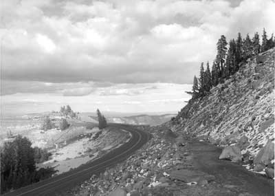
Looking north near the start of the Watchman Trail on the West Rim Drive. |
Design and Construction of Approach Roads
Just as the Rim Road was reconstructed into Rim Drive, the approach routes to Crater Lake have also been realigned in response to higher traffic volumes, increased speeds, and changing connections to the regional road network. The greatest changes to approach roads came in the 1930s, as the BPR and NPS collaborated on building Rim Drive, though redesign of small segments in each of these routes has continued to the present. Most changes have stemmed from functional concerns like improving curvature and lessening grade, rather than a concerted attempt to provide stopping points and vistas to motorists. None of the approaches could “present” the central attraction of Crater Lake, but they sometimes supplied interesting views of the steam canyons and hinterland.
Initial changes in alignment of the Fort Klamath — Jacksonville wagon road through the park took place under superintendent W.F. Arant, who started the process by hiring a location survey in October 1902. This led to crews building 2 miles of road in Munson Valley the following year and improving sections of the wagon road between Annie Spring and the park’s south entrance. Work continued on both roads in 1904 through the use of hired labor and teams. Crews completed the road through Munson Valley to Rim Village in August 1905, one that possessed a graded width of roughly 8′ and a maximum grade of 10 percent.
Arant successfully pitched the need for a new road from Whitehorse Creek to Annie Spring, so construction of this wagon route began once road crews reached the rim. The road built from Whitehorse included one section with a 10 percent grade over the Cascade Divide, but it ultimately shortened the distance formerly traveled on the wagon road of 1865 by a half mile and eliminated two relatively steep grades. Although completion of the Whitehorse — Annie Spring segment made travel easier, Arant pointed to the need for widening and straightening portions of the 1865 road still in use so as to better accommodate automobiles. He described that portion of the road between the west and south entrances of the park as being “tracks little wider than a wagon and one or two feet deep, and it is very difficult for teams to pass.” Arant reported on park roads as being kept in the “best condition possible” with only limited funds available for improvements, though widening had been accomplished in places. Generally, however, the trees and other obstacles were situated too close to road margins to permit a team to turn out of the narrow track. Dust made travel over any of the roads disagreeable over the greater portion of summer, but this could be overcome through the use of road sprinklers.
The Army Corps of Engineers Road System
Persistent dust and the recurring expense of having to regrade the roads every year prompted a report on the availability of material for surfacing from a special inspector representing the Department of the Interior in 1910. He thought careful selection of hard volcanic rock next to the roads might yield enough material for macadam, but recommended that little or no money should be expended for this purpose until a comprehensive plan for park roads was in place. Location surveys funded through the Army Corps of Engineers that summer made the inspector optimistic that funding for road building might follow that would include the three phases of grading, surfacing, and paving. The first in a series of annual appropriations for construction did not become available until 1913, at which point Arant recommended the money be spent for building good roads from the west and south entrances. Use on those roads was far greater than any other routes into the park, he reasoned, and would be “for some time to come.” The Army Corps of Engineers nevertheless maintained control on where those funds were expended, and they chose to begin their work by transporting supplies to Kirk, a rail stop located east of the park. Road building would thus begin at a new “east entrance” near the pinnacles on Wheeler Creek and then proceed in a northwestern direction to a junction at Lost Creek, where the Rim Road circuit commenced.
Pinnacles Road
This route had one advantage over the wagon road of 1865 in that it allowed for a more direct connection with a rapidly evolving regional road network. Motorists on the main north-south road corridor between California and the Columbia River to use a spur road of roughly 10 miles in length for the purpose of reaching the rim at Kerr Notch. It saved them time in comparison to going through the South Entrance, even if no services were available at Kerr Notch. Construction of the Rim Road circuit would eventually provide visitors access to the hotel and camping at Rim Village.
Almost all construction on the Pinnacles Road took place in 1913, when laborers and teams completed clearing, rough grading, and cross drainage for the 6.5 miles between the East Entrance and Kerr Notch. The last 1.5 miles nearest the rim required some side hill excavation because the road’s location remained close to Sand Creek until it approached the Anderson Bluffs. At that point engineers made note of the revetments (hand laid rock retaining walls) needed to retain the fills constructed by hand or with teams. Cross drainage along the route consisted of two “rustic” log bridges and twenty culverts with log sides and plank tops. The only subsequent changes to the road while the engineers remained at Crater Lake came in 1918, when the two bridges and nine wooden culverts were replaced with fills and corrugated iron culverts. It remained a rough graded road, one that required continual regrading due to the ruts caused by traffic, particularly trucks hauling supplies. Regrading took place on an annual basis for the next decade or so, beginning in 1914.
Fort Klamath Road
The engineers thought Fort Klamath Road should extend from the South Entrance for some 8 miles to Annie Spring, where Arant and his successor Will G. Steel had their headquarters. From there the road went north for another 3.3 miles, to where the engineers established “Camp 2,” at the junction with the Rim Road in Munson Valley. Most of the work between Annie Spring and the South Entrance involved straightening and widening the wagon road route of 1865, though two minor realignments totaling 1.5 miles took place along that stretch. Engineers found a new location for only one small portion of the wagon road Arant built through Munson Valley, this being between Goodbye Creek and the lower end of the valley.
Aside from a small amount of clearing and grading that took place just south of Camp 2 in 1913, virtually all of the Fort Klamath Road was completed over the following summer. Clearing started with removing small trees from the roadway with teams, and then felling larger diameter trees before blasting the stumps. Laborers accomplished much of the grading work by hand, or with teams and drag scrapers, though a steam shovel also assisted by making three small cuts. Cross drainage initially consisted of four log bridges and culverts made of planks or corrugated iron, though the plank culverts and two of the bridges had to be replaced in 1918 by fills and iron culverts. Just as elsewhere in the park, surfacing remained on hold since the engineers lacked funding for that phase of construction.
Medford Road
Despite being somewhat shorter in comparison with the Fort Klamath Road (6.8 miles to 11.4 miles), engineers planned two major realignments on the route linking Annie Spring with the West Entrance. The first took place in 1914, after they decided to dispense with a portion of Arant’s wagon road in order to make getting over the Cascade Divide easier. This involved a new alignment on “Corkscrew Hill,” starting above the “Corkscrew” and swinging north instead of descending to the west. What was essentially a reverse curve rejoined the old road in half of a mile, but dropped the maximum grade from 10 to 7 percent. More realignment followed in 1915, as the engineers responded to a request from the Department of the Interior for the road to follow Castle Creek from a point 1 mile west of the crossing at Whitehorse Creek to the West Entrance. The new alignment ran for more than 2 miles so that the actual entrance moved a half mile north from where the wagon road of 1865 crossed the park boundary.
An average force of twenty men and four teams worked to clear the road’s entire length from the crossing at Whitehorse Creek to the park boundary. They made a swath 30′ wide so that the standard width of roadway measuring 16′ from shoulder to shoulder could be built. Assistant Engineer George Goodwin characterized the new alignment as having long tangents and easy curves, with grade varying from 2 to 6 percent. Grading thus required a relatively small crew of sixteen men and four teams that utilized slip and Fresno scrapers. The steeper section on the Cascade Divide necessitated some excavation, a job largely accomplished by rolling displaced rock over the embankment or loading it on stone drags hauled by teams. Cross drainage consisted of thirteen corrugated iron culverts and one log bridge over Whitehorse Creek measuring 50′ long.
Subsequent work supervised by the engineers was largely limited to the annual regrading as part of road maintenance, though a log bridge crossing Little Whitehorse Creek had to be rebuilt in 1917. What Goodwin called a “permanent” construction camp on Whitehorse Creek two years earlier began to serve as a designated campground for visitors once the NPS assumed administration of the park, even though it was largely bereft of amenities. NPS appropriations did, however, allow for building a “checking station” at the new west entrance in 1917, a structure almost identical in size and appearance to one erected at the East Entrance. These two checking stations are thought to be among the first manifestations of what later became known as “NPS rustic architecture” anywhere in the National Park System.
Other Approaches
The engineers left Crater Lake in 1919, mainly because the NPS felt it possessed sufficient expertise to oversee future road construction. An NPS employee named Alex Sparrow served as park superintendent from 1917 to 1923, so this contention possessed some validity. Until 1925, however, Congress failed to appropriate even the $50,000 allotted to the engineers in 1918 for road construction and maintenance, which meant that all park roads remained unsurfaced while nothing more than preliminary surveys took place for two additional approaches to Crater Lake. One route, the Bear Creek Road, was to run from Wineglass on the northeast rim and then descend toward Cascade Spring on its way to the park boundary. The contemplated road location matched that of a rail spur from the mainline of the Southern Pacific, one first proposed in 1908 but not attempted. The road suffered a similar fate, with one of the problems being lack of funding for a connecting road through an adjacent national forest.
Engineers proceeded further on the Sun Notch Road, a short approach envisioned to be 1.5 miles in length and starting from where the Rim Road crossed Sun Creek. They agreed on a final location, but left it to Sparrow and the NPS to build a “trail” to Sun Notch in 1919. Upon its completion, the superintendent advised motorists that the first mile was passable for automobiles.
Something of a northern approach route came into being when the NPS built a trail passable for “light” vehicles between the north boundary and a point on the Rim Road below Llao Rock. It literally dodged around trees over the entire length of 8 miles, but the Forest Service connected the terminal point at the north boundary with a road that reached Diamond Lake in 1922. The trail remained in a primitive state, however, as the NPS road maintenance crew of thirty men were busy with other priorities in the park. Sparrow’s successor, C.G. Thomson, saw travel from Diamond Lake on the increase and in 1924, called for conversion of the trail into a suitable road. This project, along with his proposal to establish a checking station near the park’s north entrance, did not feature among NPS priorities in allocating its limited road budget.
NPS and BPR Collaboration on Approach Roads
Thomson welcomed the assistance from officials with the Bureau of Public Roads, whose presence as official partners at the park became official in January 1926. The NPS finally secured appropriations in 1925 for improving both the Medford and Fort Klamath roads, both of which had begun to suffer in comparison with the surfaced state highways that connected the park with nearby communities. Contractors under NPS supervision made minor realignments along the Medford Road, mainly to reduce grades and curvature. They also replaced two log bridges with fills and tried to provide a dustless pavement over a portion of the road. Similar measures were taken on the Klamath side of the road approach to Annie Spring, but the surface failed under the stress of traffic. BPR engineers subsequently helped the NPS find a satisfactory macadam surface, one where an application of light road oil on the base of surfacing material greatly reduced dust.
Route 1 (West Entrance to Annie Spring)
Work continued on what had formerly been called the Medford Road in 1926, so that the macadam surfacing had been completed by the second week of August. The finished roadway now had a graded width of 18′ shoulder to shoulder, with a surfaced width of 14′. Thomson commented on the high standard of the road, particularly once removal of construction debris had taken place and log guardrails were installed where needed. Finding a wearing course that did not require an annual application of road oil took the next two seasons. NPS engineer Ward Webber wrote about the bituminous surface treatment (paving) used in 1927, one where insufficient mixing of oil with aggregate resulted in the wearing course lacking uniform texture. He noted that some portions were too lean, while others contained too much oil, thus necessitating the reprocessing of this asphalt material when the surface began to fail under traffic. The NPS achieved better results in 1928, though it took supervision by T.R. Goodwin (a road oiling expert on loan from the California State Highway Commission) to obtain the desired texture and color.
Minimal post construction work (such as patching, widening of bank slopes, and fine grading) by NPS crews took place along this route during the 1930s, though funding through the Civilian Conservation Corps (CCC) paid for development of a small public campground on the north side of the road crossing at Whitehorse Creek. CCC enrollees built a water system and two latrines there in 1934, but the site was abandoned after the 1941 season. This came in response to a proposal for a new, but modest campground to be located at the West Entrance, where the NPS planned to add a ranger residence, comfort station, and replace the checking station. Available funding limited this development to a portable kiosk that served as a checking station beginning in 1946, with accommodation for seasonal employees staffing consisting of an unsightly shack hidden among the trees a few hundred feet away.
The proposal by Superintendent E.P. Leavitt for the road to be reconstructed over its entire length, a project aimed at producing a roadway 32′ wide with a surfaced width of 24′, had to be put on hold during World War II due to lack of funding. For the next decade after the war ended in 1945, Leavitt and his successors had to be content with much smaller amounts aimed at maintaining ditches and patching the paved surface. This type of funding did little to stave off further deterioration, as the park’s chief ranger described the road as old and poorly drained in 1949, such that the wearing course was badly cracked and weathered.
The road’s condition hardly improved over the next two decades, given how one of Leavitt’s successors described it in 1964. Superintendent Richard Nelson found extensive failures in the base (composed largely of pumice) and pavement, but also criticized how the roadway’s width of 18′ lacked adequate sight distance on the numerous curves. Snow removal posed difficulties for drivers on such a narrow road, since the initial plowing produced windrows that substantially reduced driving width during much of the winter. Steep grades and sharp curves on two sections also contributed to the road accounting for some 65 percent of all automobile accidents within the park.
Engineers with the Federal Highway Administration (lineal successor to BPR) renewed their discussions with NPS officials about road improvements in November 1967. Everyone agreed about the necessity of widening the roadway to obtain lanes 10′ wide, so the meeting focused on two proposed realignments. One involved a preliminary road design of 1961 that called for a tangent at the crossing of Whitehorse Creek, but the NPS rejected that idea in favor of a more curvilinear alignment that better matched the agency’s road standards of the time. More consideration was given to bypassing the Whitehorse crossing altogether with a new road location. Preliminary data indicated the possibility of going around Whitehorse Bluff in traversing the Cascade Divide, thereby avoiding the existing reverse curve with its two tight radii on either end. Park Superintendent Donald Spalding, however, feared the damage to timber and wildlife habitat certain to result from such a major realignment. He opted for improvements within the existing alignment, pointing to how the disadvantage of the reverse curve could be offset with curves having a radius of 400′ on either end.
Road reconstruction finally began in October 1972, with the initial contract aimed at widening the 2.4 miles between Whitehorse Creek and the top of the Cascade Divide. It also addressed the upper end of the reverse curve, where a large number of vehicle accidents had occurred due to the abrupt change in alignment. Project design called for wider lanes and some superelevation, though the FHWA engineers doubted that the improvements would result in substantially fewer accidents because the topography did not permit sufficient transition time for drivers to lower their speed.
Reconstruction went forward despite the problematic reverse curve, with completion of the initial contract in September 1974. Widening and reconstructing 2.9 miles of road west of Whitehorse Creek started the following summer, so that final inspection took place in July 1976. Several paved parking areas were added along the route as part of both contracts, though only one of them provided visitors with a scenic vista. This came at Elephant’s Back, where parking areas on both sides of the road allowed those who stopped a glimpse of Castle Creek Canyon.
Route 2 (South Entrance to Annie Spring)
Some minor realignment of the old Fort Klamath Road built by the Army Corps of Engineers began in 1925 over 8 miles of graded surface between the Annie Spring road junction and the south entrance located at “Wildcat.” The most conspicuous change that took place over the summer came at Wildcat, where the NPS erected a massive log entry arch. It stood there until 1932, when the “Annie Creek Extension” or “panhandle” of 973 acres became part of the park, thus adding another 2.3 miles of road between Wildcat and a new south entrance. Improvements begun in 1925 had resulted in widening some fills and shoulders over the 8 miles of highway so that a graded width of 18′ could be achieved. Like the West Entrance Road, this approach boasted a surfaced width of 14′ (where 2″ of bituminous plant mix overtopped a macadam base course of 6″) by 1927.
As traffic through this part of the park increased, however, both the NPS and BPR saw the urgency for a new location survey as the first step toward improving grades and curvature. Winter travel to Crater Lake facilitated by the arrival of snow removal equipment in 1930, also pointed to the need to reduce the maximum grade on this key approach route below 8 percent while also lengthening curves ranging from 50′ to 200′. Lange reported that the L-line survey done by BPR during the mid-1930s called for using about 63 percent of the old road location, with the remainder requiring realignment through new construction. He suggested several improvements, starting with the use of masonry, rather than log, guardrails because the latter type seemed to be more frequently damaged. Lange emphasized how masonry guardrail in combination with stone curb and bituminous walkways could improve the appearance of five extant parking areas, along with selective vista clearing, though he recommended retaining picturesque snags.
Despite NPS hopes for a graded roadway 32′ wide with a surfaced width of 24′, most of the funds for construction went to Rim Drive during the 1930s. Maintenance crews widened a large portion of the road surface to roughly 18′ late in the decade, while park funds paid for a light bituminous mat to be placed on that portion of Route 2 through the panhandle. Other improvements along the road corridor during this period came not at the parking areas, but at Cold Spring, formerly a camping place on the Fort Klamath — Jacksonville wagon route and located several hundred yards from where Pole Bridge Creek crossed the highway. CCC allotments paid for building a modest picnic area and campground there beginning in 1934, with enrollees installing a water system, several latrines, as well as tables and fireplaces, over the next three seasons.
Reconstruction of the South Entrance Road finally took place during the summer of 1963. The typical section featured a 26′ surfaced width with 2″ of asphalt concrete pavement over 10″ of crushed aggregate. This project also included construction of six parking areas lined by bituminous curb and three picnic areas where the old and new roads had their greatest divergence in alignment. The park landscape architect of the time, Paul Fritz, effected one change to the plans prior to actual construction. He wanted a more pronounced curve at the Godfrey Glen Overlook in contrast to the original design, where lengthening the curve would allow traffic to reach speeds in excess of 60 miles per hour through an area where many visitors entered and left the parking area.
Project plans called for eliminating the Cold Spring facilities, partly due to fears about surface water contamination (visitors drank from the spring), but also because the NPS wanted to concentrate overnight use at the much larger Mazama Campground located near the Annie Spring junction. The new picnic areas possessed a greater number of tables and fireplaces than at Cold Spring, though the new facilities were divided among sites called “Lodgepole,” “Annie Creek Falls,” and “Ponderosa.” NPS plans to place interpretive markers in various locations throughout the park during this period resulted in a routed wood sign in the Ponderosa picnic area located near the South Entrance. At roughly the same time a plastic panel was placed on the stone base affixed to a masonry guardrail at the Godfrey Glen Overlook, a vista point located roughly a mile from the Annie Spring junction. This overlook remained the only place along the South Entrance Road to receive a masonry guardrail, mainly due to how it complemented the stone supporting the interpretive panel. Other safety barriers along Route 2 consisted of metal guardrail, with most sections having their ends buried into bank slopes on the road margin.
Funding for the next project on Route 2 came almost three decades later through the Repair, Rehabilitation, and Reconstruction (3-R) program, but in two phases. The first, in 1991, treated 6.5 miles of road south from the Annie Spring junction to a point roughly one mile north of the old entrance at Wildcat. A second phase followed on the remaining highway four years after the first, as part of a contract to rehabilitate the Munson Valley Road (Routes 3 and 4). The initial treatment in each phase consisted of recycling the existing pavement in place, then adding a bituminous surface treatment on top of this mat. A limited amount of road base reconstruction took place in 1991 (over a cumulative distance of roughly a mile) and involved 1′ to 2′ of excavation. This occurred prior to the final treatment, where a hot mix asphalt concrete mat 2″ in depth served as the wearing course.
Routes 3 and 4 (Annie Spring to Rim Village)
Initial reconstruction of what gradually became known as the Munson Valley Road corresponded with the grading, surfacing, and paving of Routes 1 and 2 from 1926 to 1928. A slightly wider roadway of 20′ resulted from this project so that the surfaced width of the road could go to 16′. Virtually all of the grading and surfacing of the 6.4 miles of road through Munson Valley took place during the first two seasons of work, with Superintendent C.G. Thomson identifying a need for guardrails at hazardous points as well as “dust proofing” through a light application of oil. He also mentioned the greatly improved alignment resulting from “appropriate” log bridges across Annie Creek and Goodbye Creek, each constructed as part of the road project.
The first bridge, one measuring 152′ in length, spanned Annie Creek and appeared to relieve traffic congestion at the road junction there. The bridge, like the longer Goodbye Creek Bridge finished in 1929, was constructed of peeled Douglas fir and mountain hemlock. Although quite attractive with log balusters and rounded posts, both bridges needed major repairs by 1938. BPR engineers condemned the 240′ Goodbye Creek Bridge in 1941, even though the NPS had installed new stringers and decking members three years earlier.
With the Annie Creek span also scheduled for replacement, the anticipated high costs of new bridges led a BPR engineer to suggest several possible realignments of the Munson Valley Road in November 1941. Even with projections based on fills rather than bridges over Annie and Goodbye creeks, all of his estimates greatly exceeded available funding. The NPS limped through the next fifteen years by using a detour around the head of Annie Creek and another involving a temporary bridge over Goodbye Creek. Construction of new bridges finally began during the summer of 1955 as the first Mission 66 projects at Crater Lake. They consisted of glue-laminated beams and “square sawn” members bolted together, with the trussed “bent” legs resting on concrete piers. In all likelihood these structures manifested the first use of glue-laminate bridgework in the National Park System and constituted some of the earliest examples anywhere in the country.
Most of the work to reconstruct the Munson Valley Road took place over two summers beginning in July 1961. A typical section sported a roadway of 26′, while ten paved parking areas lined by bituminous curb were added along Route 3 and fourteen such pullouts appeared on Route 4. Two picnic areas were developed on either side of the Goodbye Creek Bridge, to some extent serving to better hide evidence of the detour road, as well as an older track used for access to the park’s main power line. Other changes included some special drainage treatments to alleviate problems with excess water caused by seasonal springs and seeps, so several masonry spillways were designed and placed at the edge of the roadway. Plans also showed two short realignments, the first being at Park Headquarters at the junction with Rim Drive, where a gas station built in 1926 had been demolished to make way for a new facility located across the Munson Valley Road in 1958. The other realignment came on a curve at grade located just uphill from the Goodbye Creek Bridge. In similar fashion to the picnic areas located on the South Entrance Road, old roadway was utilized for parking at what became a more defined trailhead. This change spurred conversion of an earlier “Godfrey Glen Trail” into a loop 1 mile in length, where visitors were aided by a pamphlet that interpreted sixteen stations along the circuitous footpath.
Realignment of the Annie Spring junction came independently of reconstructing the Munson Valley Road, first in 1958 when an entrance station and a separate office building were erected just south of the Annie Creek Bridge. This alignment moved the junction slightly away from the bridge in favor of creating a “T” intersection just south of it, one where islands bordered with concrete curb delineated turning lanes. Apparent dissatisfaction with the islands, most likely due to the complications they posed in winter snow removal operations, led to a more extensive realignment of the junction in 1968-69. This one involved moving a portion of Route 2 away from Mazama Campground, with the “T” intersection now placed half a mile south of the bridge.
Rehabilitation of the Munson Valley Road through a 3-R project came in 1996, with the undertaking largely aimed at recycling the pavement laid in 1962. It also included removal of several parking areas and two cut banks thought to impair driver visibility. Four small concrete retaining walls faced with stone masonry were added. These changes took place on Route 4 above Park Headquarters, in concert with a minor correction at the intersection with Rim Drive.
Route 5 (East Entrance to Kerr Notch)
Reconstruction and partial realignment of the old Pinnacles Road started in 1929, when BPR supervised two projects, one being 4.2 miles of grading and surfacing between U.S. 97 and the East Entrance through the adjoining national forest. This project was hitched together with grading and surfacing 2 miles of road inside the park (5-A1). It included establishment of a delineated parking area overlooking the “Pinnacles” on Wheeler Creek. Specifications for a graded roadway of 22′ with a surfaced width of 18′ were noticeably greater than the previous BPR standards for park roads governing reconstruction of Routes 3 and 4 just two years earlier. New standards came in response to heavier and faster vehicles that could now reach average speeds of 50 miles per hour.
Work on the remaining 4.5 miles of the East Entrance Road had to wait until 1931, when the BPR awarded a contract for grading that section to McNutt and Pyle of Eugene. Engineers did a location survey report in the intervening period on the road from Lost Creek to Kerr Notch (segment 5-B) since it had not been included within the BPR reconnaissance survey of 1926. New estimates were needed once the NPS made a decision to route the road away from Sand Creek and instead along the western edge of Kerr Valley, with the upper section being near the base of Dutton Ridge. After making a late start the previous fall, the contractors resumed work in midsummer of 1932 and completed work during the first part of September. NPS landscape architect Merel Sager noted in one of his reports that the project included 11,400 cubic yards of Type B excavation so that little or no damage to trees resulted from blasting. He also wrote about the first rounding of slopes ever done at Crater Lake, a bid item that required several tries before the contractors achieved success. A specification for old road obliteration was also included in the contract so that obvious indications of the route graded by the Army Corps of Engineers could be removed whenever it came into view.
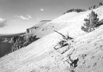 A portion of Red Cloud Cliff near the East Rim Drive. |
BPR engineers completed plans and specifications for surfacing and paving segments 5-A2 and 5-B in 1932, but another three years passed before work commenced. They awarded the contract to J.C. Compton, a firm that also paved Routes 7-A and 8 during the summers of 1935 and 1936. Compton’s men started on the East Entrance Road during the first season, leaving only the final seal coat and minor shoulder treatments for the following year. Lange’s only real comment on Compton’s work consisted of an observation about the uniformity and smoothness of the resulting road surface. He largely attributed the results to placing aggregate with a Jaeger spreader, the first machine of its kind in the west, as Superintendent David Canfield later noted.
Aside from replacement and removal of log guardrail at two parking areas and the Pinnacles Overlook, subsequent changes along Route 5 have been confined to Lost Creek Campground and the East Entrance area. With the road reconstruction essentially completed in 1935, Lange sought to improve the undeveloped camping area at Lost Creek using a site plan that featured a loop road with parking spurs, tables, and fireplaces. He noted the placement of ten log tables and as many fireplaces in the summer of 1938, later adding that more improvements to existing facilities should be made. A rapidly shrinking budget for CCC projects meant few changes at the site until 1957, when a Mission 66 project funded replacement of tables, fireplaces, and pit toilets, but also led to completion of parking spurs and two unsurfaced road loops at Lost Creek Campground.
The resulting expansion from ten to twelve sites at the campground occurred after the NPS closed the East Entrance in 1956, though in the face of steadily increasing park visitation. This closure came in response to average daily traffic during the summer having declined to only thirty-five vehicles, largely due to the relocation of U.S. 97 away from nearby Sun Pass in 1949. Park crews razed a log checking station at the boundary even before that time, since the NPS chose to use a portable kiosk on the East Entrance Road near Lost Creek. CCC enrollees built a stone masonry “motif” at the boundary in 1937 that complemented signage at the other three road entrances to the park. The structure sat virtually forgotten once the closure took effect. The East Entrance opened again in September 1971 as a means to augment circulation on the new one-way road system on Rim Drive. With only 2.5 percent of almost 600,000 park visitors using the entrance over the 1972 season, it closed again the following year. With the road blocked by boulders at the Pinnacles Overlook and re-contoured for a short distance beyond that point, the East Entrance has remained closed to motor vehicles since that time. Access for hikers and bicyclists over the half mile stretch between the overlook and a parking lot built by the U.S. Forest Service near the park boundary was encouraged, however, after NPS employees built a trail along the edge of Wheeler Creek Canyon in 1991.
Route 8 (North Entrance to Diamond Lake Junction)
Although the NPS used a bulldozer for widening the Diamond Lake Auto Trail to a “standard width” in 1930, BPR ran a P-line survey for the prospective North Entrance Road later that summer. A section of the proposed alignment proved unsatisfactory to Sager and other NPS landscape architects since there was a possibility that it might cut through the middle of the Pumice Desert as part of a tangent almost 5 miles in length. Shifting the line half a mile east where it crossed the Pumice Desert made enough difference to Sager that he agreed to a new alignment. This one also kept the road in timber longer so as to reduce any scar seen from the rim, while also breaking up the tangent to some extent. Sargent thus staked what became the L-line in May 1931 and it met with NPS approval shortly thereafter.
The contract for grading almost 8 miles of road between the Diamond Lake Junction and the park’s north entrance went to A.C. Guthrie and Company of Portland in September. Their crew of about twenty men then cleared the roadway for another month, until bad weather forced suspension of the job. Rough grading began when work resumed in July 1932, with the contractor also required to do a considerable amount of roadside cleanup, old road obliteration, and slope rounding. The cleanup came partly in response to mountain pine beetle infestations during the 1920s in this part of the park, attacks that resulted in considerable loss of lodgepole pine. Obliteration of the old auto trail crossing the Pumice Desert largely consisted of removing the shoulders, so the old line was still somewhat visible from afar. Sager, however, “felt sure” that in several years natural re-seeding of sedges and other “low vegetation” would help. He also commented that flattening and rounding of slopes at the road margin greatly added to the highway’s appearance, so much so that BPR included this item as a specification for all subsequent grading contracts in the vicinity.
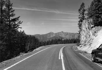 East Rim Drive near Anderson Point, looking northwest toward Kerr Notch. |
With the grading contract well on its way to completion by late August, BPR began advertising for a surfacing project to encompass both the West Rim Drive (Route 7-A) and the North Entrance Road. Like other contracts awarded from 1931 to 1933, it contained incentives aimed at alleviating unemployment, such as a cap of thirty hours per week for each man working under special wage rates. The Homer Johnson Company of Portland submitted the low bid, but did not begin the job until August 5, 1933, due to a heavy snow pack at the rim. With a roadway of 22′ already established by the grading contractor, BPR specified a surfaced width of 18′ on both routes, in accordance with park highway standards of 1932.
One NPS landscape architect, Armin Doerner, observed that work was slow in getting underway, but this comment had more to do with the subcontracted masonry guardrails along Route 7-A than the surfacing done by the prime contractor. Johnson completed the job by October 1934 so that paving both routes could take place over the following summer. The paving contractor, J.C. Compton of McMinnville, used the latter half of the 1935 season to complete all but the sealing of several miles along the North Entrance Road.
Once construction of this approach finished in the late summer of 1936, CCC enrollees began building an entrance sign motif on the park’s north boundary. Its design, which featured a large wooden sign with raised lettering, hung from a log projecting horizontally from an imposing stone masonry motif, matched one for the East Entrance, but visitor numbers through each “gate” reflected opposite trends. Motorists using the East Entrance had been declining steadily once a road connection between U.S. 97 and the North Entrance through an adjoining national forest was initially graded in 1931. Increased traffic brought by the opening of the Willamette Highway nine years later led to placement of a temporary entrance station on the park’s north boundary, a structure replaced by a portable kiosk in 1949. NPS planners projected an adjoining development during this period, something that included two staff residences, a fire cache, and even a small campground. The scarcity of water in this locality, however, restricted facilities to a ramshackle building used to house seasonal rangers and two pit toilets.
Developments along the North Entrance Road during Mission 66 were limited to a parking area in the Pumice Desert that featured an island to provide motorists who stopped with some separation from moving traffic. The parking area contained an interpretive marker, one originally intended to convey the “story” of Pumice Desert as well as identify peaks seen in the distance. Although Mission 66 provided a golden opportunity for funding road reconstruction over a decade beginning in 1956, the NPS elected not to widen what had become the park’s most heavily used approach route. Park officials simply saw the North Entrance Road as lower priority to the southern approaches used year round.
Widening as part of a reconstruction project eventually came about as the result of studies conducted by the Federal Highway Administration in 1980 and 1983. Planners saw ample justification for a new road having 28′ of surfaced width, given the traffic volume of 600 vehicles a day, as well as a need to accommodate both recreational vehicles and bicyclists. Other key parts of the project included realignment of the Diamond Lake (North) Junction, expansion of the parking area where the Pacific Crest Trail crossed the road, and a new development near the boundary in accordance with park expansion approved by Congress in 1980. The latter consisted of moving the entrance station about 1.5 miles north to a point where a rest area and turnaround could be built close at hand. Reconstruction commenced in 1985, but the contractor defaulted, so the project remained at a standstill over the following year. It finally came to a close in 1987, with the only subsequent changes along Route 8 consisting of building a new checking station four years later, as well as an entrance sign and motif modeled after the precedent set by the CCC at the old park boundary.
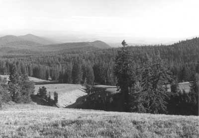
Looking south toward the Klamath Basin from Dutton Ridge. |
Construction and Use of Other Roads
Designation of roads as “secondary” and “service” for purposes of documentation is simply a way to classify what cannot be termed a “primary” route such as a circuit or approach road. In this context secondary roads are available for both visitor and administrative use, but remain in an unsurfaced condition so that annual re-grading is needed. There is only one such road in Crater Lake National Park, the so-called “Grayback Motor Nature Trail,” which connects Lost Creek Campground with what is presently a picnic area and trailhead below Vidae Falls. A number of secondary roads originally built for fighting forest fires have been converted to trails. Vehicles on these roads were largely restricted to administrative use until 1971, when the NPS banned all motorized travel in the backcountry. Service roads, by contrast, are shorter but more broadly defined to encompass surfaced access available for either public or administrative use. These are largely confined, however, to the three main developed areas of Rim Village, Park Headquarters, and the Annie Spring vicinity. Paved campground loops and access to residential facilities predominate in those three localities, though this category also includes two unsurfaced loops at Lost Creek Campground, as well as entry to a pair of bone yards on one approach road.
Secondary Roads
Route 6 (Lost Creek to Vidae Falls)
This remnant section of the old Rim Road is really an alternate to a portion of Rim Drive, so one BPR engineer recommended it be known as “Route 7 Alt.” in 1946. It was used as such during the first decade following the end of World War II because rock fall on Anderson Point, Dutton Cliff, and Sun Grade often blocked Rim Drive for at least part of several summer travel seasons. By the mid 1950s, however, NPS master plan drawings indicated that this road had assumed the designation of “Route 6.” Some grading of it by park crews for maintenance purposes undoubtedly took place, most likely on an annual basis, yet planners in 1968 described this road as having been “abandoned” almost three decades earlier. They nevertheless found it in “fair to good condition” and easily passable by automobile.
The impetus for identifying at least one “motor nature trail” in national parks such as Crater Lake has often been attributed to NPS Director George Hartzog, who ordered that this type of experience be considered as part of the master planning process in 1968. As originally conceived, planners of that time saw the “Grayback Ridge Motor Nature Trail” as a one-way gravel road destined to receive “minimal use” given its location away from the main travel corridor between Annie Spring and the North Entrance. They nonetheless called the interpretive possibilities “exceptional,” so R.G. Bruce, a park naturalist, designed sixteen wayside exhibits for placement at regular intervals between Lost Creek and Vidae Falls. Once installed, however, these devices were criticized in one interpretive plan as being overly lengthy in regard to text while also failing to effectively develop the designated theme. By the time the NPS undertook its first general management plan for Crater Lake in 1976, a new group of planners called the Grayback wayside exhibits “obsolete,” noting that a newly printed guidebook removed the need for them.
Rapidly escalating fuel costs and gasoline shortages affecting park operations led Superintendent James Rouse to propose closing the Grayback Road to the regional director in September 1979. He justified such a move by presenting the idea that vehicle access by way of segments 7-D and 7-E made the Grayback Road redundant as a motor nature trail, given the one-way circulation system clockwise then in force on this portion of Rim Drive. Less than four years later, however, he wrote to a new regional director about abandoning those segments of Rim Drive in favor of widening and improving the Grayback Road. Rouse mentioned having recently met Lange, who told him of the road location controversy involving 7-D and 7-E1 during the 1930s, though he placed greater emphasis on cost savings derived from abandoning 5.5 miles of Rim Drive extending from Kerr Notch to Vidae Falls.
His successor, Robert E. Benton, eventually opted for the status quo in keeping all of Rim Drive open for summer travel and then directing that circulation on it return to a two-way system in 1987. The Grayback Road, meanwhile, remained one-way and at roughly the same graded width (12′) as when originally constructed in 1913, though Benton thought the motor nature trail designation was outmoded and at one point asked his division chiefs for recommendations on possible uses. Declining fuel prices and an increasing park budget over the last half of the 1980s insured annual re-grading of the road, though its status as a “motor nature trail” became a casualty to shifting priorities in NPS planning.
Routes 25-49 (fire roads)
What were called “motorways” or “truck trails” at one time originated in 1929, when park employees began laying out a “fire control system” of access roads intended to cross the largest number of sections possible in the backcountry. Construction began the following year, with the initial 22 miles built without cutting what Sager called “larger” trees. He described the roads as being of a low standard, being built by a bulldozer that simply scraped away forest litter down to mineral soil and then pushing material to one side. This method did not provide for drainage, so the roadbed often became a ditch or gully where it traversed the lowest part of the terrain.
Almost 130 miles of fire roads became part of this system, with most of the construction completed by 1934. Grades varied between flat and 10 percent along most of the motorways, where 12′ became the standard width. The fire roads remained unsurfaced, so portions damaged by erosion or characterized by high centers sometimes made travel on them a challenge. Their proliferation came in response to a desire to suppress fires started by lightning in remote corners of the park, or to reach patrol cabins built by the CCC in 1933-34. Employees could drive the roads for recreational purposes by permit, but the rangers installed locked gates at public entry points to stop visitor use of the motorways, since there were fears in the NPS about intentional or inadvertent ignitions in the backcountry.
Regular maintenance of the motorways commenced in 1941 as part of fire suppression activities and continued sporadically until 1971, when the NPS stopped virtually all motorized administrative access to areas in the park now studied for their suitability as legally designated wilderness. The shift toward managing much of the backcountry as wilderness, even though Congress failed to act on formal NPS recommendations made in 1974, led to making roughly 52 miles of fire roads part of the park’s maintained trail system. Subsequent trail reroutes aimed at enhancing the wilderness experience of backcountry visitors have since slightly reduced that total.
Service Roads
Rim Village
All three service roads at this site extend from the main roadway that links Crater Lake Lodge with a cafeteria and plaza. The Rim Cabin road (Route 10) runs for one-fifth of a mile, beginning west of the cafeteria and going behind that structure to a point down slope of the plaza. A sinuous network of roads in the former Rim Campground (Route 11) allow for vehicle circulation through what is currently a picnic area. Another road approximately 800′ in length provides employees with access to the concessionaire’s dormitory, a building erected in 1973.
The concessionaire funded the construction of twelve cabins clustered behind the cafeteria in 1931, each being located along the outer edge of an unsurfaced road loop. Twelve additional cabins were built slightly further east of the first group over the ensuing decade, thus necessitating extension of the road to a point below, but not connected with, the plaza. With removal of the cabins in 1985, most vehicle traffic on this service road went to a loading dock located at the rear of the cafeteria.
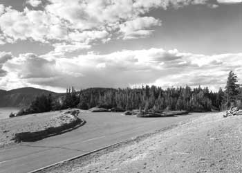 A parking area on East Rim Drive above Grotto Cove. |
Formalizing the Rim Campground with a defined set of roads and designated sites began in 1933, as a way to control impacts in the face of heavy use. CCC enrollees planted shrubs to screen sites, installed picnic tables and fireplaces, and partially buried logs in order to define parking spurs. Driving on unsurfaced roads created dust, so the NPS preferred using oil as a palliative rather than crushed stone surfacing, given higher costs and noise associated with the latter. Increases in visitation and the popularity of camping, even during the Depression, generated a need to expand the campground, so the NPS responded by adding a new road loop south of the existing one in 1934. Aside from providing more campsites, the new loop had enough room for an “open air theater,” one where interpretive programs could be held on summer evenings.
The theater never materialized, but more expansion along with reconstruction of the campground came during the summer of 1957. The contracted portion of this Mission 66 project consisted of clearing and grubbing for new road construction, building new subgrades with a crushed stone base, then paving with asphalt. Obliteration of several old road sections and restoration of construction scars continued on a day labor basis for the next two seasons, in conjunction with setting barrier rocks to define fifty-five campsites. In addition to a paved surface at least 12′ wide that extended over nine-tenths of a mile through the campground, the project brought about a new entrance road from the main roadway through Rim Village, one wide enough to allow two way traffic. The need for a more spacious entrance, as well as several wider arterial roads, became moot in the summer of 1975 when the NPS discontinued overnight camping at Rim Village in favor of a picnic area that received only a small fraction of previous visitor use.
A service road leading to the concessionaire’s dormitory overtopped a portion of the road built by the Army Corps of Engineers in 1914. Located just east of the Rim Campground and at the outer edge of a broad pumice field south of Crater Lake Lodge, this service road leads to an employee parking lot situated adjacent to the dormitory. After burial of electrical, water and sewer lines underneath the old roadbed to serve the dormitory, the road was paved to a width of 14′ as part of construction activities taking place over the summer and fall of 1973.
Park Headquarters
Of the three service roads at this site, the oldest connects a utility area or maintenance yard with an administrative plaza situated at an entry point with the Munson Valley Road. This road also extends uphill from the administrative plaza and provides vehicular access to a residential area built with the intention of housing permanent NPS employees during the summer season. At the south end of the maintenance yard is another service road, a one-way loop serving the residential area for temporary NPS employees called “Sleepy Hollow.” Across the Munson Valley Road from Sleepy Hollow is the park’s largest residential complex, “Steel Circle.” The road through it (Route 21) consists of an outer loop where housing units were located and an inner access that allows employees to reach a building used for social functions and gatherings.
Metamorphosis of what the Army Corps of Engineers initially called “Camp 2” began in 1926, when the NPS built a warehouse and incorporated stone masonry in its ground floor walls. This type of construction immediately gained favor over earlier log structures and became the preferred mode of construction as the headquarters development expanded over a wider area over the next seven years. The need to establish a defined circulation system quickly became evident in the wake of largely unconfined vehicular access to the site.
Grading of a service road to connect the new administrative plaza with both the utility and residential areas took place in 1933, with all excavation done by hand to maximize the numbers of men hired on this public works project. With most of the grading completed that fall, laborers began surfacing a portion of the roadway with 4″ of crushed rock obtained from a contractor who used a preexisting quarry located about 5 miles from Park Headquarters. A short construction season dictated that the contract had to be completed in 1934, though subsequent settling under traffic meant surfacing needed water, then be mixed, and re-laid. The NPS let another contract for crushed rock in 1935, so that this material could be integrated with emulsified asphalt and spread roughly 1″ in depth. It was then rolled, and the process repeated twice more before motorists began to use the road surface.
Some rough grading of a service road from the utility area to Sleepy Hollow began in 1933 as part of building the first five cabins there for temporary employees. They appeared on both sides of the road and were joined by three additional structures in 1936. Finish grading, surfacing, and paving took place over the following summer to the same specifications as the service road through the administrative plaza. Lange added two parking areas along the Sleepy Hollow road in 1937 as part of accommodating employees still housed in tents. The parking areas disappeared when the utility area expanded in 1957, an undertaking that included establishing a road connection between it and the new residential area to be built across the Munson Valley Road. Piecemeal removal of cabins in Sleepy Hollow started in 1984 and continued over the next five years so that a new housing area for temporary employees could be constructed on the site in 1990. Contractors realigned the service road as part of the project so that new structures were situated on the inside of a paved access loop.
Grading of the road through the Steel Circle housing area occurred in 1956 as a precursor to building a number of units largely consisting of duplexes with flat roofs. A portion of the site had once been used as a landfill, so the contract included grading the original access road from Rim Drive in addition to creating a main entrance from the Munson Valley Road. The former connection did not last long, due to fears that visitors might unduly disturb residents, so the road in Steel Circle has only one entry point. Contractors surfaced this road in September 1957 so that paving could be completed prior to the end of the construction season.
Annie Spring vicinity
Much like they had at Rim Village and Park Headquarters, NPS landscape architects turned their attention to this site once collaborative planning and design with BPR engineers established the alignment for the road junction and stream crossing. By 1926, planners envisioned a surfaced “plaza area” where Routes 1 and 2 met adjacent to the Annie Creek Bridge, yet they also called for less development in this area in favor of more facilities at Park Headquarters and Rim Village in the future.
One exception was a campground to be located next to the new plaza, where in 1928, the NPS hoped to eventually accommodate 200 visitors. In the mean time, however, officials knew visitors preferred the Rim Campground, so improvements such as surfaced roadways and hardened sites with rustic log tables were centered on it. Annie Spring Campground thus consisted of an informal main parking area flanked by comfort stations and was largely used on an overnight basis by a few visitors who arrived late in the day. CCC laborers built a new comfort station there in 1934 and began clearing a loop road for an expanded campground that summer. Tables and fireplaces for fifteen sites followed over the next three years, so that by 1938, the official park brochure described the Annie Spring Campground as a comfortable alternative (in being situated at a lower elevation) to the larger and more popular Rim Campground.
Reconfiguration of the campground began in September 1956 with the aim of increasing its size to twenty-five sites. Contractors made a longer loop road, one sometimes referenced as Route 12, by moving the intersection with approach roads 300′ further south in conjunction with realigning the Annie Spring road junction. Adding parking loops between the extant fifteen sites and along a slightly extended access road produced the desired expansion, one that included new comfort stations, tables, and fireplaces in 1957. Surfacing to a width of 15′ also took place that summer so the campground could serve visitors displaced by construction associated with reconfiguring the camp facilities at Rim Village. Closure of the Annie Spring Campground came in 1968, in the midst of another road junction realignment, though its facilities had been pressed into service during the intervening decade only when the adjacent Mazama Campground filled to capacity.
Self-imposed limitations by the NPS on a wholesale expansion of the Rim Campground after 1941 stemmed from chronic impacts associated with over use. As annual visitation climbed above 250,000 in the immediate postwar period and then exceeded 370,000 in 1954, the need to develop one large campground away from the rim became more acute. Rather than expand southward from the Annie Spring Campground as envisioned in 1928, the NPS chose to develop a site located across Route 2 and used as CCC Camp Annie Spring from 1934 to 1941.
Grading of the first four campground loops occurred from August to November 1956, concurrent with placement of utilities. Over the following summer, surfacing of the campground roads (referenced collectively as Route 15) occurred at roughly the same time as installation of new tables having concrete bases and metal fireplace grates. Roads in the campground continued to expand with the clearing of a fifth loop in 1960, so that development of forty-five new campsites along it could commence the following July. Like loops A through D, the road that defined E loop had a surfaced width of 15′ due to one-way circulation, though the main two-way access between loops went to 20′. Placement of barrier rocks around the sites finally completed the project in September 1963, only to be followed by construction of two additional loops (F and G) starting in August 1965. The last two loops were bid as a “package,” one containing items such as road construction, extension of utilities, and development of fifty additional campsites. Placement of surfacing material followed by an oil treatment constituted what was virtually the last step in completing the job, one accepted by the NPS during the early part of August 1966.
A prospective realignment of the South Entrance Road adjacent to Mazama Campground that came to pass in 1968-69 allowed planners to consider how to allocate space between the old road location and the new. They initially foresaw adding more than 110 campsites in four new loops to the existing total of 190 in 1966, but two years later opted for a “trailer village” divided into units totaling 100 sites. Public opposition to the trailer village idea helped to stifle any new development there until 1987, when ten new quadriplex units were built to replace cabins demolished in Rim Village two years earlier. Although the concessionaire funded construction of these units, the NPS extended utilities and a service road with two loops to them. The NPS also funded a large parking lot for what it now called “Mazama Village,” (given the new development’s proximity to the campground) one largely aimed at supporting a camper store erected by the concessionaire in 1990.
A contractor began grading another service road in the vicinity during the summer of 1996 as the initial step to building a housing complex for concession employees supposedly displaced by the rehabilitated Crater Lake Lodge. Work completed over the following summer even included the park’s first paved bicycle path, one that joined Mazama Campground with the construction site located across Route 2. It also included two loop roads that provided vehicle access to the central housing and service facility, a satellite dormitory, garage, and sites for recreational vehicles.
Outlying Areas
Two service roads located away from the three main developed areas are surfaced with gravel and can be found along the South Entrance Road, although they are restricted to administrative use. The roads are entries to the South Utility Area (Route 17), a bone yard located near the park boundary, and the Pole Bridge Quarry (Route 50) situated across Route 2 from the abandoned Cold Spring Campground. At Lost Creek Campground, by contrast, the two road loops (Route 14) have remained unsurfaced as part of a conscious effort to retain its primitive character in combination with the relatively informal campsites. The graded roads there have thus remained at 12′ wide.

Phantom Ship from the Reflection Point substation on East Rim Drive. |
Conclusion
No part of the park’s road system has yet been nominated to the National Register of Historic Places, though two buildings associated with the Rim Drive circuit were listed in 1988. Portions of the system (routes 2, 3, 4, 7, and 8) nevertheless became part of the Volcanic Legacy Scenic Byway, a route that achieved All-American Road status in 1998. This national designation led to preparation of a corridor management plan, where one supplement aimed at making future site design through the park and an adjacent national forest compatible with the original stone masonry features found on Rim Drive.
The assumed eligibility of Rim Drive for listing is based on meeting two of four National Register criteria for areas of significance. These are Criterion A, for its association with the history and development of Crater Lake National Park, and Criterion C, for its association with landscape architects and engineers who produced an outstanding example of blending naturalistic and functional design in the areas of landscape architecture and highway engineering. As a linear designed landscape that took shape between 1926 and 1941, Rim Drive also fits the framework established for two previous multiple property listings that highlighted similar themes at Park Headquarters and Rim Village. A multiple property National Register form on Landscape Design in the National Park Service placed Rim Drive and other national park roads built during that period into the wider context of American history, focusing on conservation, public recreation, government, and landscape architecture as areas of significance. That documentation form also covered trails associated with historic park roads, particularly where this part of a circulation system reflected naturalistic principles underlying their planning, design, and construction. In addition to Rim Drive and five associated trails, the park also contains well-preserved examples of earlier road construction that may also qualify for listing. Portions of wagon roads built in 1865 and 1869 are extant in association with historic camps located along those routes. The park also contains two remnant pieces of a wagon road built in 1905-06, as well as representative segments of a road system designed for automobiles and attributed to the Army Corps of Engineers. These illustrate how roads in the vicinity of Crater Lake evolved prior to the advent of NPS administration in 1917, both in terms of construction techniques and the standards used in providing access for a steadily increasing number of visitors.
The park road system of past and present also in some ways illustrates the transformation of American highway engineering and landscape design over more than a century, and serves as a reminder of how travel to Crater Lake changed during that period of time. Where several thousand people reached the rim each summer during the 1890s, annual visitation has increased more than a hundred-fold. The system was altered and upgraded to meet demands for vehicular access to the park, though these improvements helped reduce the average length of a visit to Crater Lake from several days in the early part of the twentieth century to less than four hours at present.
Bibliography
Books
Hewes, Laurence Ilsley. American Highway Practice. New York: John Wiley & Sons, 1942.
McClelland, Linda Flint. Building the National Parks: Historic Landscape Design and Construction. Baltimore: The Johns Hopkins University Press, 1998.
Marriott, Paul Daniel. Saving Historic Roads: Design and Policy Guidelines. New York: National Trust for Historic Preservation and John Wiley & Sons, 1998.
Ruhle, George C. Along Crater Lake Highways: A Road Guide to Crater Lake National Park. Crater Lake: Crater Lake Natural History Association, 1953. The 1964 revision is titled Along Crater Lake Roads.
Williams, Howel. The Geology of Crater Lake National Park, with a Reconnaissance of the Cascade Range Southward to Mount Shasta.Washington, DC: Carnegie Institution of Washington Publication 540, 1942.
Articles
Bayliss, Dudley C. “Planning Our National Park Roads and Our National Parkways,” Traffic Quarterly (July 1957), pp. 417-440.
Canfield, David H. “Building the Rim Road at Crater Lake: Brief Survey of the Difficult Problems in the Construction of this Scenic Highway,” The Earth Mover 23:4 (April 1936): pp. 7-10.
Mark, Stephen R. “A Study in Appreciation of Nature: John C. Merriam and the Educational Purpose of Crater Lake National Park,” Oregon Historical Quarterly103:1 (Spring 2002): pp. 98-123.
Williams, Ira A. “Some Notes on the Geology of Crater Lake,” Oregon Out of Doors 1:2 (June 1922): pp. 59-94.
Federal Documents
A. Corps of Engineers, U.S. Army.
Report upon Crater Lake National Park. Extracts from Annual Reports of the Chief of Engineers to the Secretary of War. Washington, DC: Government Printing Office, 1912-1919.
B. Federal Highway Administration, U.S. Department of Transportation.
Garvey, Jane F., et al. Flexibility in Highway Design. Publication Number: FHWA-PD-97-062. Washington, DC: USDOT, 1997.
Western Direct Federal Division, Road Improvement Study, Crater Lake National Park, original copy in park maintenance files, transmittal date June 22, 1984.
C. National Archives and Records Administration, General Services Administration.
Record Group 30, Bureau of Public Roads, accession 43518, box 110, Pacific Northwest Region, Seattle.
Record Group 77, Army Corps of Engineers, Office of the Chief Engineer, First Portland District, boxes 406-410, CLP files 100 — 224, Pacific Northwest Region, Seattle.
Record Group 79, National Park Service, Resident Landscape Architect Monthly Reports to the Chief Architect, location 3001A-E, boxes 1-2, Pacific Sierra Region, San Bruno.
Record Group 79, National Park Service, accession 67A618, boxes 4499 and 10003, files 620-631, Pacific Northwest Region, Seattle.
D. National Park Service, U.S. Department of the Interior.
Gilbert, Cathy A. and Luxenberg, Gretchen A. The Rustic Landscape of Rim Village, 1927-1941. Seattle: Cultural Resources Division, Pacific Northwest Region, 1990.
Good, Albert H. Park and Recreation Structures: Part I — Administration and Basic Service Facilities. Washington, DC: Government Printing Office, 1938.
Gyorgyfalvy, Robin. Volcanic Legacy Scenic Byway, Corridor Management Plan, Supplement III. Produced in cooperation with the Winema National Forest, final draft dated December 14, 2001.
McClelland, Linda Flint. Historic Park Landscapes in National and State Parks, multiple property documentation form for the National Register of Historic Places, approved by the Keeper of the National Register, October 4, 1995.
Senos, Rene and Dietz, Rebecca. Rim Road Cultural Landscape Inventory, Crater Lake National Park. Draft of September 1997.
Shelby, Bo and Wolf, Donald W. Social Impacts of Design Alternatives: Visitor Behavior and Management Alternatives at Crater Lake National Park. Report 81-2 from the cooperative park studies unit, Oregon State University, Corvallis.
Soulliere, Laura E. Historic Roads in the National Park System. Special History Study, NPS D-1075. Denver: Resource Planning Group, Denver Service Center, 1995.
E. Crater Lake National Park Museum and Archives Collections
| catalog no. | name of collection |
| 1695 | Superintendent’s Annual Reports, 1928-1953 |
| 1716 | Superintendent’s Monthly Reports, 1928-1966 |
| 8556 | William Gladstone Steel scrapbooks no. 35 — 41 (photostatic copies made c.1966, bound as vols. II and III in library) |
| 8883 | Francis G. Lange Photograph File |
| 8885 | Crater Lake [National Park Service] Photographic File |
| 8889 | Building and Construction Files |
| 8895 | Biographical Files, John C. Merriam (Crater Lake memoranda, 1928-34) |
| 8899 | Drawings, Plans, and Maps |
| 10137 | Francis G. Lange Professional Papers |
Historic American Engineering Record
Historic American Engineering Record Addendum to Crater Lake National Park Roads
HAER No. OR-107
LOCATION: Crater Lake National Park consists of 183,224 acres located primarily in Klamath County, Oregon, though about 4 percent of the park is in the adjoining Douglas County and 1 percent in Jackson County. The total mileage for all primary highways in the park is 69.89, of which the circuit around the rim accounts for 32.27 miles. Secondary and paved service roads in the park amount to 13.75 miles, for a system total of 83.64 miles.
DATES OF CONSTRUCTION: Circuit roads: Rim Road (1913-19), superseded by Route 7, Rim Drive (1931-40). Approach roads: 1. West Entrance Road — part of Fort Klamath — Jacksonville wagon road (1865), with some relocation (1905-06), Medford Road (1914-17), superseded by Route 1 (1925-28) with widening and minor realignment (1972-76); 2. South Entrance Road — part of Fort Klamath — Jacksonville wagon road (1865), Fort Klamath Road (1914-17), superseded by Route 2 (1926-28) improvements (1940), with some widening and realignment (1962); 3. Munson Valley Road — part of road to the rim from Annie Spring (1904-05), part of both Rim Road and Fort Klamath Road (1913-14), superseded by Routes 3 and 4 (1926-28), widening and minor realignment (1963); 4. East Entrance Road — Pinnacles/Rim Road (1913), superseded by Route 5 (1929-30, 1932-36); 5. North Entrance Road — auto trail (1919), superseded by Route 8 (1932-36), with widening and some realignment (1985-87).
STRUCTURE TYPE: Park road system
DESIGN: U.S. Army Corps of Engineers, Bureau of Public Roads (Public Roads Administration, Federal Highway Administration), National Park Service
CONTRACTORS: Various
OWNER: National Park Service, Crater Lake National Park.
SIGNIFICANCE: The primary roads in Crater Lake National Park were designed and constructed to provide visitor access to the park’s scenic features, which are largely concentrated along the rim of Crater Lake. Blending roads harmoniously with the landscape was the stated goal of the National Park Service in its collaboration with the Bureau of Public Roads, most notably on the circuit called “Rim Drive.” The aim of subordination in road design to geological phenomena, dramatic vistas, and subalpine forests also applied to the approach roads, particularly where ancillary attractions like the “Pinnacles” or Annie Creek Canyon could be seen by motorists. The Rim Drive, however, remains an especially noteworthy example of “naturalization” among all national park roads built during the 1930s.
Remnants of other roads at Crater Lake illustrate construction methods that date to 1865 and changed once horse-drawn grading equipment became available a decade or so later. Early wagon roads were eventually realigned for highways designed for automobiles, but pieces of a circulation system built by the Army Corps of Engineers from 1913 to 1919 are still evident in the park, particularly in places near the rim. Evolving design standards can also be seen within the current road system, a product of a collaboration that began in 1926 between the National Park Service and the Bureau of Public Roads.
PROJECT HISTORIAN: Stephen R. Mark, 2003
PROJECT INFORMATION: Documentation of Crater Lake National Park’s road system was conducted during the summer of 1999 by the Historic American Engineering Record (HAER), a long-range program aimed at documenting historically significant engineering and industrial works in the United States. HAER (Eric DeLony, Chief) is a division of the National Park Service, U.S. Department of the Interior. This project was funded by the Federal Lands Highway Program, administered by the U.S. Department of Transportation, through the NPS Park Roads and Parkways Program. Fieldwork, drawings, and photography were completed under the direction of Todd A. Croteau, Program Manager, and Tim Davis, Program Historian. The recording team consisted of field supervisor and historian Christian Carr (Bard Graduate Center) and architectural technicians Sarah Lehman (University of Oregon), Walton Stowell (SCAD Savannah, Georgia), and Simona Stoyanova (ICOMOS, Bulgaria). Jet Lowe of HAER produced the accompanying large format photography. Stephen R. Mark, Historian, produced the historical report, which was edited by Justine Christianson, HAER Historian.
Other pages in this section
*** previous title *** --- *** next title ***