Pumice Flat Trail – Crater Lake National Park
| Difficulty: Moderate
Length: 2.73 miles (4.39 km) Elevation: 5853 – 6342 ft (1784 – 1933 m) |
Trailhead coordinates:
Latitude: N +42° 50.160 or 42.836 Longitude: W -122° 8.543 or -122.142 Altitude: 5853* ft (1784* m) |
REI Trails Project partners with Crater Lake Institute to produce their trails app. Click the map below, get the app – then come back, we offer more.
Trail Description
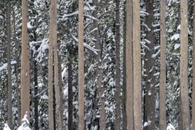
This trail moves from Hwy 62 to the Stuart Falls trail and the southern portion of the Pacific Crest Trail (PCT). Lodgepole pine is a major component of the forest cover in this area.
Trailhead location: The trailhead is located on Hwy 62 just a few hundred feet south of the Lodgepole picnic area turnout and 2.75 miles south of the Annie Springs south entrance. It is also 6.9 miles from the southern park border with Hwy 62. Look to the south side of the road for the trailhead.
Seasonal Information: Expect the trail to be covered in snow from October to early July, however, conditions vary somewhat from year to year. See Crater Lake Current Conditions for more information.
Trail Profile for Pumice Flat Trail (same as Bald Crater Loop Trail)
Related Maps
Digital USGS topographic maps (PDF files) – the following maps are relevant to the Bald Crater Loop trail. See more Crater Lake Institute online USGS digital maps.
| Series | Name | Year | Scale | Contour Interval | File |
| USGS 7.5′ | Union Peak | 1985 | 1:24,000 | 40 ft | usgs-union-peak-7.5 |
| USGS 30′ x 60′ | Crater Lake | 1989 | 1:100,000 | 50 m | usgs-crater-lake-30-minute |
| USGS 30′ x 60′ | Diamond Lake | 1978 | 1:100,000 | 50 m | usgs-diamond-lake-30-minute |
| USGS 1° x 2° | Klamath Falls | 1970 | 1:250,000 | 200 ft | usgs-klamath-falls-1-2 |
| USGS 1° x 2° | Medford | 1976 | 1:250,000 | 200 ft | usgs-medford-1-2 |
| USGS 1° x 2° | Roseburg | 1970 | 1:250,000 | 200 ft | usgs-roseburg-1-2 |


