The Geology of Crater Lake National Park, Oregon With a reconnaissance of the Cascade Range southward to Mount Shasta by Howell Williams
The Glaciation of Mount Mazama
Evidences of Early Glaciation on the Caldera Walls
Llao Rock
|
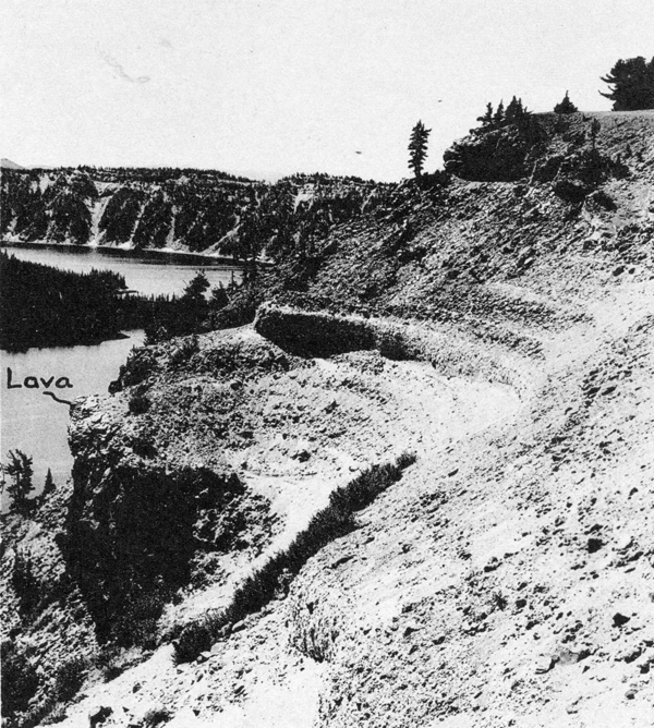
Plate 30. Fig. 1. Section on the caldera rim, 150 yards south of the Llao lava flow. Above the topmost lava lie 6 feet of lump pumice, then 30 feet of bouldery till, 7 feet of lump pumice with large lithic blocks (forming small cliff), 60 to 80 feet of bouldery till mixed with pumice, and finally the topmost pumice and scoria, products of the culminating eruptions of Mount Mazama. See also figure 7a. |
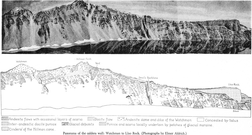
Most geologists who see Crater Lake decide even from a distance that the dacite flow of Llao Rock occupies a glacial valley. That this is actually the case may be verified by closer study, for an almost continuous layer of morainic debris occurs immediately beneath the western “wing” of the flow, thoroughly reddened by gas action and containing many striated boulders up to 18 inches across. Toward the margin of the flow, the till is considerably admixed with and overlain by dacite pumice. Above the pumice lies a younger till which partly overlies the edge of the Llao flow (plate 12, figure 2). Clearly, the eruption of the Llao dacite was both preceded and followed by glaciation. What seem to be the same two layers of till are well exposed on the spur about 150 yards south of the western edge of the Llao flows (plate 30, figure I). At least two other layers underlie the western “wing” of the flow, as shown in the panorama, plate 29, and beneath one of them there is a well striated surface of andesite.2
The glacial till immediately below the western “wing” of Llao Rock can be followed almost to the bottom of the old pre-Llao valley, but there it is obliterated by the feeding pipe of the flow. On the opposite, eastern slope of the old valley there is no trace of glacial material.
Although no moraines have been found immediately below the eastern “wing” of Llao Rock, two thin bands of fluvioglacial sand, separated by a flow of andesite, are exposed at the base of the great deposit of pumice which underlies the dacite, approximately at the same elevation as the bottom of the pre-Llao valley (plate 29).
Plate 29. Panorama of the caldera wall: Watchman to Llao Rock. (Photographs by Elmer Aldrich.)
***previous*** — ***next***


