As if to illustrate the latter point, a contemporary account of opening the trail appeared in 1923, as part of a volume on travel to Crater Lake and other destinations:
“There is but one trail down to the water, and without a trail the descent is extremely difficult and dangerous, however carefully you choose your spot. On our first day at the lake, this trail was still snow-blocked, but the boatmen and one or two fishermen had been down and got a few boats out, and, being possessed of Alpine stock and a rope, we saw no reason to wait. But even as we started down, the government gang appeared, armed with shovels, and began on the trail. When we were two or three hundred feet below them, we had to work down through a sharp ravine, like a bottle neck, into which the concavity of the drift was drawing all the lumps of snow tossed out by the trailbreakers above. As they saw us approaching this chute, they redoubled their efforts, and rained upon us a veritable barrage of snow-cakes, which attained tremendous velocity long before they reached us. Some of them were large and solid enough to knock your feet out from under you, or give you a staggering blow on the head, and we clung to our rope as we passed that bombardment with more tenacity than on many a steeper slope, taken in the higher mountains.49
 |
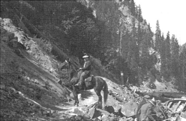
| Visitor on horseback at the boat landing, about 1921. Photo by Alex Sparrow, courtesy of the Southern Oregon Historical Society. |
Construction of a new trail to Crater Lake did not start until 1927, after scenic photographer Fred Kiser “blazed” the route and guided a NPS survey party that made the final location.50 It started some 800 feet west of his studio at a site adjoining the new plaza in Rim Village, across from where the concessionaire’s cafeteria was to be built in 1928. Intended as a NPS “standard” trail for front-country use, design of what became the “Crater Wall Trail” included 24 short switchbacks in traversing 900 feet of relief over its length of 1.6 miles.51 Those switchbacks, however, represented the biggest challenge for the annual tasks of opening and maintenance over the next three decades given the combination of loosely consolidated material inside the caldera, high snowfall, and sections prone to avalanches. At the outset Thomson waxed about how the trail better accommodated visitors who did not wish to walk during a brief period when the concessionaire experimented with renting mules and burros. As such, the trail was designed to be six feet wide, with a maximum grade of 15 percent. It terminated on a natural bench with more room for docking, so that circulation there improved in comparison to the site further east where the Sparrow Trail reached the shoreline.52

