 |
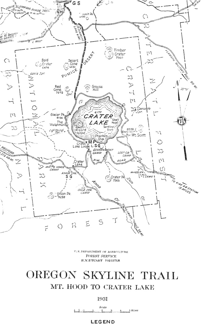
| Map showing route of the Oregon Skyline Trail through Crater Lake National Park and vicinity, 1931. Courtesy of Wendy Hull, Federal Highway Administration, Vancouver, Washington. |
The Forest Service reconnaissance of 1934 noted that the park lacked any signage which indicated the existence of an Oregon Skyline Trail, something again underscored by a scout group traversing the park by horseback in 1937.125 Two years later, Superintendent Leavitt and two of the rangers worried less about signs and more about motorists and pack stock sharing park highways. The NPS thus supported several changes to the route, beginning with the Forest Service possibly building a southwesterly link from Diamond Lake toward Lake West so that the trail might enter the park at Boundary Springs. From there it could follow existing motorways to Red Cone Spring, and then go south along a fire road to the headwaters of Castle Creek, just as the existing route did. Trail users could then either go up Dutton Creek, where equestrians were to then tie their horses at a point below Rim Village, or proceed by way of a bridle path to the campground at Annie Spring. South of there a short section of trail could be constructed so that a connection to the existing motorway, one that ran toward Union Peak, might be made—thereby avoiding the highway route to Cold Spring and the motorway across Pumice Flat. The locations of prospective horse camps were also discussed (mainly because the Forest Service issued a map of the Skyline route) but the NPS took no action toward building them. For its part, the Forest Service was anything but encouraging about redirecting the trail from Diamond Lake. Instead, they attempted to convince park officials that crossing the Pumice Desert on horseback had great appeal, especially if it could be done by separating the trail from the North Entrance Road.126

