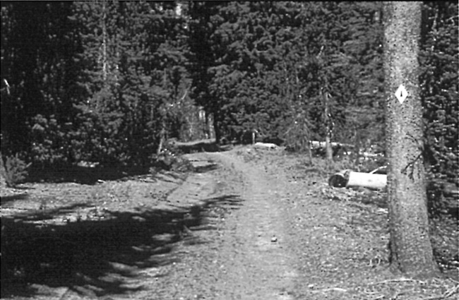
Another new segment of the PCT within the park came about once Forest Service crews reached the north boundary in July 1972 and began developing a trailhead with parking on Highway 138.164These developments stemmed from an agreement reached with the NPS in 1969, whereby the PCT was to follow the watershed divide south of Mount Thielsen, so that a new trail segment had to be built east of the North Entrance Road from the boundary.165 NPS crews did not commence work until the USFS had finished its portion of the project, so opening of the park’s segment was delayed until 1976.166 This piece of the new PCT still made use of a motorway, though for only two miles (it utilized part of a much longer loop around Timber Crater) until it crossed the highway between Grouse Hill and Red Cone. In all, roughly 4.5 miles of “connections” to the new Pacific Crest Trail (as opposed to the old Oregon Skyline route) were built in the park by NPS crews during this period.167
 |
| Section of the Pacific Crest Trail on one of the fire roads, 1970s. National Park Service photo. |
With the active maintenance of motorways for administrative use by government vehicles ending in 1971, the NPS began to more earnestly consider where to develop campsites along the PCT. Heretofore camping on the trail supposedly required a permit, even if the campsites were informal and largely concentrated in the vicinity of Red Cone Spring, Gold Camp Meadow, Bybee Creek, or along Dutton Creek.168 The park’s annual visitation exceeded 600,000 for the first time during the 1976 season, and with it came rising use of the PCT. Management response took the form of a permit system to track overnight use away from developed areas of the park, while self registration stations were placed at both ends of the PCT route and at four other trailheads as part of a wider NPS effort to track backcountry use in the national parks.169 Park staff wanted to concentrate backcountry camping at designated sites rather than let dispersed use (as evidenced by fire rings) continue over a wider area. Consequently, a designated backcountry camp for hikers had been established by 1978 at Lightning Spring, to be followed by ones near Dutton Creek and Red Cone Spring in 1979.170
Although overnight camping on the PCT assumed greater importance as a management concern by the late 1970s than previously, other changes in backcountry trails were driven primarily by day use. The numbers could be suspect due to different counting methods, but hiking was said to have more than doubled from 1958 to 1968, and within the following decade, doubled again.171 Most of the use still came on frontcountry trails (Cleetwood Cove, Garfield Peak, Watchman, and Mount Scott), just as it had before Mission 66, though the superintendent claimed that information derived from overnight permits and day use registers justified regular care of more backcountry trails. As filings stood, the NPS maintained about 70 miles of trail in the park as of 1978, though much of that total included what had been fire access roads (motorways) before 1971.172
While annual visitation at Crater Lake reached its zenith of 617,000 in 1977, the park’s backcountry attracted only a small percentage of hikers (who continued to favor frontcountry destinations) and a tiny fraction (less than one percent) of the overall total. Nevertheless, trail crews periodically cut back brush and cleared fallen logs from the motorway routes maintained as trails, and began covering one of the vehicle tracks in order to give the fire access roads a more “natural” appearance.173 New construction in 1977, however, was limited to realignment of the short upper section of the Dutton Creek Trail. This was aimed at locating a new trailhead next to the Munson Valley Road, only a short distance from Rim Village.174

