What drove the reroutes was the feeling that the motorways no longer served, if they ever did, hikers wanting to experience the park’s backcountry. Apart from the very different purposes of building fire roads and engineered recreational trails, wanting to enhance several experiential characteristics that led visitors to walk away from roads had been articulated following completion of the first reroute projects funded through the Fee Demonstration Program. As one contribution quoted from existing literature in the annual publication Nature Notes from Crater Lake:
“Mystery is where landscapes give the impression that one could acquire new information by traveling deeper into the scene. Good trail layout accentuates mystery and a winding path, where constantly shifting views of vegetation and the landscape sustain interest.Legibility allows for extensive exploration in an environment that looks easy to discern if a person goes further into it; trails can therefore utilize landmarks and periodic openness to reduce anxiety about getting lost. A prospect often highlights the hike, by providing a vista that extends for miles, even if in just one direction. Refuge describes places on or near the trail that provide seeing without being seen, whereby information is gained without giving any away.209
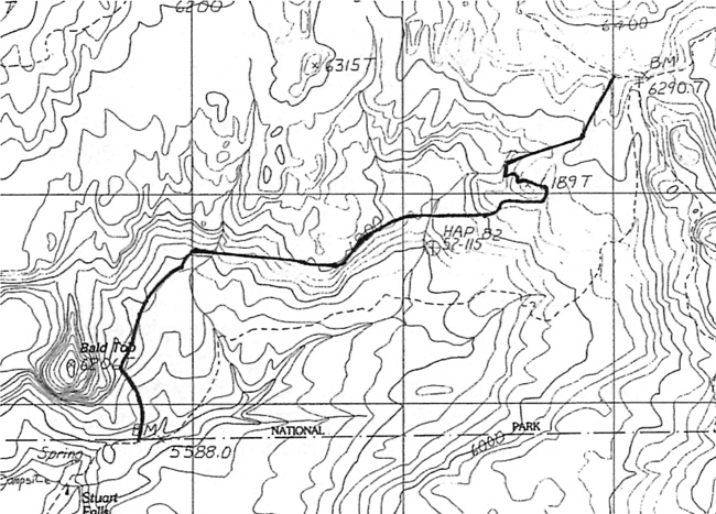
The last in this series of reroutes could likely be considered the most dramatic as it completely eliminated the Red Blanket Motorway as a hiking “trail.” Instead, a new route linked the previously rerouted PCT segment nears its junction with the Pumice Flat Motorway with the park boundary, less than a quarter mile from Stuart Falls on the Rogue River – Siskiyou National Forest. The new trail came closer to Bald Top than the motorway had and made for a more seamless transition with the Forest Service trail network in the Sky Lakes Wilderness.210
 |
| Portion of a topographic map showing realigned trail (solid line); dashes show existing (motorway) routes in 1997, author’s files. |
Funding for reroutes was largely limited to the one fee demonstration project that ended in 2004, but the NPS concurrently utilized money from different sources to make various kinds of improvements on other trails without realigning them. Although the idea of making Godfrey Glen Trail handicapped accessible could be traced to a park-wide report on accessibility by Jacque M. Beechel in 1979, project planning did not begin until 1993, when Kelly Donahue wrote a draft report on the trail.211 Some dedicated year-end funding made more detailed design work possible through the Denver Service Center in 1998, so that a separate fee demonstration project could commence in 2000.212 The park’s trail crew and other staff members completed work to re-open the route in 2002, but the self-guiding interpretive component languished after only one draft.213

