Crater Lake: The Campaign to Establish a National Park in Oregon by Steve Mark, Crater Lake National Park Historian
 |
|
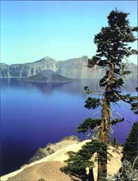
Photo by Steve Mark. |
TEN TOWNSHIPS AND THE GOLDEN ARROW
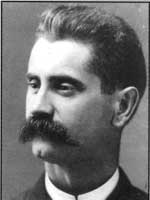 |
| William Gladstone Steel: Crater Lake’s foremost advocate. Courtesy Oregon Historical Society #23267. |
The long campaign to establish Crater Lake National Park began at Fort Klamath in 1885. There two vacationers from Portland, William Gladstone Steel and J.M. Breck, met an army captain named Clarence E. Dutton who had been detailed to accompany University of California geologist Joseph LeConte on a summer trek to examine the volcanic phenomena in the region. The four men followed a wagon road leading from Fort Klamath to Jacksonville by way of Annie Spring. On the other side of the Cascade Divide they turned north along a blazed trail that ran along a creek later named for Dutton. After climbing and climbing, the men at last reached their goal, and stood upon the caldera rim enraptured by the beauty of Crater Lake.
Making Crater Lake a national park seems to have been first discussed at their campsite in what is now Rim Village, but the idea became Steel’s primary focus for the next seventeen years. He stopped in Roseburg on his way home to discuss the idea with Oregon Congressman Binger Hermann, and began organizing a petition drive. The public support Steel wanted came with no difficulty and by the beginning of 1886, the petition had arrived in Washington, D.C. The petitioners sought to have the president withdraw the lands surrounding Crater Lake from settlement and from land claims arising from mining or timber values while Congress considered the merits of establishing a national park. [1]
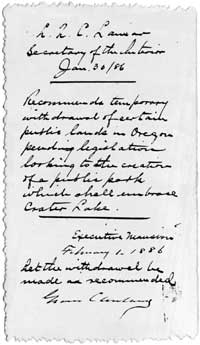 |
| With this handwritten executive order, President Grover Cleveland in 1886 withdrew from the public domain ten townships that would form the nucleus for Crater Lake National Park in 1902. |
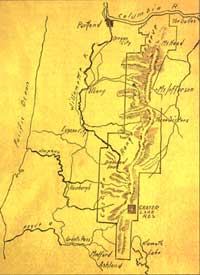
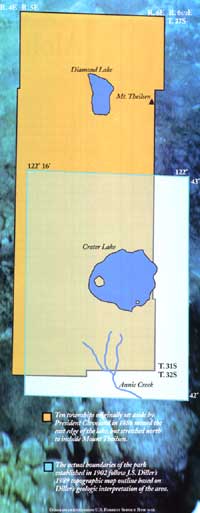
President Grover Cleveland ordered that ten townships of unsurveyed public domain adjacent to the lake be withdrawn from all forms of entry on February 1, 1886. This reservation was larger and slightly different from the actual park boundaries set in 1902. Only two townships wide, the withdrawal stretched from Union Peak in the south to well beyond Mount Thielsen. It simply represented a guess at what might be suitable for a national park, but the administration wanted to avoid infringing on the Fort Klamath Military Reservation to the south and the Klamath Indian Reservation to the east.
Crater Lake and its surroundings needed to be examined in greater depth, so Dutton headed a government-sponsored expedition during the summer of 1886. He needed civilian assistance for the procurement of boats and supplies, so Steel landed that job (he and Breck had hauled a canvas vessel to Crater Lake in 1885) and oversaw construction of three boats in Portland. The largest, Steel named the “Cleetwood” because of a dream he had had while traveling. In the dream, his deceased father joined Steel and both of them saw the heavens. As Steel’s father waved his hands above his head and told his son to look, the sky became filled with golden arrows, called “cleetwood” in the dream. [2]
Steel put the completed boats on a rail car in July 1886 and took the train to Ashland. From there, Steel and an expedition of thirty-five men loaded the boats on wagons and made their way to Crater Lake by way of Fort Klamath. Most in the party were soldiers, but some were United States Geological Survey personnel.
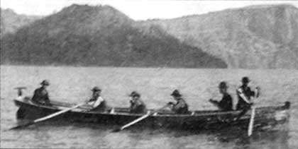 |
| 1886 expedition members row the Cleetwood on Crater Lake. Photo courtesy National Park Service. |
While some of the expedition’s members began mapping the topography around Crater Lake, others took on the challenge of measuring the lake’s depths. They had to use triangulation to pinpoint the boat’s position on the water, so as the two fixed points they used their camp (later called Rim Village) as one, and the Watchman (so named for the party of engineers stationed on the summit to receive signals) as the other. The great depths recorded by the party astounded the men, and they soon realized that Crater Lake was the deepest fresh water body in the United States. Several measurements (the party took 168 readings over a three-week span) exceeded 1,500 feet, with the deepest at an incredible 1,996 below the surface. This reading stood as official until soundings taken in 1958 established the maximum depth at 1,932 feet. [3]
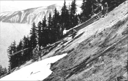 |
| Ropes and muscle had to be used to slide a boat down the steep slope to the lake in 1903. Photo courtesy National Park Service. |
This so-called “Cleetwood Expedition” generated considerable publicity in Oregon and elsewhere, but seemed to have little effect on Congress. Bills introduced by the Oregon delegation in 1886 and 1887 died in committee because of considerable opposition. The issue was not Crater Lake’s worthiness, nor even the exploitation of natural resources, but the fear of many in Congress that national parks threatened to become a drain on the Treasury. It did not help that the administration of Yellowstone during this time had become so problematic that it required Army intervention.
Alternatively, bills introduced in 1888, 1889, 1891, and 1893 would have conveyed Crater Lake to the state of Oregon in much the same way that Yosemite Valley had been given to California in 1864. These bills died, too, amid suspicions among House members that legislation providing for a state park would simply bring about the momentum needed to make Crater Lake a future national park. [4]
Steel opposed the state park bills and worried that Cleveland’s withdrawal could be reversed by a future president on the advice of his secretary of the interior. To buy time, Steel wanted a more permanent form of withdrawal. This would keep Crater Lake National Park, when finally established by congressional act, from being compromised by speculators having title to lands that should belong to the people. He had become a convert to the cause of forestry by 1889, and, with the help of a friend in Salem, started to think in terms encompassing the entire Cascade Range in Oregon.
THE JUDGE AND A FOREST RESERVE
With efforts to establish a national park around Crater Lake effectively stymied by 1889, Steel began looking for other ways to gain the protection he sought for this area. An acquaintance of his, Judge John B. Waldo, advised Steel as early as 1885 that he ought to petition for reservation of the entire Cascade Range in Oregon. Although Steel opted for only ten townships around Crater Lake at first, he remained open to a more ambitious reservation once a national movement to retain federal ownership of forest lands gained momentum in the late 1880s. [5]
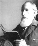 |
| Judge John Waldo: Encourage Steel to seek protection for the Cascades. Courtesy Oregon Historical Society #64412. |
A member of an Oregon pioneer family that settled east of Salem in 1843, Waldo served as chief justice of the state Supreme Court from 1884 to 1886, and won one term as state representative in 1888. He loved the mountains, avidly read Thoreau, and spent much of each summer in the wildest and most remote parts of the Cascades. During the summer of 1888, for example, Waldo and his companions made the first recorded journey along the crest between Mount Jefferson and Mount Shasta. They made the trip because Waldo intended to have the legislature ask Congress for a huge “public reserve or park.” It was to encompass twelve miles on each side of the Cascade Divide and run along the entire length of the range in Oregon. Settlement and logging would be prohibited and other uses regulated so that water supplies, game, and recreation could be perpetuated for all time. [6]
This memorial of 1889 met defeat in the state Senate, so it never left Salem. Congress did, however, pass legislation in 1891 allowing the president to proclaim “forest reserves” from any land still in the public domain that had trees or was covered with undergrowth. The Oregon Alpine Club, headed by Steel, now became the leading proponent of establishing forest reserves in Oregon. Their first success came in 1892, when the Bull Run Forest Reserve was created to protect Portland’s water supply. It took another year before President Cleveland acted to establish the nation’s largest reserve.
The Cascade Range Forest Reserve came into being (along with a much smaller reserve near Ashland) on September 28, 1893, and encompassed 4.5 million acres that later formed the basis for several national forests. Within its boundaries was the earlier Crater Lake reservation made during Cleveland’s first term in office. [7]
Steel saw the new reserve as a way to buy time for his national park proposal, in that the proclamation was more permanent than the 1886 withdrawal often townships. Congress, however, still had not appropriated any funds nor provided direction in the management of forest reserves. Unregulated sheep grazing on the reserves represented an immediate threat in the eyes of many forestry advocates They saw the animals as responsible for denuding forest cover and thereby degrading the forests capacity to store water for agriculture and municipal use. Many herders burned large areas to improve forage, impairing visibility for months at a time and contributing to the loss of prime timber. When the Secretary of the Interior issued an order prohibiting grazing on the reserve in 1894, the sheep owners attempted to fight back through the Oregon delegation in Congress. The delegation led an effort to severely reduce the Cascade Range reserve while some sheepmen openly defied the secretary’s order.
Things came to a head in 1896, when Steel spent most of six months in Washington, D.C., orchestrating a lobbying campaign in defense of the reserve. After some close calls, the reserve emerged intact, so Steel returned to Oregon in June with the intention of leading a trip to promote interest in Crater Lake. He wanted to bring the Mazamas, a Portland-based mountain climbing group Steel started in 1894, to Southern Oregon for an ascent of Mount McLoughlin and some extended camping at what later became known as Rim Village. In early August a deputy U.S. marshal was sent to Crater Lake to arrest sheepherders who had brought some 2,000 sheep into the area. This resulted in four sheep owners having to appear in federal court, where charges were dropped in view of the judge’s warning to keep sheep away from Crater Lake thereafter. [8]
The Mazamas gathering that August was important in several ways. Fay Fuller, as one of the Mazamas, had the honor of christening the ancient volcano whose remnant caldera held Crater Lake. The mountain that the Klamath Indians called gi was, Fuller named after the climbing club—which in turn had taken its name from the Spanish word for mountain goat. Secondly, Steel had prevailed upon several government scientists to conduct various studies of the proposed park area. The investigators presented their findings to the campers throughout the week (the first formal interpretation at Crater Lake) and subsequently published research papers in the annual journal of the Mazamas. This volume served not only as a record of the trip, but was also intended as the first guidebook for visitors to Crater Lake.
 The commission’s final report recommended retaining existing forest reserves and adding some new ones, but remained silent on the issue of national park status for Crater Lake. In June of 1897, Congress passed legislation giving a degree of permanence to the reserves and provided funds for their management. They provided a somewhat utilitarian direction, allowing the location of mineral claims and authorizing uses such as logging and grazing at the interior secretary’s discretion. The Secretary drew up regulations to implement the legislation, and included a provision banning sheep from the area near Crater Lake. This conveyed some of the protection Steel desired, but he worried about a clause in the new law allowing the president to reduce, modify, or eliminate forest reserves at any time.Steel had to cut short his time with the club members because he had to meet a special forest commission arriving by train in Medford and deliver the members to Crater Lake. The controversy over federal forests had by now prompted Cleveland to appoint a body to make recommendations about the number of reserves and their future management. Steel naturally thought it critical to discuss the fate of both the Cascade Range reserve and Crater Lake with the commission. He walked from Rim Village to the train depot in less than three days, and arranged for wagons to transport the commissioners back to Rim Village. The weather had turned wet and misty by the time they arrived at the rim, but Steel convinced commission members John Muir and a young forester named Gifford Pinchot to join him in camping at the lake shore for one night hoping to reach Wizard Island the next day. Rain and rough water canceled the boat trip, though Steel appeared to have succeeded in obtaining the commission’s support for retaining the forest reserve and establishing a national park at Crater Lake. [9]
A NATIONAL PARK IN THE STATE OF OREGON
Once Congress began appropriating money for managing the forest reserves in 1898, staff hired by the General Land Office (the Bureau of Land Management’s forerunner) could patrol them. Trespass grazing consequently ceased in the area around Crater Lake, but the few forest reserve rangers hired for that summer had several competing demands on their time. Their priorities also included preventing wildfires (a stand replacement fire that started north of Fort Klamath grew to 18,000 acres in September 1898 and gave Grayback Ridge its name) and locating the reserve’s actual boundaries on the ground.
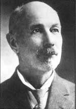 |
| J.S. Diller: the geologist who first unraveled the story of how Crater Lake came to be. Courtesy National Park Service. |
Mapping efforts in the vicinity of Crater Lake ran ahead of other areas in the forest reserve, mainly due to the U.S. Geological Survey having begun work during the Cleetwood Expedition of 1886. Geologist Joseph Diller can be credited with taking the Crater Lake topographic sheet to publication in 1898 because it helped to illustrate his study of how volcanic forces shaped the area around Mount Mazama. Among the things Diller discovered in compiling the map was that the ten townships reserved in 1886 did not extend far enough east to encompass all of Crater Lake. He and others agreed that the boundaries needed reworking, so subsequent bills aimed at establishing a national park were redrafted to reflect the dimensions of the USGS Crater Lake map. On it were features Diller thought directly related to Mount Mazama’s climatic eruption and the geological story of Crater Lake. He deleted Diamond Lake and Mount Thielsen in favor of including all of Mount Scott, then went far enough south to encompass such features as Union Peak, the Pinnacles, and most of Annie Creek Canyon. [10]
Thomas Tongue, a congressman from Astoria, introduced a new bill containing the reworked boundaries in January 1898. Supporters took heart when the House Committee on Public Lands issued a favorable report on the proposed legislation. The report, titled “National Park in the State of Oregon,” consisted of testimonials by former Congressman Hermann (at that time chief of the General Land Office), as well as Diller and the other scientists who had assembled at Crater Lake in 1896. The bill went no further, however, because of opposition from some key congressmen who still saw national parks in places such as Crater Lake as a continual drain on the Treasury, with little hope for any real return on the government’s investment. Enactment of legislation establishing Mount Rainier National Park on March 2, 1899, did not presage action on the Crater Lake measure. Tongue introduced another bill in the House, identical to the previous one in December 1899. Tongue’s bill and another introduced in the Senate by the Oregon delegation three months later, again went nowhere. [11]
Only when Theodore Roosevelt arrived in the White House in 1901 did the stars start to align. That December, Tongue introduced House Resolution 4393, worded identically to the bill he brought to the House almost four years earlier. The same report from the Department of the Interior accompanied it as in the previous three tries, but this time Steel acted on Tongue’s advice to work up a petition and secure additional testimonials on Crater Lake. Steel collected 4,000 signatures on the petition by March and solicited endorsements from prominent figures, both in and out of government. As might be expected, the replies he received from John Muir and Gifford Pinchot differed, since their views about the use of the forest reserves had openly diverged over sheep grazing in 1897. (Pinchot believed in carefully regulated grazing, while Muir opposed it under all circumstances.) Oddly enough, Muir was noncommittal about Crater Lake’s suitability as a national park. Pinchot, by contrast, expressed great enthusiasm to Steel. He also became a critical ally for the bill in his role as the new president’s leading advisor on conservation and public lands.
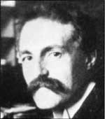 |
| Gifford Pinchot: Theodore Roosevelt’s forestry advisor. Courtesy Jeff LaLande. |
Pinchot went to Roosevelt about the Crater Lake bill, and the president had a word with the House speaker, who objected to letting the bill out of committee for debate on the house floor. This kept the bill alive to be debated, but Tongue still had to negotiate with congressmen who could block any further progress. The House passed it on April 19, but with an amendment that allowed the location and working of mining claims. Three of the bill’s six sections were deleted, though none of these (appointment of deputy marshals, payment of court costs, and authorization to deploy troops) constituted crucial sticking points. The House version was referred to the Senate committee on April 21, and its members reported favorably on it later that month. Passage of HR 4393 by the Senate came May 9, without debate or amendments. It became law on May 22, 1902, when Roosevelt signed the bill. [12]
Steel wrote to the president the day after Senate passage in order to obtain the pen Roosevelt later used in signing the bill. Pinchot, Diller, and Tongue also received letters from Steel expressing his gratitude for their part in the long campaign to establish Crater Lake as a national park. Almost a century later it stands alone in Oregon, even though national park proposals involving at least ten other areas within the state have been made at one time or another. Those efforts have so far failed for a variety of reasons, with perhaps the most important one being timing—though the story of how Crater Lake National Park came to be also includes no small amount of perseverance and good fortune.
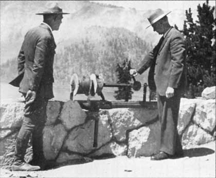 |
| During a visit to the park in 1931, former Park Superintendent William Steel, right, examines the lake-sounding device used in 1886. Photo courtesy National Park Service. |
Steve Mark is the park historian for Crater Lake National Park and Oregon Caves National Monument.
ENDNOTES
1. Harlan Unrau, Administrative History, Crater Lake National Park. Oregon, Vol. 1 (Denver: USDI-NPS, 1988), pp. 27-30.
2. “Surveying Boats,” The Portland News, 28 June 1886.
3. J.S. Diller, The Geology of Crater Lake National Park, U.S. Geological Survey Professional Paper No. 3 (Washington, D.C.: Government Printing Office, 1902), pp. 47-48.
4. Unrau, Pp. 36-38
5. Gerald W. Williams, “John B. Waldo and William G. Steel: Forest Reserve Advocates for the Cascade Range of Oregon,” in Harold K. Steen, ed., Origins of the National Forests(Durham, N.C.: Forest History Society, 1992), pp. 314-315.
6. Jeff LaLande, “A Wilderness Journey with Judge John B. Waldo, Oregon’s First Preservationist,” Oregon Historical Quarterly 90:2 (Summer 1989), pp. 117-166.
7. Unrau, pp. 46-53.
8. Williams, pp. 321-327.
9. Stephen R. Mark, “Seventeen Years to Success: John Muir, William Gladstone Steel, and the Creation of Yosemite and Crater Lake National Parks,” Mazama 72:13 (1990), p. 10; see also articles in Mazama1:2 (October 1897), pp. 139-238.
10. Diller, p. 5.
12. Mark, pp. 11-12; Unrau, pp. 98-111.
This article first appeared in Southern Oregon Heritage Today, January 2001, Vol. 3 No. 1, published by the Southern Oregon Historical Society.
Other pages in this section
*** previous title *** --- *** next title ***


