National Park Service Cultural Landscapes Inventory: The Watchman, Crater Lake National Park, 2001
Analysis And Evaluation
Views And Vistas
Views from Watchman Observation Station and Watchman Trail were the driving force behind their conception, design, and construction and continue in present day to contribute to the historic integrity of the cultural landscape. Views from the observation station and trail were important at Crater Lake for two purposes: as a fire lookout and as an educational/interpretive setting for park visitors. The trail and observation station continue to furnish this setting on Watchman Peak (8013’), bestowing commanding views of the park and region (Greene, 1984, 249-50).
The observation station and trail were useful to park rangers and interpretive staff in the protection of forest resources. The location of Watchman Peak was the ideal site for an observation station, which was regularly staffed during the fire season from 1917 through present day. The observation station was part of a network of fire lookouts, maintained in cooperation with the U.S. Forest Service and U.S. Indian Service (A precursor to the Bureau of Indian Affairs). The network, linked by short wave radios and telephones, included Crater Lake’s Mount Scott (first constructed in 1926 and updated in 1952) and other fire lookouts located in surrounding National Forest Lands. This network provided almost 100% visual coverage of Crater Lake National Park (Greene, 1984, 249-50).
During the period of significance, specific views obtained from the observation station were noted. “The summit of the Watchman affords some very fine views of the western portion of the park and the upper Rogue River Valley, as well as some excellent views of the lake in the vicinity of Wizard Island” (Robertson, 1932, n.p.). These commanding views were important for park visitor enjoyment and education. Several telescopes were installed at the observation station for the “benefit of visitors to the station” (Sager, 1932, n.p.)
As early as 1916, when the first trail was aligned to Watchman Peak, the trail was thought to provide “scenic advantages” to be used by “tourists in ascending the Watchman Peak” (Crater Lake National Park, 1918, n.p.). By 1933 a Ranger-Naturalist was stationed at the observation station to meet park visitors at the base of the peak and escort them to the summit to view the landscape and educate park visitors about the park’s geology, flora, and fire protection efforts. Along the trail, views of the Rogue River Valley to the west and Mount Shasta to the south were highlighted. At the summit, park visitors were invited to observe views from the parapet and observation station platform. Park visitors learned about theories of Mount Mazama’s origins and the consequential formation of Crater Lake. The guided tour was intended to connect the superficial views park visitors experienced with in-depth scientific explanations of the landscape (Thomas, 1934, n.p.). In this way, visitors could make sense of their experiences at the park.
Today, Watchman Observation Station and Watchman Trail retain integrity of views and vistas as they continue to present park personnel and park visitors with views of Hillman Peak (8151’) to the north; Mount Shasta (14161’), Castle Point (6276’), and the Klamath Basin to the south; Wizard Island and Crater Lake’s caldera to the east; and the Rogue River Valley to the west. These views were visible during the period of significance and were envisioned in the Crater Lake Master Plan.
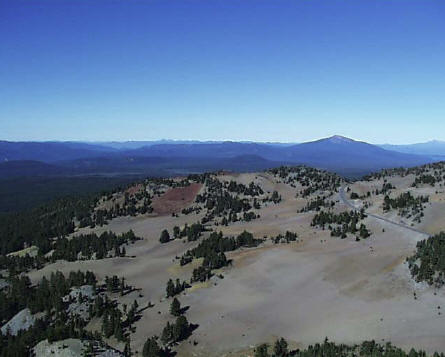 |
| Contemporary photograph of view north from Watchman Observation Station. View of Mt. Bailey at center right (CCSO 2001). |
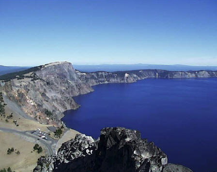 |
| Contemporary photograph view east towards Crater Lake. Note parking lot located at the Watchman Overlook (CCSO 2001). |
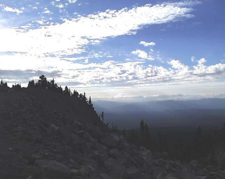 |
| Contemporary photograph of the view west towards the Rogue River Valley from Watchman Trail (CCSO 2001). |
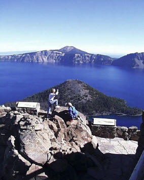 |
| Contemporary photograph of view east towards Crater Lake and Wizard Island from Watchman Observation Station (CCSO 2001). |
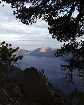 |
| Contemporary photograph of a view to the east of Crater Lake from Watchman Trail (CCSO 2001). |
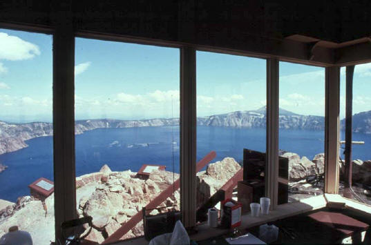 |
| Historical photograph from 1985 showing view east of Crater Lake from the interior of Watchman Observation Station (CRLA slide file). |
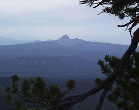 |
| Contemporary photograph of view south of Union Peak from Watchman Trail (CCSO 2001). |
Other pages in this section


