

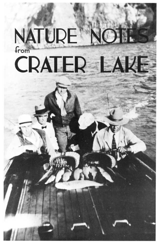
Volume 25, 1994
All material courtesy of the National Park Service. These publications can also be found at http://npshistory.com/
Nature Notes is produced by the National Park Service. © 1994
Introduction
This volume of Nature Notes is something of a milestone because this publication has now appeared for 25 summers since its inception in 1928. For three decades it was a casualty of increasing visitation and dwindling budgets for educational programs, but a symposium to celebrate the park’s 90th anniversary in 1992 sparked its revival. As a result, this is the third consecutive year that Nature Notes has been published.
The 1994 Nature Notes share a common characteristic of park friends wanting to share their understanding of Crater Lake and Oregon Caves with others. Authors include employees of the National Park Service, Volunteers-in-Parks, and members of the newly organized Friends of Crater Lake. Although the first article deviates from the usual practice of presenting only original research or observation in Nature Notes, the christening of Mount Mazama is relevant to the experience of park visitors. It is also fitting because the Mazamas were the first group to befriend Crater Lake and 1994 is their centennial.
Other articles in this edition were contributed on a volunteer basis and have not been published previously. Reprinting submissions that have appeared in Nature Notes is encouraged, as long as credit is given to the authors and the Crater Lake Natural History Association.
Established in 1942, the Crater Lake Natural History Association’s purpose is to aid the National Park Service’s educational and resource management programs at Crater Lake National Park and Oregon Caves National Monument. Toward this end it sponsors this edition of Nature Notes from Crater Lake. The association operates three publication sales outlets, two at Crater Lake National Park and one at the Illinois Valley Visitor Center in Cave Junction, Oregon. Proceeds from sales items are used entirely to support the association’s goals. A list of items available for sale can be obtained by writing to the Executive Director, Crater Lake Natural History Association, P.O. Box 157, Crater Lake OR 97604, or by calling (541)594-2211 ext. 499.
Reflections
Ernest G. Moll, Blue Interval, 1935. Illustration by Karl J. Belser.
(Watchman and Hillman)
Their war of winds and mountain-strife laid by,
They seek in the blue water a fairer goal
As man may find within a loved one’s eye
Tranquil and clear, the image of his soul.
Christened Mount Mazama
Editor’s note: This article appeared in the Tacoma Ledger on September 6, 1896. Excerpts are reprinted here to show how the Mazamas’ special relationship with Crater Lake began. Their excursion to the lake occurred almost six years before establishment of the national park but this outing inspired the first formal talks aimed at interpreting Crater Lake and its surroundings. Reports from the three scientists mentioned appeared in the 1897 edition of Mazama, the club’s yearbook.The Mazamas have just returned from their annual outing. They climbed Mt. Pitt [McLoughlin], christened Mount Mazama, and illuminated Crater Lake and Rogue River falls. It was the most successful expedition yet chronicled by the society’s historian and to be long remembered by hundreds who met from several states to explore the summit of the Cascades in the heart of Oregon. In point of numbers it was an important occasion, and it is estimated by one of the government scientists, who was established three weeks at the lake, that nearly 1000 men and women were encamped upon its banks. Of these perhaps seventy-five were Mazamas, members of the northwestern organization of alpine climbers, all of whom have ascended at least one mountain over 10,000 feet high. None others need apply, for this club purposes to have only genuine mountain enthusiasts identified with its accomplishments.
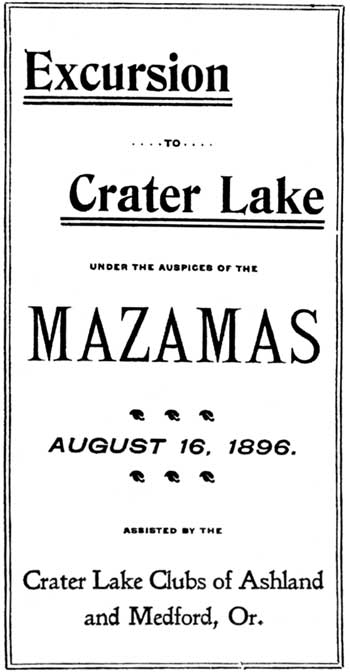
Portion of the Mazamas’ leaflet promoting their trip to Crater Lake.
Courtesy of the Klamath County Museum.
To me Crater Lake is the most impressively beautiful body of water in all the world that I have found. It lies on the very ridge of the Cascades, in Klamath County, southern Oregon. [The lake is] five or six miles in diameter, nearly circular, the vast crater of an extinct volcano…
Wagons may be driven to the very edge of the mountain that contains the lake, where it breaks suddenly off into abrupt spurs and rough precipices that plunge directly 2000 feet below into almost unknown depths. This volcano-hewn rim, unpolished and severe, extends for twenty-five miles around and above the lake, marking the contour of the huge pit wherein the water serenely lies…
In the western portion of Crater Lake rises Wizard Island, a perfect cinder cone…Its steep, sliding walls of pumice, sparsely covered with evergreen timber, make tedious climbing. The top breaks off suddenly into a depression, one hundred feet deep and about four hundred feet in diameter, known as the Witch’s Cauldron. Here the Mazamas held their business meeting, electing a number of new members, many of whom had only qualified a few days before, on the summit of Mt. Pitt. The same evening witnessed the most important ceremony of the expedition.
Several hundred people gathered around a huge camp fire to celebrate the christening of a once majestic mountain, unnamed throughout time’s changes, and remarkable for the deep blue cup it has for centuries protected. Appropriate toasts were offered, introducing interesting facts on the geology and nomenclature of the lake, its fish and fish foods, forest preservation, trees and plants and the wonderful features of the adjacent mountains. The culminating event was the christening of “Mount Mazama” over those rugged slopes. I had the honor to break a bottle filled with melted snow brought from its last crater. The name Mazama will be entered upon the government maps and remain in use. This is right inasmuch as no original name has been sacrificed to commemorate our society…
One of the most interesting features of the expedition, enhancing materially the Mazamas’ pleasure, was the presence of several of the government’s most eminent scientists, who pursued their various studies and observations during our stay. Their interest in the society and participation in its plans was fully appreciated by the members. Every evening instructive talks were held around camp fires, and in the day time these gentlemen accompanied several investigating expeditions around the lake.
 A South American mountain goat is the Mazama’s namesake. The group’s logo highlights this connection and features the U.S. Coast and Geodetic Survey symbol for mountain peaks. |
Frederick Coville, chief government botanist, exhibited a collection of plants growing in this vicinity, and gave a number of interesting talks on their distribution and growth. Several unusual species are found, and among the trees are noticed the noble fir, Alpine hemlock, and Tamarack pine.
Dr. C. Hart Merriam, assisted by Prof. Bailey and other scientists, made a collection of twenty-five different species of mammals, forwarding all the specimens to the Smithsonian Institution. Mr. J.S. Diller is known as the volcano sharp of the government geological survey. One of his favorite retreats is Crater Lake, which he considers more wonderful than any body of water known. He is now engaged in a geological map of the same and has been spending several weeks making observations for this particular work. He is an interesting, and at the same time economical speaker, with the faculty of weaving facts into a charming drapery of language. In fact, contact with these men of exact knowledge is most instructive and on this occasion made doubly fascinating the freedom, the enjoyment and the witchery of the mountains.
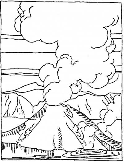
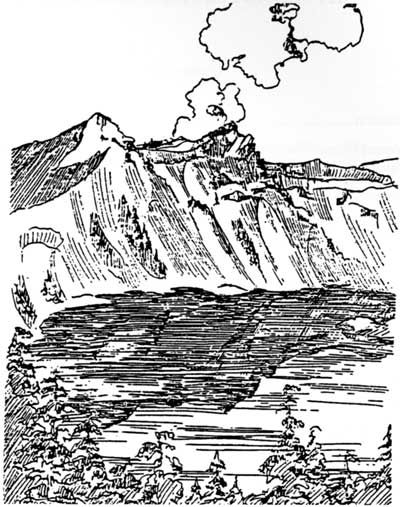
Illustration by L. Howard Crawford, Nature Notes from Crater Lake, 1934.
Reminders of Uncertainty
An earthquake is one of the most unnerving experiences that a person can have at Crater Lake. Quakes registering magnitudes of 5.9 and 6.0 brought thoughts of Mount Mazama’s reawakening to park residents on the evening of September 20, 1993. This heralded over 2500 aftershocks in the following three months, most of which could be detected only by seismograph.
Fortunately the epicenter (or the place where seismographs indicate the shocks are focused) turned out to be the Mountain Lakes Wilderness Area, an old caldera located 40 miles due south of Crater Lake.
These tremors did not portend volcanic activity, but are periodic reminders that Crater Lake sits on the edge of a place where the earth’s crust is expanding. A restless sea of mountains called the Basin and Range is shoving the great Cascade-Sierra Nevada chain westward.
Characteristics of the Basin and Range Province
The vast area extending from southcentral Oregon to Utah and encompassing most of Nevada is testimony to 20 million years or more of movement. It is called Basin and Range because comparatively flat areas of drainage alternate with north-south trending mountain ranges. Most of the basins do not drain to the sea, but one at its western edge does. Despite that hydrographic anomaly, the Klamath Basin south and east of Crater Lake National Park is characteristic of the larger Basin and Range region. Like so many others, the wide basin seen from Rim Village or Dutton Ridge is defined by mountain ranges running roughly parallel to each other — often with one range forming a steep rise, or scarp, away from the basin.
Earthquakes can occur as the Basin and Range pushes against the Cascade-Sierran wall. Where the earth’s upper crust snaps and breaks, fracture lines called faults are produced. In this most recent earthquake, a “normal” fault permitted one side of the fracture to drop down and pull away from the other. Some northwest- trending faults, so typical of Basin and Range seismic activity, produced the steep scarps on the east side of Upper Klamath Lake which can be seen so readily while traveling on Highway 97 from Crater Lake to Klamath Falls. Like a ramp which lets one side slip slowly down and slightly away, the plane of a normal fault is similar to a slanted wall where the top is tilted away while the bottom is pulled closer to you.
Although the earthquakes of 1993 have been attributed to this type of activity, the fault responsible is difficult to define. Some seismographs suggested that the fault skirts Upper Klamath Lake and Howard Bay, but aftershock epicenters have been placed some distance away. Since many faults do not reach the surface or may not be vertical, it is not surprising that the September earthquakes do not appear related to any known fault.
Earthquakes in the Klamath Basin
Since 1945 at least 12 earthquakes have occurred in the Klamath Basin. Geologists estimate that the fault zone around Upper Klamath Lake is capable of generating quakes as large as magnitude 7.25. An army officer’s report from Fort Klamath in 1873 described one earthquake as severe enough to have knocked people and animals to the ground. Two hard shocks lasting some five to ten seconds each in this quake broke every pane of window glass at the fort, but the wooden frame buildings there appeared to have suffered little damage.
With relatively little property damage resulting, the September quakes seemed less intense at Fort Klamath than the ones 120 years earlier. Park structures at Crater Lake seemed unaffected, but Klamath Falls reported severe damage. As a small village called Linkville in 1873, Klamath Falls had comparatively little experience with quakes of 5.9 and 6.0 magnitude. Some of its brick buildings, being relatively rigid, appeared susceptible to the shock waves that moved outward from the epicenters of these earthquakes. Several structures had to be demolished, adding to the toll of several million dollars in property losses.
A Volcano’s Warning Signs
As much as the Klamath Basin’s dramatic landscape has been affected by earthquakes, most visitors cannot fail to notice the imprint of a related phenomenon. For the most part, volcanic activity is concentrated in the same areas as seismic activity. Vulcanism occurs where magma reaches the earth’s surface through a long crack (fissure) or central vent. An example of the former is Lava Beds National Monument at the southern end of the Klamath Basin, while the latter is amply demonstrated by Mount Mazama — the mountain which holds Crater Lake.
Volcanic activity can release ejecta (debris which range from large chunks of lava rock to glowing ash), liquid lava, and gases. Volcanoes located in the Cascade Range such as Mazama can erupt explosively and eject lethal particulate matter and/or gasses. Swarms of local earthquakes, which generally increase in size and number, usually precede such an event, as they did before Mount St. Helens erupted in 1980.
The September earthquakes did not, of course, follow the pattern signaling another chapter in Mazama’s eruptive history. Nevertheless, it would be a mistake to assume that the mountain is dead or even dormant. The long-suspected presence of hydrothermal vents at the bottom of Crater Lake has been confirmed by researchers who piloted a submarine there in 1988 and 1989. Water significantly warmer than prevailing lake temperatures has been found near bacterial mats and features known as “blue pools” at the bottom of Crater Lake. What it suggests is heat from the volcano perhaps playing a role in perpetuating what we see from the surface.
The “Burp” of 1945
Although one might be so bold as to liken present levels of hydrothermal activity to a pilot light left on low, little is known about these vents. No clues have surfaced as yet about the so-called “burp” which occurred almost half a century ago. Bluish-gray clouds of smoke or gas appeared over the lake several times from September to December of 1945. Each time visitors and park staff saw these clouds, the day was calm and clear with no sign of fog or storm conditions. A cloud would form near the center of Crater Lake, rise sharply, mushroom out, and finally drift away with the prevailing breezes. By the time U.S. Geological Survey personnel arrived to monitor the lake with portable seismographs in January 1946, the strange phenomenon ceased.
Many people were willing to forget about the “burp” once formation of the clouds seemed to stop. The park superintendent at the time, however, noted that a strange disturbance affected several Oregon lakes in August 1919. Most pronounced was a marked discoloration and the destruction of more than 1000 fish in Diamond Lake from what observers took to be an underwater eruption. Newspapers mentioned disturbances of less intensity in Crater Lake, Upper Klamath Lake, and Marion Lake. An explanation has eluded geologists, but like the earthquake example, it is hard to be certain about phenomena of such short duration that occur underwater and/or underground.
Uncertainty is what drives some people to engage the scientific method, which is aimed at explaining or interpreting the phenomena observed. Science depends upon following a logical plan, beginning with fundamental observations. These are followed by the formulation of hypotheses so that a plan can be implemented by a way of collecting information or data for analyses. This method must allow for replication by other investigators and will determine if the initial hypotheses are to be accepted or rejected. At all phases, an open mind is required. If preconceived notions about the phenomenon to be studied affect the thinking of an investigator to deviate from the method, the effort becomes unscientific. Good scientific investigations generally yield more questions than were initially asked.
A Mysterious Buried Log
Radiocarbon dating of organic material such as buried wood is a valuable tool in attempting to understand the past. Trees destroyed by Mount Mazama’s climactic eruption have been used to ascertain the date of that cataclysmic event at 7700 years Before Present. So many carbonized trees have been found in the Crater Lake region that the 7700 year age is the common assumption for all buried logs in or near the park.
A buried log five and one half feet below the present surface was discovered in 1984 by Marion Ribble near Spring Creek, southeast of Crater Lake. Water-saturated buried wood is safe from decay organisms, and may remain preserved for thousands of years in an oxygen-free environment. The simple interpretation of the Spring Creek log could have been that the tree was buried during Mazama’s climactic eruption. After all, this was the story behind a highly-publicized discovery in 1991 northeast of the park, near Chemult. The “Mazama Tree” was found inside a vertical tree well entombed by a fiery avalanche deposit, and then covered by a 3 5 foot deposit of airfall pumice. This well-preserved log did indeed date to Mazama’s climactic eruption 7700 years ago.
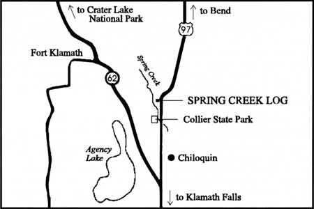
Map showing the location of the Spring Creek log
The Spring Creek log, however, was buried beneath redeposited ash, not airfall pumice. What led to the entombment of the Spring Creek log was not a fiery avalanche flow, but an event which might have made Spring Creek or its antecedent a reservoir for log debris. This log is not carbonized, bearing only surface bark char, displays intact cellular wood structure, and its widely-spaced tree rings provide evidence for favorable climactic conditions. These characteristics sparked enough curiosity to have the log radiocarbon dated. Its age (after calibration to correct for the difference between radiocarbon and calendar years) proved to be 7025 years Before Present. This means the tree first grew approximately 700 years after Mazama’s climactic eruption.
The unexpected date for the Spring Creek log raises a number of questions. Could neighboring cinder cones have produced sufficient ashfall to create dams to the flow of water and allowed large quantities of debris to accumulate? Perhaps an oxbow lake of the ancient Williamson River–which might have predated Spring Creek — served as a reservoir for log debris. Once these hypothesized dams broke, large lowland areas became inundated with deposited debris including buried log fragments.
At this point a reconstruction of events on Spring Creek is, of course, only conjecture. But admitting that we do not have all the pieces to the puzzle is, however, a bedrock of scientific inquiry. We always live with the possibility that our interpretations based on limited evidence may be wrong. With this in mind, the next earthquake should not have to be a reminder that we live in a very complicated and sometimes inexplicable world.
Further Information
Tom Brown, Jr. and Morgan Brandt, Tom Brown’s Field Guide to Nature Observation and Tracking, New York: Berkeley Books, 1983.
Louise R. Forrest, Field Guide to Tracking Animals in Snow, Harrisburg, PA: Stackpole Books, 1988.
James Halfpenny, A Field Guide to Mammal Tracking in North America, Boulder, CO: Johnson Books, 1986.
Donald W. Stokes, A Guide to Nature in Winter, Boston: Little, Brown and Company, 1976.
Donald and Lillian Stokes, Animal Tracking and Behavior, Boston: Little, Brown and Company, 1986.
Remote But Not Forgotten
Three miles south of Kerr Notch on the Pinnacles Road lies a small campground called Lost Creek. With only 16 sites, it appears to be almost forgotten. But not to a number of park employees who regularly visit Lost Creek during the summer.
 pinnacles Illustration by L. Howard Crawford, Nature Notes from Crater Lake, 1934. |
A maintenance worker arrives daily to clean the restrooms and camp area. Sometimes repairs to buildings are required if they are damaged by bears, porcupines, or thoughtless visitors. Maintenance personnel also test the campground’s water system daily to ensure that it meets strict standards.
Park rangers visit Lost Creek all summer to meet the needs of visitors who come to this corner of the park. Many of the rangers participated in a campground revegetation project several years ago that is now adding greatly to the area’s appearance. A number of native trees and shrubs have reduced the visible impact from many years of camping on pumice soils.
From Lost Creek Campground, a dirt road (the Grayback Motor Nature Trail) heads west one way, returning to East Rim Drive at Vidae Falls. In early spring a crew grades the roadway and removes trees that have fallen during the winter months. Sometimes elk, deer, or even an occasional bear with cubs can be seen feeding along this route.
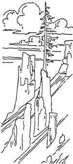
Four miles south of Lost Creek are the Pinnacles. These are fumaroles which served as passageways for gasses escaping from the pumice-scoria flows when Mount Mazama erupted. Although these erosional remnants are found along several other canyons, the Wheeler Creek Pinnacles are the most impressive in the park. A newly constructed wayside exhibit describes in greater detail how these were formed. For the safety of visitors, a new guard rail has been installed because the canyon drops sharply from the road. Like Lost Creek, Wheeler Creek is a forgotten stream that will share many surprises with those who care to explore it.
In Rare Abundance…
A Story of Serendipity and Biogeography
The living biota we enjoy around Crater Lake’s caldera reflects the 7,700 years of change since Mount Mazama’s climactic eruption. Mysteries abound despite our attempts to understand the distributions of plants and animals. Nevertheless, we do know that present-day populations of plants, for example, are a reflection of historic events such as fire, volcanic disturbances, and climatic changes. Thus, in the sense of genetic lineage, contemporary plants are the survivors of many changes critical to sustaining life on Earth. Much attention has been paid to the coniferous forests which dominate the park landscape, yet there are many lesser woody and herbaceous plants whose presence and life stories may go unnoticed.
Besides the many who have scanned the landscape during short visits, the National Park Service has had several capable field botanists who worked toward completing and annotating a Flora for Crater Lake. Elmer Applegate, F. Lyle Wynd, William Baker, and Richard M. Brown would be quick to point out how the gift of finding things not sought for has shaped their work. For a thorough inventory of Crater Lake’s plants to be achieved, we must acknowledge the role of serendipity in botany. Serendipity has led to the realization that some plants are locally rare — that is, in the oxymoronic sense, in rare abundance. Once rare isolated populations have been located, we often find that individuals of the same species are abundant within the boundaries of that small, local population.
As an example of rare abundance, Rick Kirschner wondered in 1978 whether beargrass occurs at Crater Lake. No botanist had collected a voucher specimen for Crater Lake so beargrass was not listed in Crater Lake’s Flora. But I knew that Rick had worked at Mount Rainier National Park, where wildflowers are profuse. I was also aware that Rick knew how to recognize flowering beargrass, Xerophyllum tenax, a member of the Lily Family and not a true grass. Earlier distribution maps of beargrass place it well north, west, and south of the park — but no populations were known to be within its boundaries.
While on backcountry patrol in the northwestern part of the park, Rick thought that he had seen what appeared to be beargrass flowering in the distance but he returned to headquarters without a voucher specimen. Could this be another curiosity reported without evidence, or was it truly an opportunity for discovery? In time we successfully relocated the site to confirm the presence of beargrass at Crater Lake. Of course, the discovery of a small population well inside the park boundaries raised a number of questions: Did the devastation of Mazama’s climactic eruption have anything to do with beargrass distribution? Could it be that 7,700 years ago, a small area shielded by deep snow and harboring beargrass miraculously survived the catastrophe? Did beargrass colonize much more recently?
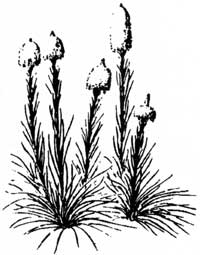 beargrass David L. Wheeler & Thomas Atzet, Guide to Common Forest Plants, Forest Service, USDA, Pacific Northwest Region, 1985. |
Factors which contribute to the perpetuation of rare plants become critical for park managers who aim to promote and sustain species diversity. Some species are sensitive to severe fire disturbances and may suffer population declines, whereas others may be favored by more moderate fire effects. This may be the case with another member of Crater Lake’s rare plant list, and an object of yet another accidental discovery.
During August 1982, park ranger John White and I collected a plant from the Solanaceae Family thriving in robust colonies on Crater Peak’s southwest slope. Our mission was not collecting plants, but merely to examine the park’s first forest fire area that had been allowed to burn under natural conditions. Following two weeks of variable fire behavior in August 1978, a wet snow extinguished what lightning had ignited. The Good Bye Fire burned old-growth noble/red fir forest, and the changes in habitat and vegetation were dramatic. Having started a fire effects monitoring project, I know this plant did not occur on the site before the fire event. The magic of the “friendly flame” had created a specialized habitat, with the result being what was once rare now is locally abundant.
The identity of this member of the Solanaceae (Nightshade) Family turned out to be the rare dwarf nightshade, Chamaesaracha nana. Other family members are more familiar and include such notables as the potato, tomato, tobacco, and pepper. Upon hearing of the dwarf nightshade’s discovery, resource manager Mark Forbes labeled it correctly as a “dwarf tomato.” The fruits are approximately one centimeter in diameter, colored light green, and give the appearance of a miniature green tomato. Although small mammals utilize these fruits, people are advised to avoid consumption until more is known about the tomato’s composition. Like the beargrass example, a number of questions remain unanswered: How did these plants arrive in this place? Where was the plentiful seed source to account for such a proliferation of dwarf nightshade colonies? Could it be that the seeds lay buried within the volcanic soils, remaining viable for many decades and awaiting a fire event?
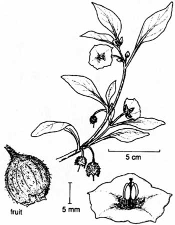
dwarf tomato
James C. Hickman, The Jepson Manual, Higher Plants of California, University of California, Berkeley & Los Angeles, CA, 1993, p. 1075.
Searches of herbaria were made throughout the Pacific Northwest to determine if any voucher specimens of dwarf nightshade existed from or near Crater Lake National Park. The park herbarium contained only a single sheet displaying two small, non-flowering plants collected by Applegate in 1934 from a dry slope of Bald Crater, a feature located in the park’s northwest corner. Other collections known include a single colony found by my wife Joy and me in 1978 along an old fire road on the southwest flank of Crater Peak. Individual plants have been observed along the Grayback Motor Nature Road which connects Lost Creek Campground with Vidae Falls.
Throughout dwarf nightshade’s range, populations are locally uncommon or rare – that is, in rare abundance. This is especially true in California, where the plant has been found but is rare in the Lake Tahoe region, Lassen Volcanic National Park, and Mount Shasta. In this respect the distribution of dwarf nightshade differs from that of beargrass, which is generally common throughout its range.
Nevertheless, the occurrence of dwarf nightshade and beargrass at Crater Lake National Park represent two cases where the rare abundance of plants is significant. Serendipitous finds often provide a way to better understand the landscape because a plant’s broader importance may lie in its biogeography. By piecing together a pattern of distribution, we may better comprehend the controlling factors for why organisms are found in some places and not others. Perhaps they might be a key to larger mysteries surrounding 7,700 years of change at Crater Lake and elsewhere.
Hiking in a Montane Mire
Sphagnum Bog is one of many charming areas in Crater Lake National Park. It is four miles west of the lake, but an easy hike from the Rogue River National Forest. The trail to Sphagnum Bog can be reached by taking state highway 230 and turning east at the sign for National Creek Falls. Use forest road no. 6536 to go east, then spur road 660 to find the trailhead. It is only about one quarter mile to the park boundary once you are on the trail.
On the way into Sphagnum Bog, you may be lucky enough to see a number of rare and interesting plants. One with a small purple-blue flower is Mount Mazama collomia,Collomia mazama. If you see one, note its location and report your find on the observation cards available at park visitor centers. Remember, as with all flowers in the park, do not pick or allow anything to harm it.
In roughly a mile and a half, the access trail intersects with the so-called Bald Crater Loop. Go south to Crater Springs and cross the creek once to reach the bog. The total distance to the bog is 2 1/4 miles. Upon finding the wetland area, a deep sense of the primordial can be felt. Amid the bog’s hollows and mounds of vegetation, you should find that sphagnum becomes more obvious. This genus is represented by two species in the bog, S. squarrosum and S. subsecundum Sphagnum has large open cells which make it seem like a sponge to the touch. This is because most members of the genus have the ability to hold 20 or more times their dry weight in water.
Sphagnum is a moss which grows only in water and has the ability to acidify its surroundings. Although it grows continually upward, Sphagnum is balanced by decay at the bottom of the plant. Its partial decomposition in water forms peat. Varying in consistency from turf to a slime, peat further decomposes to a dark brown or black and can impart a tea color to standing water.
Boggy peatlands characterize much of the British Isles, northern Canada, and other places in the upper latitudes. Sphagnum bogs in those areas usually have relatively few nutrients and harbor acid-tolerant vegetation such as pitcher plants, sundew, or heaths. The park’s sphagnum bog is somewhat different than the boggy peatlands, though it is a peat producing ecosystem. It is classified as a montane mire, which are relatively common in subalpine regions of the Cascade Range where moisture accumulates in small basins or in poorly-drained slopes.
Sphagnum Bog is an area that is saturated most of the year. The trail will bring you to the headwaters of Crater Creek, which is fed by two large springs. This part of the Crater Creek basin is relatively flat and poorly drained in comparison to other spring areas on the park’s western boundary. Along with sedges and shrubs, Sphagnum forms a carpet of vegetation in many wet areas of this bog. Water beneath this carpet can be deep, so be careful or you may be struggling to free yourself from the mud. Most of the wet areas can be avoided by staying to the forest or shrub communities which surround the bog.
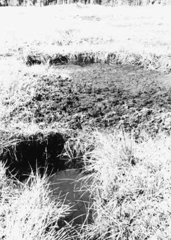
One of Spaghnum Bog’s pools
Photo by Roger Brandt.
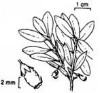 bog blueberry Hickman, pp. 569 & 543. |
These plant communities also illustrate the slow process of plant succession in the mire. In contrast to the boggy peatlands, the park’s sphagnum bog is not dominated by Sphagnum. Being relatively high in nutrients, this montane mire is characterized instead by brown mosses, shrubs, and sedges. Plant succession began with sedge communities establishing themselves on gentle slopes where seepage from the two springs drainage accumulated. Thickets of boa blueberry, Vaccinium occidentale, followed at the basin’s edge. Conifer invasion of the mire, however, has been somewhat retarded. A limiting factor is probably the prevalence of peat.
The peat in Sphagnum Bog averages six feet deep and is underlain by pumice. Mount Mazama’s eruptions produced the pumice, though formation of the mire presumably began when a cool, wet trend in the region’s climate developed about 4000 years ago. At that time, sedges and herbs began invading shallow pools which had formed over poorly drained areas.
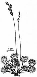 sundew Hickman, pp. 569 & 543. |
What eventually developed at Sphagnum Bog is a fascinating mosaic of vegetation highlighted by the wetland’s deep pools and insectivorous plants. The pools are sometimes called kettle holes, though this is a misnomer because Sphagnum Bog is not glacially-carved. They are five feet or more in depth and located in the lower portion of Sphagnum Bog’s eastern arm. Two species of sundew, Drosera anglica and Drosera rotundifolia, and three bladderworts, Utricularia, feed on insects. The sundew trap bugs with sticky hairs that bend over once the prey is caught. When the insect dies, the hairs secrete a digestive juice that breaks down the soft parts of the insect’s body. The soluable products are then absorbed and used by the plant.
Despite some wet footwear and pant legs, a day spent at Sphagnum Bog will provide an experience with a rich variety of plant habitats in a fairly small area. If you are fortunate, a large number of birds and mammals may also be seen. Like other wetlands, Sphagnum Bog is a place that provides a memorable contrast to drier forest areas in the park. But keep your eyes open for Sphagnum so that you will avoid an unexpected encounter with the bog’s deep pools!
Further Information
Susan Seyer, Vegetative Ecology of a Montane Mire, Crater Lake National Park, Oregon.M. S. Thesis, Oregon State University, Corvallis, 1979.
Taking Inventory at Oregon Caves
Effective monitoring, mitigation, and restoration of important resources can be done only if good inventories exist. Few caves, however, have good inventories. This is because many of them are very diverse, often difficult to access, and represent an alien environment to most people.
To close this data gap, volunteers from EARTHWATCH helped National Park Service staff at Oregon Caves complete the first comprehensive inventory of any large federal cave in the United States. One of the difficulties in conducting inventories is that definitions sometimes set arbitrary limits, but this one is flexible enough for use in other caves. As a result, inventory items for Oregon Caves were developed from a standardized 400 word glossary which caters to site-specific needs, yet allows for comparisons of those features that many caves have in common.
Several important correlations became apparent during the inventory. One of them involved finding the largest passages correspond with fault directions and the direction water flows the fastest, or steepest hydraulic gradient. This helps explain why Oregon Caves is so big in comparison to nearby caves.
Inventory teams also found marked breaks between the dimensions of some cave features which allow more sophisticated comparisons to be made. Similar features, such as parallel ridges among microgours in flowstone and those occurring in rimstone dams, can be separated by breaks in averaged measurements or by different distributions. For example, microgours usually range up to one quarter of an inch in size while the low end measurements of rimstone dams are about one inch. Consequently, flowstone and rimstone can be better indicators of localized differences in the cave’s hydrology. This is possible because flowstone is formed by water slowly seeping between rock layers in contrast to rimstone dams following stream flow.
More information is now at hand concerning the magnitude of direct human impacts on cave formations. “Cave slime” are actinomycetes bacteria, which appear as small white spots on walls. This bacteria is less evident along the tour route, leading to the supposition that bacteria feeding on lint from clothing may be outcompeting cave slime. There are also fewer white formations on the tour route than elsewhere in the cave. Skin oils and smoke from torches decades ago have certainly contributed to this situation.
Now that the inventory has provided some insight on human impacts at Oregon Caves, cleaning and repair of formations has begun. Tons of rubble from previous trail building efforts have already been removed. These measures are part of a restoration effort and will enhance future visits to the cave.
Other pages in this section