Volume 11 No. 1 – July 1, 1938All material courtesy of the National Park Service. These publications can also be found at http://npshistory.com/Nature Notes is produced by the National Park Service. © 1938. |
Preface
By John E. Doerr, Jr., Editor
Crater Lake National Park
The park includes an area of 250 square miles on the crest of the Cascade Range in southern Oregon. The area was established as a national park in 1902, preserving the unsurpassed scenic beauty of Crater Lake, a deep lake, the clear fresh water of which reflects and refracts unusual hues of blue. Color is only one of the elements of the inspiring beauty of Crater Lake. Its setting is unique. The lake, having an area of 20 square miles, is cupped within the crater of an extinct volcano. Cliffs 500 to 2000 feet high completely surround the lake. The crater walls are partially mantled with hemlock, fir, and pine trees. On the gentle outer slopes of the mountain which one ascends in approaching Crater Lake there are deep canyons, magnificent forests and open meadows supporting a colorful display of mountain wild flowers. Hiking and fishing are popular outdoor sports during the summer months. Skiing is popular in the winter, and the park being accessible throughout the winter months by the west entrance road from Medford and the south entrance road from Klamath Falls.
Oregon Caves National Monument
This national monument, an area of 480 acres, is located in the Siskiyou Mountains in southwestern Oregon. The caves, named “The Marble Halls of Oregon” by Joaquin Miller, are truly marble halls. Underground water penetrating to great depth along fractures in the marble formation has dissolved out an extensive system of chambers. Water dripping from the ceiling and walls has decorated the halls and passageways with fantastic stalactites and stalagmites which stimulate one’s imagination as well as one’s appreciation of the beauties of nature in caverns never touched by sunlight. In the magnificent forest around the cave entrance there are trails along which one gets inspiring views of forest-covered mountains and valleys. Along the trails one can observe many species of trees, mammals, and birds.
Lava Beds National Monument
Located in northeastern California, the monument includes an area of 45,000 acres. As the name suggests, volcanic formations, some of quite recent origin, are of greatest importance. There are hundreds of lava tubes which were once the passageways for streams of molten lava. Volcanic cones rise above the general level of the adjacent country. There are excellent examples of “aa” and “pahoehoe” lava flows. Within the monument there are interesting historical features including battlefields of the Modoc War of 1872-73. There are important ethnological and archaeological features. Petroglyphs on cliffs and pictographs in caves are evidence that the region was inhabited by primitive people long before the coming of the white man.
Most of the Crater Lake National Park area is occupied by the truncated cone of Mt. Mazama, the crater of which cups the lake. The basal altitude is about 4,000 feet, culminating in the higher points of the crater rim at approximately 8,000 feet. Mt. Scott on the eastern margin is nearly a thousand feet higher. For a considerable portion of the year the park is covered by snow. Even at the south entrance, which reaches the edge of the level valley, not infrequently there are remnants of snowdrifts until late in May; and not before July is the ground entirely bare on the south rim. Rarely drifts remain a month later. Consequently the flowering season is very short. Usually there are few, if any, flowers out before the first of June; and the season is practically over by the middle of September. Beginning at the lower levels, they continue up the mountain slopes following the retreating snow. In general there is a gradual replacement by other forms. Some of the lower forms, more adaptable, find themselves at home on the higher reaches. These, however, for the most part, ascend the warmer, more exposed slopes, just as plants of the upper levels tend to drop down the cold streams and shady sides of canyon walls. Radiating glacier valleys and stream-cut canyons, wet meadows, bogs, rocky walls, talus slopes, pumice flats, forest areas — all these are among the local contributing factors in distribution and time of flowering.
Within the limits of the park there are upwards of 560 species of flowering plants. Of these there are perhaps not more than twenty-five percent which might be considered wild flowers in the more popular sense of the term. In the present account only these more showy and attractive forms are included. The first to be considered are those which are most likely to engage the attention of the average visitor, such plants are to be seen along the main thoroughfares, improved trails, about camp grounds and other more frequented places. A second group includes those found off the beaten paths and in more distant and inaccessible places, in reach of visitors who have more time and interest in plant exploration.
The growing time is so brief that it is difficult to draw the line between seasons. Late spring soon merges into early fall. By the first of August, normally, before the first flowers are gone, most of the latest plants are in bloom; thus for a short season nearly all are in flower at the same time. So in an attempt to list the plants with reference to their time of blooming, it seems convenient to divide them into two groups: (A) the earliest or lower level flowers typically associated with the ponderosa pine, as at the south entrance; and (B) the later appearing flowers of the upper slopes, characteristic of the hemlock forest area, as for example around Park Headquarters. Between the hemlock and the ponderosa pine is a more indefinite belt dominated by lodgepole pine. A similar situation exists in the more open spaces above the main hemlock belt, extending up to the highest points, such for example as Cloudcap and Llao Rock. This area is typified by the white-bark pine, a timberline tree of the higher peaks of the Cascades and other ranges. Much of the moisture is here lost in the loose soil and by the more rapid evaporation characteristic of high altitudes. These conditions limit the plants both in number of species and of individuals. While a few mat plants with well developed root systems and other adaptive features are peculiar to this windswept area, and a lesser number of the ponderosa pine association occur here, most of them are found in the main hemlock region below.
Group A
The earliest or lower level flowers typically associated with ponderosa pine, arranged in accordance with their respective habitats.
| (1) Dry Land Plants | |
| Purple fritillary | Fritillaria atropurpurea Nutt. |
| Alaska rein-orchid | Habenaria unalaschensis (Spreng.) Wats. |
| Sulphur plant | Eriogonum unbellatum Torr. |
| Dwarf larkspur | Delphinium depauperatum Nutt. |
| Waxy currant | Ribes cereum Dougl. |
| Gummy currant | Ribes hallii Janez. |
| Serviceberry | Amelanchier floridaLindl. |
| Glandular Five-Finger | Potentilla galandulosa Lindl. |
| Bitter-cherry | Prunus emarginata (Dougl.) Walp. |
| Bitterbrush | Purshia tridentata (Pursh) DC. |
| Naked-fruit rose | Rosa gymnocarpa Nutt. |
| Mountain ash | Sorbus sitchensis Roem. |
| Douglas spiraea | Spiraea douglasii Hook. |
| Scouler willow | Salix scouleriana Barr. |
| Squaw carpet | Ceanothus prostratus Benth. |
| Snowbrush | Ceanothus velutinus Dougl. |
| Fireweed | Epilobium angustifolium L. |
| Oregon sunshine | Eriophyllum lanatum (Pursh) Forbes |
| Yellow collomia | Collomia grandiflora Dougl. |
| Scartlet gilia | Gilia aggregata (Pursh) Spreng. |
| Douglas phlox | Phlox douglasii Hook. |
| Curly-bloom | Phacelia heterophylla Pursh. |
| Western hound’s tongue | Cynoglossum occidentale Gray |
| Pine paintbrush | Castilleja pinetorum Fernald. |
| Heart-leaf arnica | Arnica cordifolia Hook. |
| Entire-leaf ragwort | Senecio integerrimus Nutt. |
| Green-leaf manzanita | Arctostaphylos patula Greene. |
| Pinedrops | Pterospora andromeda Nutt. |
| Snowberry | Symphoricarpus albus (L.) Blake |
| (2) Streambank and Meadow Plants | |
| Slim solomon | Smilacina sessilifolia Nutt. |
| Monk’s hood | Aconitum columbianum Nutt. |
| Baneberry | Acteae spicata arguta Torr. |
| Columbine | Aquilegia formosa Fisch. |
| Henderson buttercup | Ranunculus occidentalis dissectus Hend. |
| Big-leaf avens | Geum macrophyllum Willd. |
| St. Johnswort | Hypericum scouleri Hook. |
| Meadow paintbrush | Castilleja miniata Dougl. |
| Common monkeyflower | Mimuls guttatus DC. |
On the foregoing lists, the earliest to bloom are purple fritillary, slim solomon, Douglas phlox, gummy currant, waxy currant, serviceberry, bitter-cherry, ragwort and manzanita.
Group B
The later appearing flowers of the upper slopes, characteristic of the hemlock forest area, arranged in accordance with their respective habitats.
| (1) Dry Land Species | |
| Spotted coralroot | Corallorrhiza maculata Raf. |
| Mertens coralroot | Corallorrhiza mertensiana Beng. |
| Rattlesnake plantain | Peramium decipiens (Hook.) Piper |
| Gorman stonecrop | Gormania watsoni Britten |
| Newberry knotweed | Polygonum newberryi Small |
| Pyrola-leaf erigonum | Eriogonum pyrolaefolium coryphaem T & G. |
| Mountain sorrel | Oxyria digyna (L.) Campt. |
| Pussy-paws | Calyptridium umbellatum (Torr.) Greene |
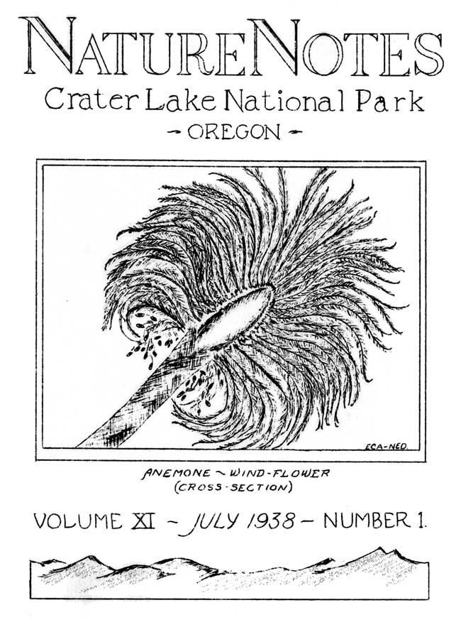
| Western windflower | Anemone occidentalis S. Wats. |
| Crater Lake sandwort | Arenaria pumicola Coville & Leiberg |
| Broad-pod rockcress | Arabis platysperma Gray |
| Crater Lake currant | Ribes erythrocarpum Coville & Leiberg |
| Tolmie saxifrage | Saxifraga tolmaei Torr. & Gray |
| Fan-leaf five-finger | Potentilla flabellifolia Hook. |
| Creeping raspberry | Rubus lasiococcus Gray |
| Desert lupine | Lupinus aridus Dougl. |
| Mat manzanita | Arctostaphylos nevadensis Gray |
| Prince’s pine | Chimaphila umbellata (L.) Nutt. |
| Striped pyrola | Pyrola secunda L. |
| Blue stick-seed | Hachelia jessicae (McGregg.) Brand |
| Applegate paintbrush | Castilleja applegatei |
| Spiderweb paintbrush | Castilleja pilosa arachnoidea (Greenman) Jepson |
| Dwarf monkeyflower | Mimulus nanus Hook. & Arn. |
| Lousewort | Pedicularis racemosa Dougl. |
| Davidson pentstemon | Pentstemon menziesii davidsonii (Greene) Piper |
| Rock pentstemon | Pentstemon rupicola Howell |
| Red elderberry | Sambucus racemosa callicarpa (Greene) Jepson |
| Black twinberry | Lonicera involucrata Banks |
| Red twinberry | Lonicera conjugialis Kell. |
| Coville aster | Aster ledophyllus Gray. |
| Bloomer rabbitbrush | Chrysothamnus bloomeri (Gray) Greene |
| Thoroughwort | Eupatorium occidentale Hook. |
| (2) Wet Land Species | |
| Western tofieldia | Tofieldia occidentalis S. Wats. |
| Green corn-lily | Veratrum viride Ait. |
| Bog onion | Allium validum S. Wats. |
| St. John yellow lambstongue | Erythronium grandiflorum pallidum |
| Blue-eyed grass | Sisyrinchium idahoense Rock. |
| Ladies’ tresses | Spiranthes romanzoffiana Sham. & Schl. |
| White bog-orchid | Habenaria dilatata (Pursh) Hook. |
| Green bog-orchid | Habenara stricta Lindl. |
| Smartweed | Polygonum bistertoides Pursh |
| Spring-beauty | Claytonia lanceolata Pursh |
| Gorman buttercup | Ranunculus gormani Greene |
| Brewer mitrewort | Mitella breweri Gray |
| Dense-flowered spiraea | Spiraea densiflora Nutt. |
| Klamath lupine | Lupinus latifolis ligulatus (Greene) C. P. Sm. |
| Yellow wood violet | Viola glabella Nutt. |
| White bog violet | Viola macloskeyi Lloyd |
| Mountain laurel | Kalmia polifolia microphylla Rehd. |
| Alpine shooting-star | Dodecatheon alpinum Greene |
| Lewis monkeyflower | Mimuls lewisii Pursh. |
| Primrose monkeyflower | Mimulus primuloides Benth |
| Elephant heads | Pedicularis groenlandica Retz. |
| Gray blue fleabane | Erigeron salsuginosus (Richards) Gray |
Among the very earliest of the last list are: yellow lambstongue, spring beauty, western windflower and alpien shooting-star.
The following list is made up of flowers not included in any of the foregoing, plants found in outlying sections not often seen by visitors. They are more common on the west slope of the Cascades, especially in the deep glacial valley of Redblanket Creek which at the southwest corner of the park drops to about 3700 feet altitude. This provides a gateway for the entrance of many west coast plants. A few of these plants reach the east side via the Klamath Gap, reaching the park up Annie and Sun Creeks.
| Fairy bells | Disporum oregonum (S. Wats.) Benth. & Hook. |
| Twisted-stalk | Streptopus amplexifolius (L.) DC. |
| Wake-robin | Trillium ovatum Pursh |
| Ookow | Brodiaea pulchella (Salisb.) Greene |
| White brodiae | Brodiaea hyacinthina (Lindl.) Baker |
| Cat-ear | Calochortus elagans Pursh |
| Large camas | Camassia leichtlinii (Baker) Wats. |
| Klamath lambstongue | Erythronium klamathense Applegate |
| Washington lily | Lilium washingtonianum Kell. |
| California iris | Iris californica Leicht. |
| Twayblade | Listera carina Piper |
| Wood-anemone | Anemone deltoidea Hook. |
| Drummond windflower | Anemone drummondii S. Wats. |
| March marigold | Caltha biflora DC. |
| Tall larkspur | Delphinium scopulorum glaucum Gray |
| Deer-foot | Achlys triphylla (Smith) DC. |
| Mountain oregon grape | Mahonia nervosa (Pursh) Nutt. |
| Piper oregon grape | Mahonia piperiana Abrams |
| Insideout | Vancouveria hexandra (Hook.) Merr. & Dec. |
| Grass of Parnassus | Parnassia intermedia Rydb. |
| Syringa | Philadelphus lewisii Pursh |
| Ocean-spray | Holodiscus discolor (Pursh) Maxim. |
| Thimble-berry | Rubus parviflorus Nutt. |
| Baker violet | Viola bakeri Greene |
| Round-leaf violet | Viola orbiculata Geyer |
| Clarkia | Clarkia rhomboiden Dougl. |
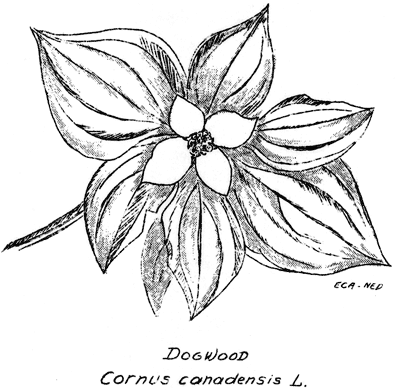
| Canada dogwood | Cornus canadensis L. |
| Nuttall dogwood | Cornus nuttallii (T. & G.) Coville |
| Madrono | Arbutus menziesii Pursh |
| Round-leaf pyrola | Pyrola rotundifolia incarnata DC. |
| Star-flower | Trientalis europae latifolia Torr. |
| Simple gentian | Gentiana simplex |
| Mazama collomia | Collomia mazama |
| Western jacobs ladder | Polemonium occidentale Greene |
| Narrow-leaf phacelia | Phacelia linearis (Pursh) Holzinger |
| McBride lungwort | Mertensia paniculata subcordata (Greene) |
| Narrow-leaf skullcap | Scutellaria angustifolia Pursh. |
| Scouler bellflower | Campanula scouleri Hook. |
| Blue bellflower | Campanula prenanthoides Dur. |
| Alice fleabane | Erigeron aliceae Howell |
| Goldenrod | Solidago elongata |
Other pages in this section


