|
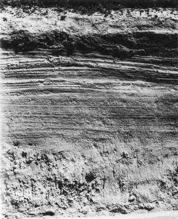
Plate 17. Fig. 3. Pumice deposits on Diamond Lake highway. At the base, 4 feet of coarse, unbedded pumice-flow deposits containing a charcoal log (near hammer). Above, bedded, fine pumice fall. The dark band near the top is the pink zone caused by oxidation of fumarolic gases rising from the pumice flow at the base. This indicates that the fine pumice fell on the flow while it was still hot. |
Some of them measure between 2 and 3 feet across, but by far the majority are only a few inches in diameter. Hemlock, cedar, and lodgepole pine occur sparingly, but most of the wood belongs to the white and sugar-pine group. Clearly the forests, though less dense, were otherwise like those now living in these parts.
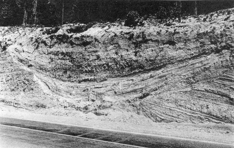
Mention should be made here of the splendid sections exposed along the Diamond Lake highway south of the Rogue River bridge. At this locality, the coarse, unbedded lump pumice is overlain by fine, well bedded pumice up to 15 feet in thickness (plate 17, figure 3). About 1/2 mile below the bridge, the deposits of the pumice flow are cut by a channel 7 feet deep and 50 feet wide, filled with stratified, granular pumice that must have been washed into place (plate 19, figure 1). Noteworthy is the much greater proportion of lithic detritus in this upper, bedded pumice (see histogram 360, figure 25). In these exposures the pink layer produced by oxidation of fumarolic gases is to be found, not at the top of the pumice flow, but between 3 and 5 feet from the top of the bedded ejecta. Presumably, therefore, the pumice showers fell on the flow while it was still giving off gas, for if they had fallen long after, the pink layer would be found at the top of the flow, as it is in the roadside sections nearer Union Creek, where the overlying stratum of bedded ejecta is absent.


