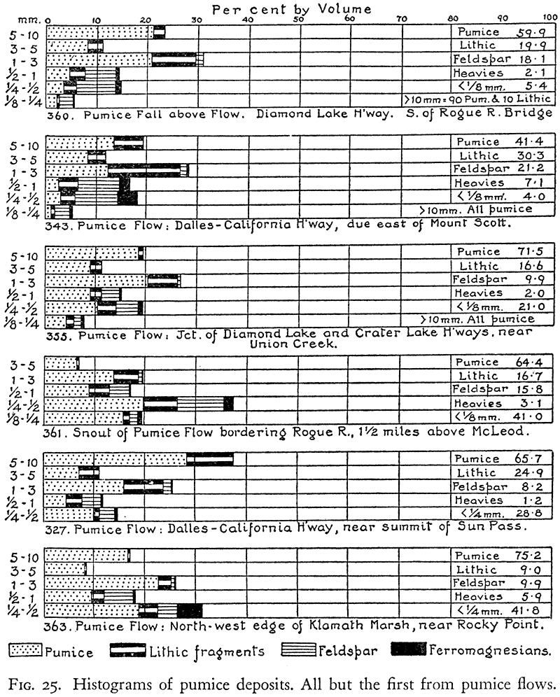
Close to the confluence of the Rogue with Bybee and Castle creeks, the thickness of the pumice flow rapidly diminishes, for thereabouts the pre-existing valley was wider and the flow spread over a broader front. The nature of its finer constituents is shown in the histogram, figure 25. None of the dark scoria flows that swept down Castle Creek reached this distance, nor did any of the scoria flows that entered via National, Copeland, and Bybee creeks. As for the lithic fragments in this part of the flow, it is extremely rare to find pieces more than an inch long, though many of the bombs of pumice exceed 2 feet across.
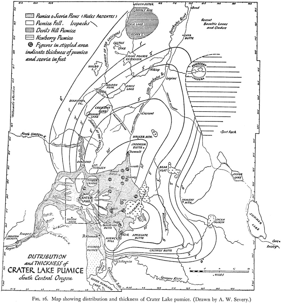
For the next 10 miles down the Rogue River, as far as Prospect, most of the pumice flow has been removed by erosion. The presence of pumice benches 100 feet above the river clearly shows that a great volume has been carried away. Apparently the flows here spread over broad basaltic flats in a series of braided tongues. Some of these overflowed the valley of the Rogue, crossed Mill, Barr, and Red Blanket creeks, and poured into the valley of the Middle Fork (see map, figure 16), where they accumulated to a thickness of 250 feet. Near the Upper Power House on the Middle Fork, the flows coming from the north cascaded into the gorge, eddied upstream for a mile, and piled against the south bank. Checked in their rush, they then turned westward and plunged into the deep gorge of the Rogue below Prospect.
Mention may be made in passing of the thick deposits of bedded and reworked pumice along the South Fork of the Rogue. Clearly these cannot be related to the flows under discussion, for a high ridge separates the Middle from the South Fork, across which it would have been quite impossible for the flows to pass. Nor can the deposits be related to the pumice fall immediately preceding the flows, for the South Fork drains an area beyond the limits of that fall. The deposits were therefore derived by down-washing of older pumice, possibly products of the same eruptions that left the coarse ejecta in the Pumice Flat at the east base of Union Peak.


