|
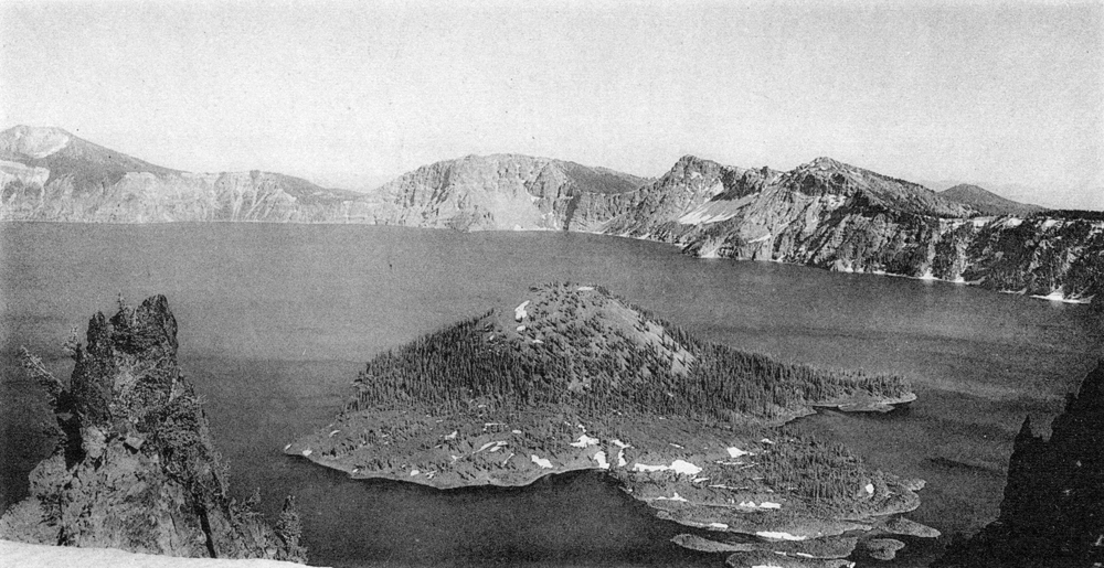
Plate 21. Fig. 1. The southeast wall of the caldera, and Wizard Island. From left to right: Mount Scott; Kerr and Sun notches with Dutton Cliff between; Applegate and Garfield peaks, with the Chaski slide between. Farther to the right, in the background, rises Crater Peak, a parasitic cinder cone. The arcuate block ridges on the flow from the Wizard Island cone are emphasized by snow banks in the intervening hollows. (Photograph by H. B. Taylor.) |
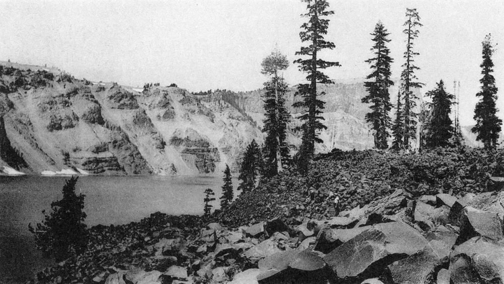
After the coarse, block lava had been erupted, a second pulse of magma broke through the northwest side of the cone. In this later flow there are no large blocks; indeed, few measure more than 3 feet across. It is also much more scoriaceous and weathers to brown crusts. In general, the boundary between the two flows is sharp. Locally, the front of the younger one forms a steep wall as much as 40 feet in height; elsewhere, well defined tongues of the finer, scoriaceous lava poured down channels in the earlier blocky flow (plate 21, figure 2). In other places, however, the flows merge in a broad intervening zone. Hence, they may represent a continuous emission of magma increasingly rich in gas.
|
Plate 21. Fig. 2. Lava flows on Wizard Island. The figure stands at the junction between the coarse block lava and the finer, scoriaceous lava. |
On the east side of Wizard Island, lavas form only a narrow strip, rising between 20 and 200 feet above the lake. Here they support a thicker growth of vegetation and have weathered to a thin soil. Judged by these features, they may be older than the lavas on the opposite side of the island.
Not all the flows of Wizard Island issued from a single vent. Those on the east escaped from radial fissures, as is suggested by the presence of lava ridges above the general level. On the southwest slope of the cone the principal vent lies about 300 feet above the lake, but doubtless other vents are buried beneath slides of scoria. Only by assuming a number of source fissures is it possible to account for the form and distribution of the flows.
Mention should be made, in conclusion, of an interesting feature to be seen through the water of the lake in the bays on the southwest side of the island. Here, the lake floor is pitted by many deep cavities, more or less lined with diatomaceous earth. Several measure 3 or 4 feet in diameter and are roughly cylindrical; others are irregular and much larger. Considerable doubt attaches to their origin. Some observers maintain that they may be related to fumarolic activity. More probably, the cylindrical pits represent molds of tree trunks that were enclosed by lava, and the larger depressions are cavities between blocks on the surface of the flow.
Age of Wizard Island. Considering the perfect symmetry of the cone, the well preserved form of the crater, and the freshness of the lava surfaces, the eruptions seem to date back only a few centuries. But if we assume that the oldest trees on the island began to grow only after the eruptions had ceased, then, according to H. H. Waesche, activity must have ended approximately 800 years ago. These were the last eruptions in the Crater Lake region. If fresh magma still exists beneath Wizard Island, it must be at considerable depth, for there are now no signs of solfataras, mofettes, or hot springs in the vicinity. It would be rash to assert, however, that Mount Mazama is quite extinct.
***previous*** — ***next***


