USGS workers used Crater Lake’s well-preserved, detailed geologic history to develop a genetic model of small caldera evolution
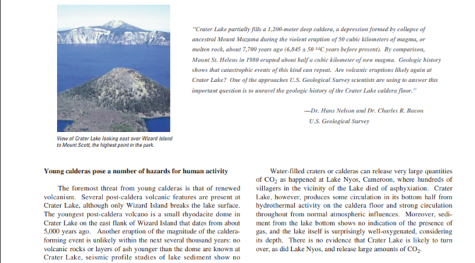
Post-caldera volcanic vents, geothermal features, and buried steam-explosion (phreatic) craters detected by seismic surveys collectively outline a ring fracture zone along which Mount Mazama subsided. These features began to form after caldera collapse about 7,700 years ago, but before the caldera filled with water to essentially its present level over the following 300 years. The large central platform of subaerial lava flows and domes erupted before the lake was present. Radiocarbon dates taken from lake-bottom organic matter indicate that the lake covered the central platform within at least 150 years of the caldera collapse. Wizard Island, one of the two major caldera-floor volcanic cones, erupted additional material into the lake as it finished filling. These subaqueous Wizard Island deposits accumulated to a height 70 meters below today’s lake surface, and the subaerial island continued to grow nearly 250 meters above the present lake surface. Merriam Cone, the other large volcanic cone, erupted completely underwater, rising more than 400 meters above the caldera floor, but it remains 200 meters below the present lake surface.
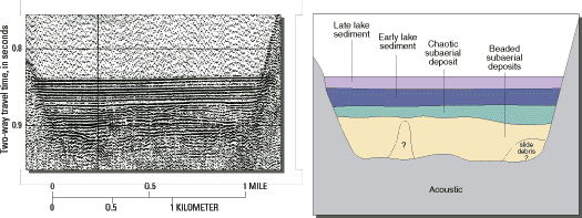
Evidence for the timing of these events is found in detailed analysis of sediment sources and of radiocarbon dates from the central platform deposits. The age of the central platform sediment shows that the last main volcanic event, extrusion of a small rhyodacite dome east of Wizard Island, happened about 5,000 years ago. Investigations also show that the early lake sediment contained pollen from gradual re-establishment of post-eruption forest surrounding the lake as well as primitive diatoms that lived in the early, more hydrothermal water. Warmer and drier climatic conditions existed during the lake’s early history, but a colder and wetter neoglacial climate has dominated for the past several thousand years.
There is evidence that large slope failures may have been triggered while volcanic and seismic activity continued up to 5,000 years ago. Since then, the geologic history of the caldera floor is marked by a distinct absence of volcanic activity. Mass wasting from the caldera walls continues, but on a much reduced scale. Lake bottom sediments now cover the chaotic subaerial debris wedges and volcanic deposits laid down as the lake was forming. This lake sediment blanket on the floor is well-bedded with a variety of sediment sizes ranging from gravel at the edge to very fine sand toward the lake center. Organic-rich muds also have accumulated on the submerged volcanic features. The lake sedimentation rate is currently high, but remains considerably lower than that found during the subaerial mass wasting that occurred before the lake formed.
Other USGS studies at Crater Lake, either published in scientific journals or in progress, include research on development of the shallow magma chamber which produced the climactic eruption, eruptive processes and caldera collapse as indicated by features of the volcanic deposits, and the early history of Mount Mazama and the many smaller volcanoes in the Crater Lake area. In addition, scientists from the USGS Cascades Volcano Observatory periodically make geodetic measurements and look for tilting or swelling of the caldera area that might forewarn of renewed volcanic activity.
| Contact Information | |
| Dr. C. Hans Nelson Department of Oceanography Texas A & M University 3146 TAMU College Station, TX 77843-3146 Phone: (409) 458-1816 Email: hans@ocean.tamu.ed |
Dr. Charles R. Bacon U.S. Geological Survey 345 Middlefield Road Menlo Park, CA 94025 Phone: (650) 329-5246 Fax: (650) 329-5203 Email: cbacon@usgs.gov |
Other pages in this section
*** previous title *** --- *** next title ***


