At this point, a discussion between C&C, UNH, and USGS determined that, if the boat was not in the lake by darkness on Friday, July 28th, then we would be forced to terminate the operation and pack up and depart because the cost of standby would begin to use operational funds. In addition, the multibeam, IMU, and workstations, as well as C&C personnel were required back in Lafayette by C&C Technologies for the mobilization of a class 1 research vessel in Hong Kong. That decision was passed on to Mr. Mack Brock, NPS at 1200 hr.
Thursday, July 27
We were informed on Thursday morning that there would be no helicopter lift on Thursday because of military red tape. However, by late Thursday afternoon we were informed that there was a high likelihood that a military helicopter would be available Friday.
Friday, July 28 (JD 210)
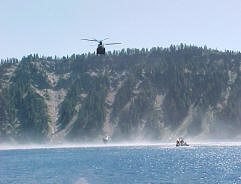
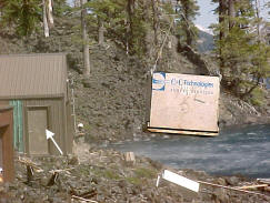
We were informed Friday morning that a military helicopter had been dispatched to Crater Lake to lift us into the lake. The helicopter arrived at 1415 hr and by 1530 hr the boat was in the water (Fig. 15) and by 1600 hr the equipment van was on Wizard Island. The remainder of the day was spent getting personal gear down the trail and setting up the field station on Wizard Island (Fig. 16).
 |
 |
| Figure 15. RV Surf Surveyor being lowered onto Crater Lake. | Figure 16. Equipment van landing on Wizard Island. |
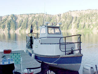
Early Friday morning the NPS used their research boat to collect a CTD cast using both their Seabird CTD and the C&C CTD to intercalibrate the two instruments. A CTD cast is required to begin the patch-test procedure. A sound-velocity profile was calculated from the cast and entered into the Simrad software for refraction calculations and ray bending. The NPS collected CTD casts several times a day for our soundvelocity profiles (SVP). The Surf Surveyor departed the Wizard Island dock (Fig. 17) at 0900 hr to begin the patch test. The initial patch test used the in-between mode over the flat basin floor in the middle of the lake. Patch testing was completed by 1300 hr and the survey began.
 |
| Figure 17. RV Surf Surveyor at Wizard Island dock. |
Saturday, July 29 (JD211)
The day was spent mapping the perimeter of the lake as close to the shore as was possible. Mark Buktenica (NPS) was stationed on the bow to guide the boat away from rocks.

