Sunday, July 30 (JD212)
All day was spent running north-south lines working from immediately east of Wizard Island toward the east. About 60% of the lake was mapped. However, when the data tapes were downloaded, we discovered that the navigation port was not sending navigation strings to the Simrad software, which means the datagram recorded by the Hydromap software had no navigation data. Fortunately, all the sensors, including navigation, are recorded separately as well as integrated into the Hydromap datagram, so we had navigation files. The problem was to reformat the DGPS data file so that it would be accepted by the processing software. We spent all evening devising a way to read in the DGPS GPGGA datagram into our processing software and finally, at about midnight, were successful.
 |
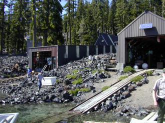
| Figure 18. Wizard Island field station for the mapping project. |
The Wizard Island field station (Fig. 18) has a diesel generator and a bank of batteries charged with a solar panel and an inverter. We tested out the battery power by switching from the generator to the batteries with only the two workstations online. The UPSs (uninterruptable power supply) immediately started sounding alarms and one immediately shut off, crashing one workstation. The second UPS switched to its internal battery and allowed enough time to shut down the second workstation. The result of this test was that all computers had to be shut down each night.
We also discovered that all of the offsets between sensors had not been entered into the IMU (inertial motion unit) software nor into the mergeNav script. All the data from Saturday and Sunday had to be remerged with the appropriate offsets, then regridded and remosaicked.
Monday, July 31 (JD213)
The first thing Monday morning the generator would not start. Consequently, we had no power to the computers. We discovered that the generator the battery was dead. The battery was replaced and the generator was restarted.
 |
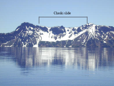
| Figure 19a. Chaski slide as seen from above lake level. View looking southeast. |
Monday was “press day”; a morning that the press was allowed on the water in the NPS RV Neuston to photograph the RV Surf Surveyor actually mapping, as well as a visit to the field station on Wizard Island. Most of the day was spent reprocessing Saturday and Sunday’s data to correct for offsets and the navigation loss.
At 1245 hr the diesel generator powering the workstations ran out of gas and only one UPS backed up a workstation; the other UPS died, crashing the second workstation. Repeated efforts could not restart the generator, apparently because of debris sucked into the fuel filter when the diesel ran dry. Finally, at 1445 hr, with a cleaned fuel filter and diesel in the tank, the generator started and we got back to processing data.

