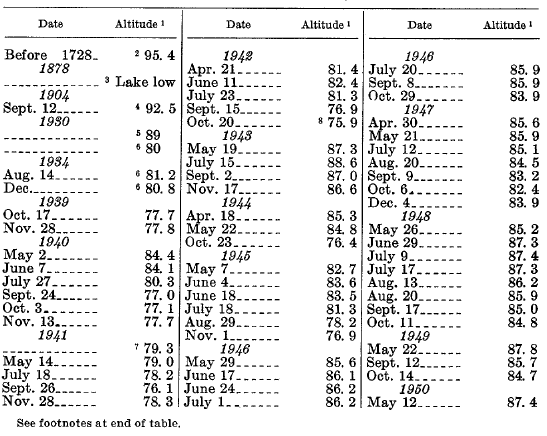
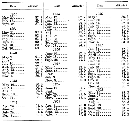
| TABLE 12.-Altitude, in feet, of water surface in Davis Lake |
 |
 |
1 Above 4,300 feet.
2 Beach and lichen line interpreted as extreme high level.
3 “Twenty feet” below high mark; see p. E32.
4 Estimated on basis of a downstream gaging.
5 Apparently intended as a recent high water level; taken from Maiden Peak sheet of topographic atlas edition of 1934. ,
6 0. C. Fisher, U.S. Bur. Reclamation, unpub. data, 1936.
7 Peak stage, May or June.
8 Minimum of record.
***previous*** — ***next***

