
 |
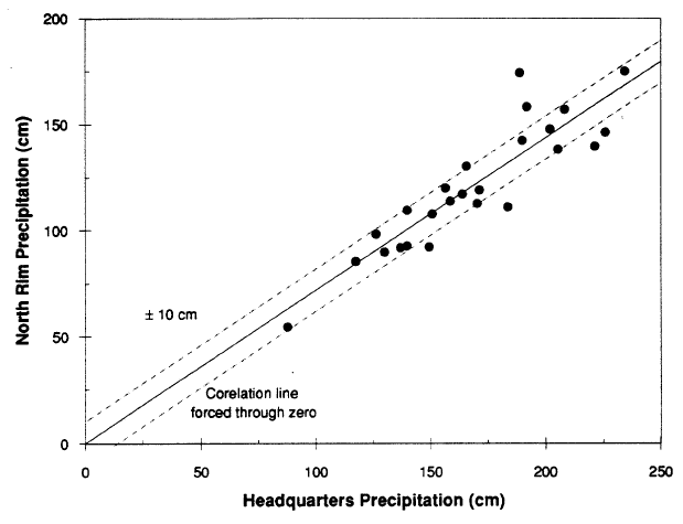
| Figure 7. Precipitation at North Rim gage versus that at Park Headquarters for July 1 – Jun 30 water year for 1964-88 time period. Correlation line calculated assuming that line passes though 0. Precipitation data for North Rim gage from National Oceanic and Atmospheric Administration (1966-77) and unpublished records of U.S. Geological Survey. |
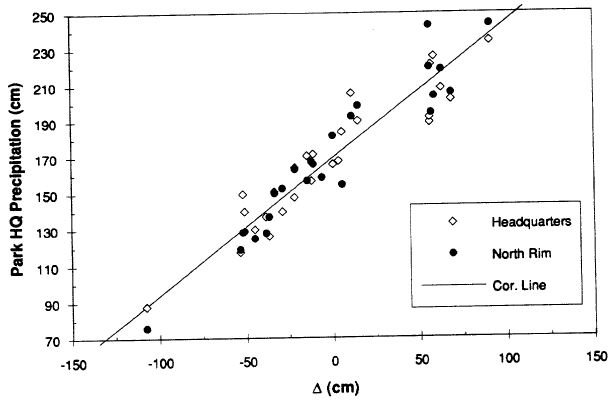 |
| Figure 8. Precipitation at Park Headquarters (1962-88) and calculated from the measurement at the North Rim (196488) versus change in level A from July I to July 1. Correlation line uses change in level as independent variable. |
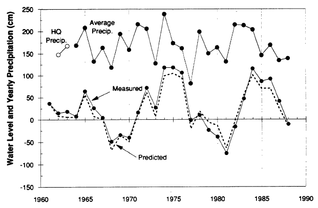 |
| Figure 9. Water level for Crater Lake (above 1882.14 m elevation) and precipitation at Park Headquarters (1962-63) and average of values for Park Headquarters and North Rim adjusted to mimic Park Headquarters values (1964-88). Water year is July 1 to June 30. Water levels shown by broken line calculated using equation (6) from precipitation values shown. |
***previous*** — ***next***