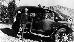
Wikipedia: “A touring car is an open car seating four or more. A popular car body style in the early twentieth century, it declined in popularity in the 1920s when closed bodies became less expensive.” – And let’s face it, unless you have one of these and your name is Gatsby, your Crater Lake Experience will certainly be less than it was in the ’20s.
Auto Touring
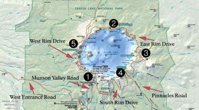
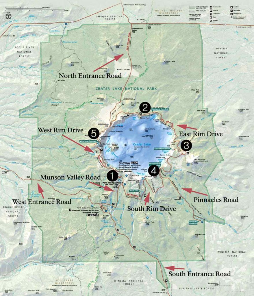
The most popular auto-touring route at Crater Lake is the 33-mile Rim Drive. This road provides spectacular views of Crater Lake and the surrounding area. The road is narrow with long, steep grades. There are several other roads (called approach roads) within Crater Lake that you can use to explore the many other habitats of Crater Lake (see the map below): These include the South Entrance road (highway 62), West Entrance road (highway 62), Munson Valley road, the North Entrance road, and the Pinnacles road.
Important Map Locations – click to enlarge
1. Steel Information Center and Park Headquarters
2. Cleatwood Trail to tour boats
3. Cloudcap Overlook spur road and Mount Scott trailhead
4. Sun Notch Overlook
5. The Watchman Overlook and trail to the historic fire tower
North Entrance Road
North Entrance Road From the Diamond Lake (North) Junction on Rim Drive, the North Entrance Road runs 9.2 miles north to meet state highway 138. Open pumice fields and features like Red Cone (7363'), Bald Crater (6478'), and Grouse Hill (7412') dominate the panorama as visitors ascend from the northern park boundary to the Crater...South Entrance Road
South Entrance Road The Civilian Conservation Corps (CCC) camp at Annie Springs in 1934. The CCC was a public work relief program that operated from 1933 to 1942 throughout the United States for unemployed, unmarried men from relief families, ages 18–25. It was part of Roosevelt's New Deal. The CCC was designed to provide jobs for young...West Entrance Road
West Entrance Road From the Diamond Lake (North) Junction on Rim Drive, the North Entrance Road runs 9.2 miles north to meet state highway 138. Open pumice fields and features like Red Cone (7363'), Bald Crater (6478'), and Grouse Hill (7412') dominate the panorama as visitors ascend from the northern park boundary to the Crater...Munson Valley Road
Munson Valley Road Not all scenery at Crater Lake is about the lake. This weatered end of a saw-cut tree is almost like a painting. Click to enlarge. Photo by Lloyd Smith From the Annie Spring Junction this road runs north to the junction with Rim Drive at Park Headquarters, and then to Rim...West Rim Drive
West Rim Drive From the Diamond Lake (North) Junction on Rim Drive, the North Entrance Road runs 9.2 miles north to meet state highway 138. Open pumice fields and features like Red Cone (7363'), Bald Crater (6478'), and Grouse Hill (7412') dominate the panorama as visitors ascend from the northern park boundary to the Crater...East Rim Drive
East Rim Drive Encircling much of the caldera rim is a scenic, two-lane road extending a little more than 29 miles from the main visitor use area at Rim Village to Park Headquarters in Munson Valley. Linking the two developed nodes is an approach road (Route 4) that extends for about 3 miles so motorists...Pinnacles Road
Pinnacles Road Almost all construction on the Pinnacles Road took place in 1913, when laborers and teams completed clearing, rough grading, and cross drainage for the 6.5 miles between the East Entrance and Kerr Notch. The last 1.5 miles nearest the rim required some side hill excavation because the road's location remained close to Sand...
North Entrance Road
South Entrance Road
West Entrance Road
Munson Valley Road
West Rim Drive
East Rim Drive
Pinnacles Road
Did you know?

The Belted Kingfisher will hover in place directly over a river, lake, or pond, watching for fish before diving to catch them.
Other pages in this section


