
Pinnacles Valley Trail – Crater Lake National Park
| Time: 30 minutes
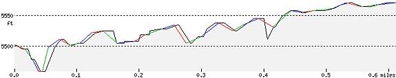
Difficulty: easy Length: .6 mi (1 km) Elevation: 5446* – 5577 ft (1660* – 1700 m) |
Trailhead coordinates:
Latitude: N +42° 50.99 or 42.84997 Longitude: W -122° 00.28 or -122.00472 Altitude: 5446* ft (1660 m) |
| Highlight: volcanic spires | |
*end of Pinnacles spur road
REI Trails Project partners with Crater Lake Institute to produce their trails app. Click the map below, get the app – then come back, we offer more.
Trail Description
|
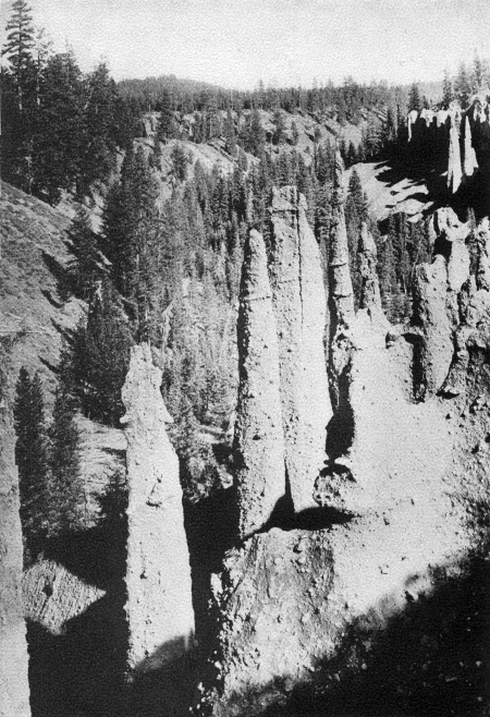
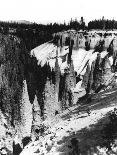
The Pinnacles, Sand Creek Canyon, The Geology of Crater Lake National Park, Oregon by Howell Williams, 1942, photograph by George Grant, National Park Service |
Related |
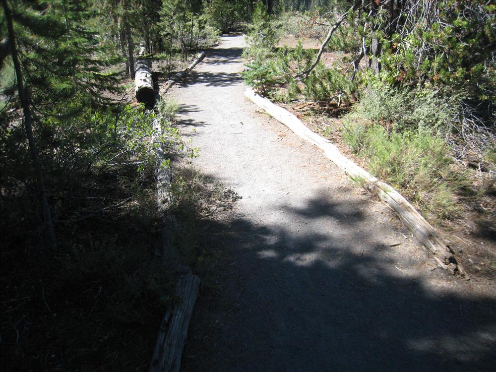
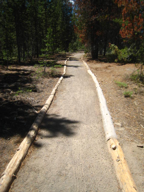
This trail makes for an easy walk along the rim of Pinnacle Valley. There are great views of volcanic spires. Use caution near cliffs. Trail ends at park boundary. Accessible to wheelchairs with assistance. open to bicycles.
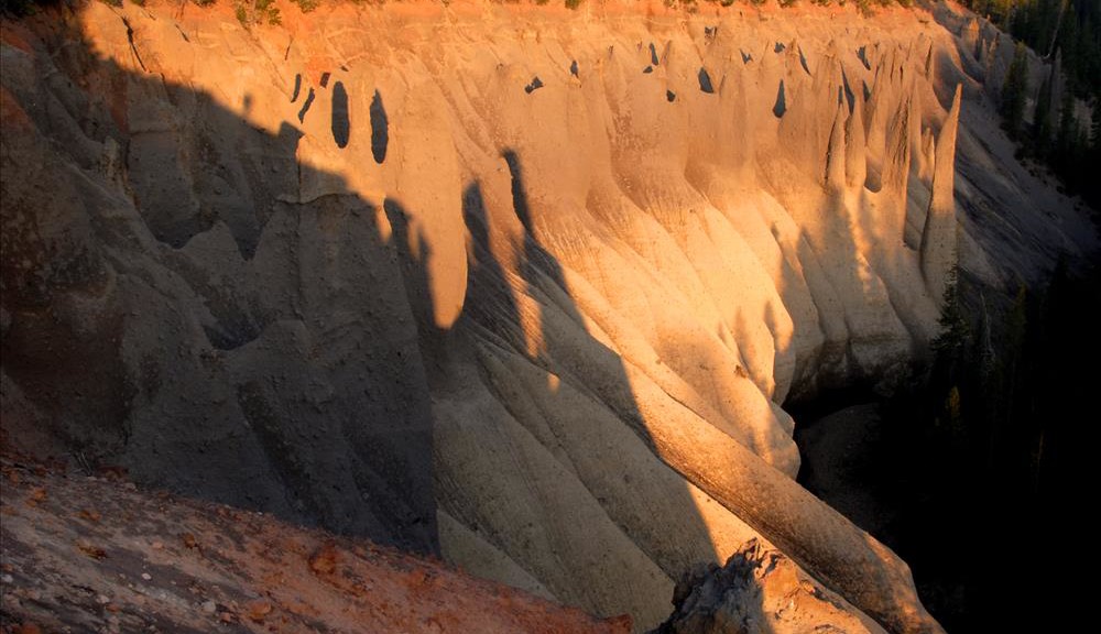
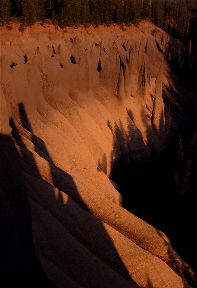
These needle-like formations of rock, called fossil fumaroles, projecting from the Sand Creek Canyon floor, were formed under sheets of volcanic pumice that preceded Mazama’s collapse. As the surface of the hot pumice cooled over the years, steam and gases were released by the hot rocks underneath through vents and tubes that were welded into cement hardness by their passage. These ancient vents now stand alone due to the erosion of the surrounding softer materials.
Trailhead Location: The trailhead lies at the end of the Pinnacles Spur Road, 7 miles (11.3 km) Southeast of the Phantom Ship Overlook off of the main Rim Drive, on the southeast corner of the park.
Nature Note: The Pinnacles are chimneys formed when hot ash cooled after the big eruption.
Seasonal Information: Expect the trail to be covered in snow from October to early July, however, conditions vary somewhat from year to year. See Crater Lake Current Conditions for more information.
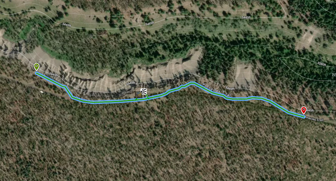
Pinnacles Valley Trail Elevation Profile
Related Maps
Digital USGS topographic maps (PDF files) – the following maps are relevant to the Pinnacles Valley trail. See more Crater Lake Institute online USGS digital maps.
| Series | Name | Year | Scale | Contour Interval | File |
| USGS 7.5′ | Maklaks Crater | 1985 | 1:24,000 | 40 ft | usgs-maklaks-crater-7.5 |
| USGS 7.5′ | Sun Pass | 1985 | 1:24,000 | 40 ft | usgs-sun-pass-7.5 |
| USGS 30′ x 60′ | Crater Lake | 1989 | 1:100,000 | 50 m | usgs-crater-lake-30-minute |
| USGS 30′ x 60′ | Diamond Lake | 1978 | 1:100,000 | 50 m | usgs-diamond-lake-30-minute |
| USGS 1° x 2° | Klamath Falls | 1970 | 1:250,000 | 200 ft | usgs-klamath-falls-1-2 |
| USGS 1° x 2° | Medford | 1976 | 1:250,000 | 200 ft | usgs-medford-1-2 |
| USGS 1° x 2° | Roseburg | 1970 | 1:250,000 | 200 ft | usgs-roseburg-1-2 |
|
Please remember to practice “leave no trace outdoor ethics” when you are out on Crater Lake National Park’s trails…and have fun! |
Other pages in this section
- Pacific Crest Trail
- Anderson Bluffs Trail
- Anne Creek Canyon Trail
- Anne Springs Cutoff Trail
- Bald Crater Loop Trail
- Bert Creek Trail
- Boundary Springs Trail
- Castle Crest Wildflower Trail
- Cleatwood Cove Trail
- Crater Peak Trail
- Discovery Point Trail
- Dutton Creek Trail
- Fumarole Bay Trail
- Garfield Peak Trail
- Godfrey Glenn Trail
- Lightning Spring Trail
- Llaos Hallway
- Mount Scott Trail
- Park Headquarters Historic Trail
- Plaikni Falls Trail
- Pumice Flat Trail
- Stuart Falls Trail
- Sun Notch Trail
- Union Peak Trail
- Watchman Peak Trail
- Wizard Island Summit Trail
- Hiking Rules and Regulations
- Best Trails at Crater Lake